rtk station
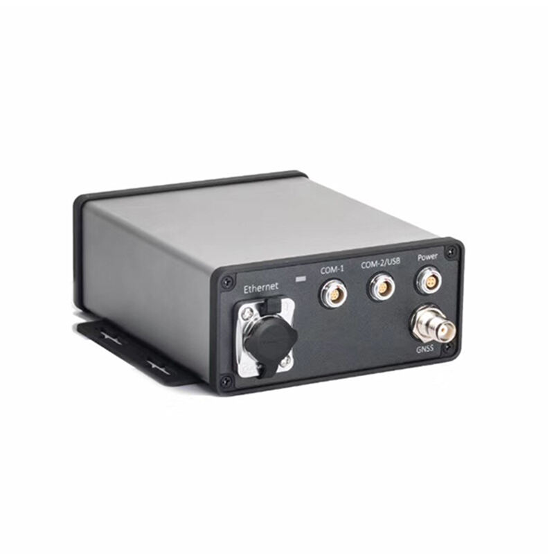
An RTK station represents a revolutionary advancement in precision positioning technology, serving as the cornerstone of modern surveying and navigation applications. RTK, which stands for Real-Time Kinematic, is a satellite navigation technique that provides centimeter-level accuracy through differential GNSS corrections. The RTK station functions as both a reference point and communication hub, continuously monitoring satellite signals and broadcasting correction data to mobile receivers in the surrounding area. This sophisticated system operates by establishing a fixed base station at a known coordinate position, where it receives signals from multiple satellite constellations including GPS, GLONASS, Galileo, and BeiDou. The RTK station calculates positioning errors by comparing received satellite data with its precise known location, then transmits these corrections to nearby rovers via radio or internet connections. Modern RTK stations incorporate advanced signal processing algorithms, multi-frequency receivers, and robust communication protocols to ensure reliable operation in challenging environments. The technological architecture includes high-gain antennas, powerful processors, weatherproof enclosures, and backup power systems for continuous operation. These stations support various communication methods including UHF radio, cellular networks, and internet protocols, enabling flexible deployment options across different project requirements. RTK stations find extensive applications in construction site layout, topographic mapping, precision agriculture, mining operations, and infrastructure development. The system dramatically reduces survey time while maintaining exceptional accuracy, making it indispensable for projects requiring millimeter-precision measurements. Additionally, RTK stations support network configurations, allowing multiple reference points to create wide-area correction services that enhance coverage and reliability across large geographical regions.