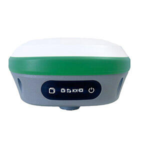
Multi-Industry Versatility and Adaptability
The RTK device demonstrates remarkable versatility across diverse industries and applications, adapting seamlessly to specialized requirements while maintaining consistent performance standards and accuracy levels. This adaptability makes the RTK device an invaluable investment for organizations operating across multiple sectors or those seeking to expand their service capabilities without requiring specialized equipment for each application. Construction professionals utilize RTK devices for foundation layout, utility installation, road construction, and building positioning, while the same equipment serves surveying teams for boundary establishment, topographic mapping, and monitoring applications. Agricultural operations benefit from RTK device guidance systems for precision planting, fertilizer application, and harvest optimization, demonstrating the technology's ability to enhance productivity across vastly different operational contexts. Environmental monitoring projects rely on RTK devices for precise sample location recording, habitat mapping, and change detection studies, while mining operations use the technology for stockpile volume calculations, equipment guidance, and safety monitoring applications. The RTK device accommodates various mounting options, from handheld operation to vehicle integration and unmanned aerial vehicle applications, providing flexibility for different project requirements and operational preferences. Software compatibility ensures seamless integration with industry-specific applications, from CAD programs used in construction to farm management systems in agriculture. The device supports multiple coordinate systems and projection methods, enabling operation across different geographic regions and project specifications without requiring additional configuration or specialized knowledge. Customizable measurement modes allow optimization for specific applications, whether requiring rapid point collection for mapping projects or precise layout work for construction applications. The RTK device maintains consistent performance across varying environmental conditions, from urban environments with signal interference to remote locations with challenging terrain or weather conditions. Training requirements remain minimal due to intuitive operation and comprehensive support resources, enabling rapid adoption across different industries and user groups. Firmware updates and feature expansions extend device capabilities over time, ensuring long-term value and adaptability to evolving industry requirements and technological advancements.