Professional Topography Total Station - Advanced Surveying Equipment for Precision Measurements

All Categories

topography total station

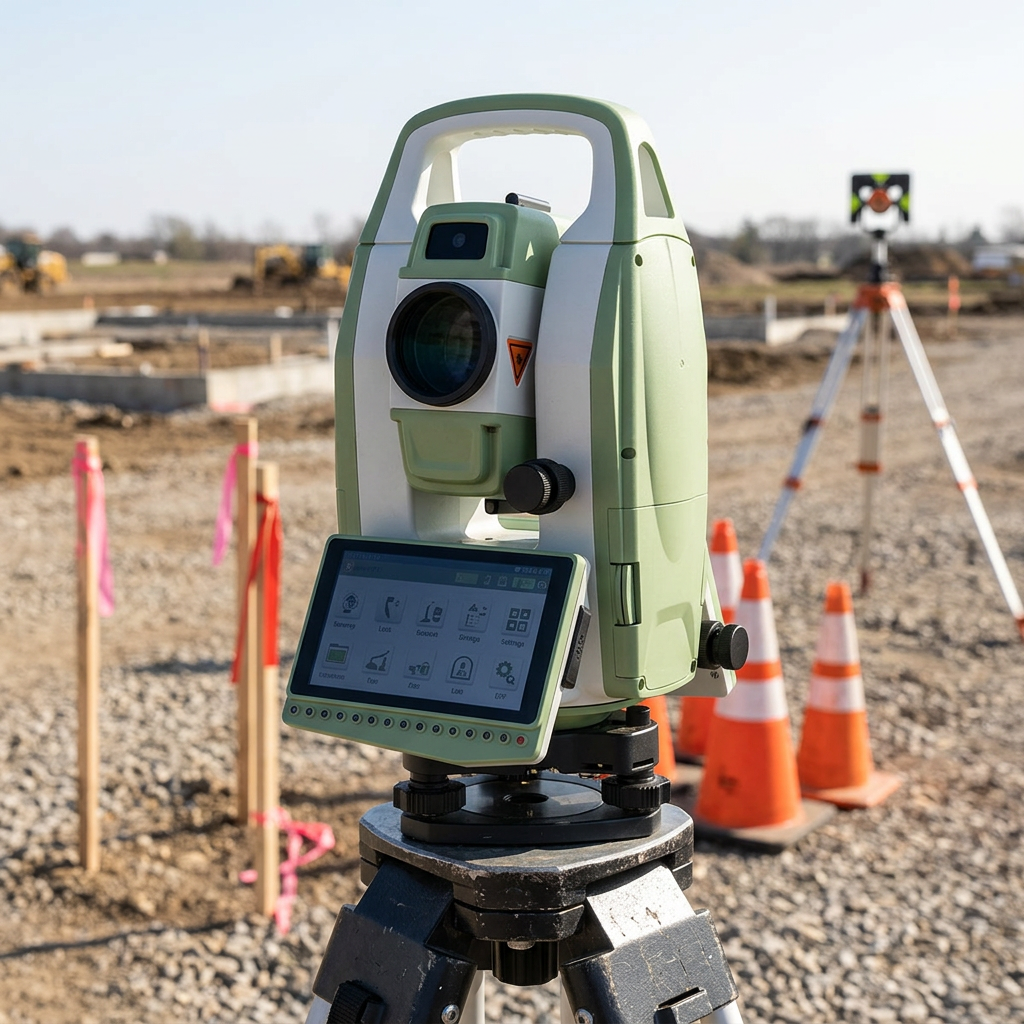
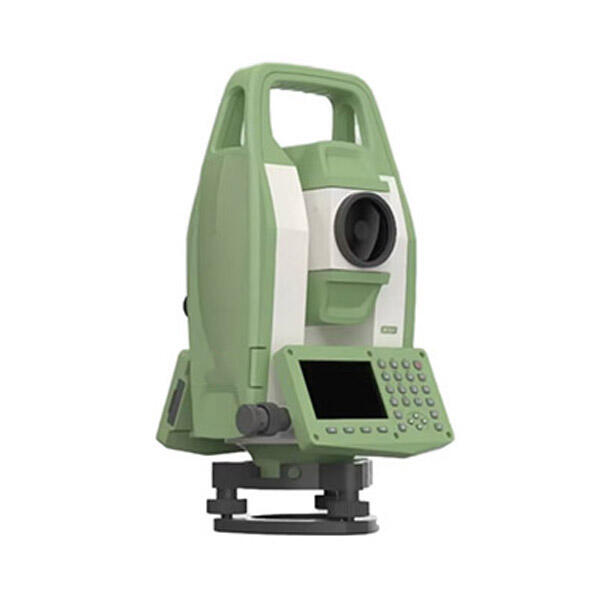
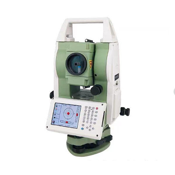
A topography total station represents one of the most advanced surveying instruments available in modern land measurement technology. This sophisticated device combines electronic distance measurement capabilities with precise angular measurements, creating a comprehensive solution for topographical surveying projects. The topography total station integrates multiple functions into a single, portable unit that revolutionizes how professionals conduct land surveys, construction layouts, and mapping operations. At its core, this instrument measures horizontal and vertical angles with exceptional accuracy while simultaneously calculating distances using electronic distance measurement technology. The device features a built-in computer system that processes data in real-time, eliminating manual calculations and reducing human error significantly. Modern topography total stations incorporate advanced laser technology that enables measurements across considerable distances, often exceeding several kilometers depending on atmospheric conditions and target reflectivity. The instrument's dual-axis compensator automatically corrects for minor leveling errors, ensuring consistent accuracy throughout extended surveying sessions. Many contemporary models feature motorized drives that enable remote operation and automated target tracking, enhancing productivity in challenging terrain conditions. The topography total station stores measurement data electronically, facilitating seamless integration with computer-aided design software and geographic information systems. This digital workflow streamlines project management and enables rapid data sharing among project stakeholders. Applications for topography total stations span numerous industries including construction, engineering, mining, archaeology, and environmental monitoring. Construction professionals rely on these instruments for precise building layout, foundation positioning, and structural monitoring throughout project lifecycles. Engineers utilize topography total stations for road design, bridge construction, and infrastructure development projects. The versatility of these instruments makes them indispensable tools for creating detailed topographical maps, monitoring ground movement, and conducting boundary surveys with exceptional precision and efficiency.

New Products

The topography total station delivers remarkable time savings compared to traditional surveying methods, completing complex measurements in minutes rather than hours. This efficiency translates directly into reduced labor costs and faster project completion times for surveying professionals. The instrument eliminates the need for multiple separate tools, combining theodolite, electronic distance meter, and data collector functions into one integrated system. Users benefit from enhanced accuracy levels that surpass conventional surveying techniques, with angular measurements precise to seconds of arc and distance measurements accurate to millimeters. The electronic data collection feature prevents transcription errors common with manual recording methods, ensuring data integrity throughout the surveying process. Weather resistance built into modern topography total stations enables operation in challenging environmental conditions, maintaining productivity during adverse weather situations. The instrument's ability to work in low-light conditions extends operational hours and improves project scheduling flexibility. Automated target tracking capabilities reduce the need for multiple field personnel, allowing single-operator surveys in many situations and decreasing overall project costs. Real-time data processing provides immediate feedback on measurement quality, enabling operators to address potential issues before leaving the field site. The topography total station's electronic storage capacity eliminates paper-based recording systems, reducing material costs and environmental impact while improving data organization. Wireless connectivity features enable remote data transfer and real-time collaboration between field teams and office personnel, streamlining project communication. The instrument's compact design and lightweight construction reduce transportation costs and setup time compared to traditional surveying equipment combinations. Battery technology improvements provide extended operational periods without recharging, maintaining productivity throughout long surveying sessions. Integration capabilities with GPS systems enhance positioning accuracy and enable seamless coordinate system transformations. The topography total station's versatility allows adaptation to diverse surveying applications without requiring specialized equipment changes, maximizing equipment utilization across different project types. Training requirements are simplified due to intuitive user interfaces and standardized operating procedures, reducing personnel development costs. Maintenance requirements are minimal compared to multiple separate instruments, lowering long-term operational expenses and equipment downtime.

Practical Tips

What Should You Evaluate Before Purchasing a Total Station?

13

Jan

What Should You Evaluate Before Purchasing a Total Station?

When investing in surveying equipment, selecting the right total station represents one of the most critical decisions for engineering professionals, construction teams, and surveying companies. A total station serves as the backbone of precise measu...
View More
How Does RTK GPS Reduce Errors in Professional Survey Work?

13

Jan

How Does RTK GPS Reduce Errors in Professional Survey Work?

Professional surveying demands precision that can make the difference between project success and costly mistakes. Traditional GPS systems, while revolutionary, often fall short of the accuracy requirements needed for construction, engineering, and l...
View More
How Can a Digital Level Boost Efficiency in Surveying Tasks?

11

Feb

How Can a Digital Level Boost Efficiency in Surveying Tasks?

Modern surveying operations demand precision, speed, and reliability to meet tight project deadlines while maintaining accuracy standards. Traditional surveying methods, while foundational, often fall short of the efficiency requirements in today's f...
View More
How Does an Auto Level Improve Site-Leveling Efficiency?

11

Feb

How Does an Auto Level Improve Site-Leveling Efficiency?

Construction and surveying professionals consistently seek tools that enhance precision while reducing time-consuming manual processes. The auto level stands as one of the most crucial instruments in modern site-leveling operations, transforming how ...
View More

Get a Free Quote

Our representative will contact you soon.
Email
Name
Company Name
Message
0/1000

topography total station

Advanced Electronic Distance Measurement Technology

Advanced Electronic Distance Measurement Technology

The topography total station incorporates cutting-edge electronic distance measurement technology that revolutionizes surveying accuracy and efficiency. This sophisticated system utilizes infrared laser beams or electromagnetic waves to calculate precise distances between the instrument and target points, achieving measurement accuracies within millimeters over considerable ranges. The technology operates on the principle of phase comparison or pulse time-of-flight measurement, depending on the specific model configuration. Modern topography total stations can measure distances exceeding five kilometers to prism targets and several hundred meters to non-prism surfaces, providing exceptional versatility for diverse surveying applications. The electronic distance measurement system automatically compensates for atmospheric conditions including temperature, humidity, and barometric pressure, ensuring consistent accuracy regardless of environmental variables. This compensation feature eliminates the need for manual corrections that were required with older surveying instruments, reducing potential calculation errors and improving overall measurement reliability. The technology enables rapid measurement acquisition, with most instruments capable of capturing distance and angular data within seconds of target acquisition. This speed enhancement dramatically improves field productivity compared to traditional chain and tape measurement methods. The electronic distance measurement system integrates seamlessly with the instrument's angular measurement capabilities, providing simultaneous three-dimensional coordinate determination for surveyed points. Advanced signal processing algorithms filter out measurement noise and atmospheric interference, maintaining accuracy standards even in challenging environmental conditions. The technology supports multiple measurement modes including single-shot measurements for precise positioning, continuous tracking for monitoring applications, and rapid measurement sequences for detailed topographical mapping. Many topography total stations feature dual-frequency measurement capabilities that enhance accuracy and reliability by comparing measurements at different wavelengths. The electronic distance measurement technology requires minimal maintenance compared to mechanical measurement systems, reducing long-term operational costs and equipment downtime. User-friendly interfaces display measurement data in real-time, enabling immediate quality assessment and measurement validation during field operations.
Integrated Data Collection and Processing Capabilities

Integrated Data Collection and Processing Capabilities

The topography total station features comprehensive data collection and processing capabilities that transform raw field measurements into usable survey information without requiring external equipment or manual calculations. This integrated approach eliminates traditional surveying workflows that involved separate data recording, manual calculations, and office-based processing steps. The instrument's built-in computer system processes angular and distance measurements in real-time, automatically calculating coordinates, elevations, and other derived measurements using pre-programmed survey routines. Advanced software applications embedded within the topography total station support various surveying methods including traverse calculations, area computations, stake-out procedures, and topographical mapping functions. The system stores thousands of measurement points in organized project files, maintaining complete measurement history and enabling easy data retrieval for analysis or verification purposes. Data quality control features automatically validate measurements against user-defined tolerance parameters, alerting operators to potential errors before they impact survey accuracy. The topography total station supports multiple coordinate systems and datum transformations, enabling seamless integration with existing survey control networks and geographic information systems. Field coding capabilities allow operators to assign descriptive attributes to measured points, facilitating automated map generation and feature classification during post-processing procedures. The instrument's data export functions support industry-standard file formats including ASCII text, DXF drawing files, and specialized surveying formats compatible with popular computer-aided design software packages. Wireless communication capabilities enable real-time data sharing between field instruments and office computers, supporting collaborative surveying workflows and immediate data backup procedures. The integrated processing system includes statistical analysis tools that evaluate measurement precision and identify potential systematic errors in survey data. Customizable measurement routines allow operators to program frequently used surveying procedures, improving consistency and reducing setup time for routine applications. The topography total station's data management system includes search and filtering functions that facilitate efficient data retrieval from large survey databases. Automatic measurement logging ensures complete documentation of field procedures, supporting quality assurance protocols and legal requirements for survey documentation.
Precision Angular Measurement System with Automatic Compensation

Precision Angular Measurement System with Automatic Compensation

The topography total station incorporates a sophisticated angular measurement system that delivers exceptional precision in both horizontal and vertical angle determination, forming the foundation for accurate surveying and positioning applications. This advanced system utilizes high-resolution electronic encoders or glass circles with photoelectric scanning technology to achieve angular measurements accurate to fractions of arc seconds, surpassing the capabilities of traditional optical theodolites. The precision angular measurement system operates continuously during surveying operations, providing real-time angular data that enables immediate coordinate calculations and survey adjustments. Automatic compensation technology represents a critical advancement in the topography total station design, utilizing dual-axis liquid tilt sensors or electronic levels to detect and correct minor instrument leveling errors. This compensation system continuously monitors the instrument's orientation relative to the local gravity vector, automatically adjusting angular measurements to account for small deviations from perfect leveling. The automatic compensation feature operates within specified tilt ranges, typically several arc minutes, ensuring measurement accuracy even when the instrument experiences minor disturbances or settlement during extended surveying sessions. Advanced signal processing algorithms analyze compensation sensor data to distinguish between actual instrument tilt and temporary vibrations, preventing false corrections that could degrade measurement accuracy. The precision angular measurement system includes temperature compensation features that account for thermal expansion effects in the instrument's mechanical components, maintaining accuracy across varying environmental conditions. Multiple measurement faces capability enables operators to observe targets in both direct and reversed telescope positions, allowing automatic calculation of collimation and index errors for enhanced measurement reliability. The system supports various angular display formats including degrees-minutes-seconds, decimal degrees, and gradian units, accommodating different surveying conventions and project requirements. Advanced measurement averaging algorithms process multiple angular observations to reduce random errors and improve overall measurement precision. The topography total station's angular measurement system includes automatic target recognition features that identify and track prism targets, maintaining measurement accuracy during target movement or atmospheric shimmer conditions. Calibration procedures built into the instrument enable field verification and adjustment of angular measurement accuracy, ensuring consistent performance throughout the instrument's operational life.

Get a Free Quote

Our representative will contact you soon.
Email
Name
Company Name
Message
0/1000