Professional GIS Collectors - Advanced Field Data Collection Devices for Accurate Surveying and Mapping

All Categories

gis collectors

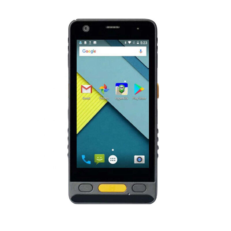
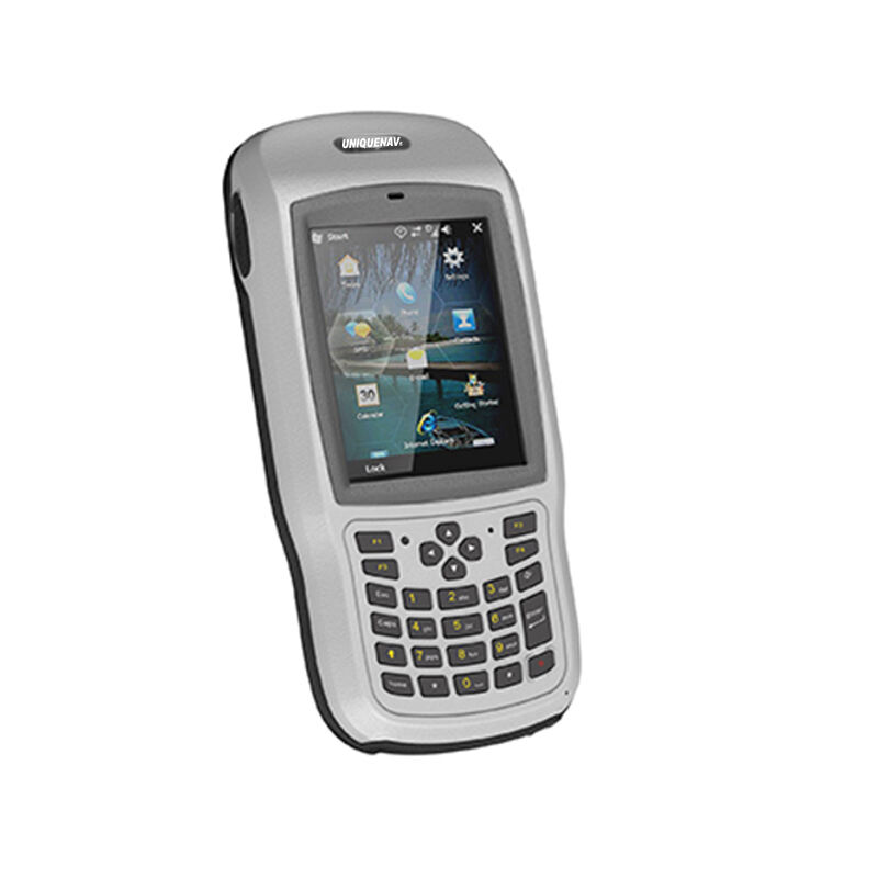
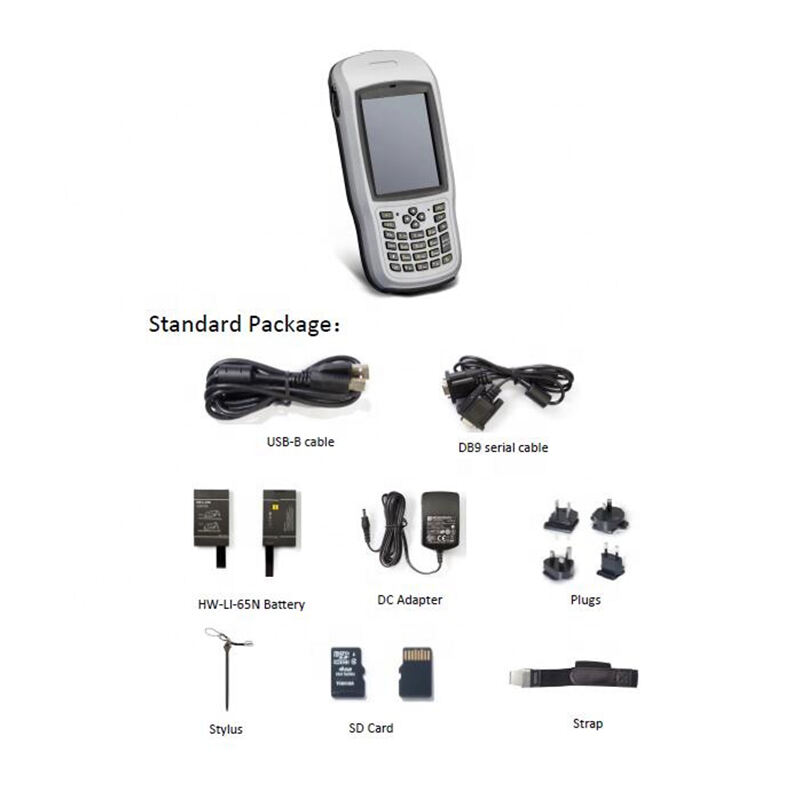
GIS collectors represent cutting-edge mobile data collection devices specifically engineered for geographic information systems and field surveying operations. These sophisticated handheld instruments combine advanced GPS technology with comprehensive data recording capabilities, enabling professionals to capture accurate spatial information directly in the field. Modern gis collectors integrate high-precision positioning systems with intuitive software interfaces, allowing users to document geographic features, collect attribute data, and perform real-time mapping tasks with exceptional accuracy. The technology behind gis collectors incorporates multi-constellation GNSS receivers that support GPS, GLONASS, Galileo, and BeiDou satellite systems, ensuring reliable positioning even in challenging environments. These devices feature ruggedized construction designed to withstand harsh field conditions, including extreme temperatures, moisture, dust, and impact resistance. The primary functions of gis collectors encompass precise coordinate capture, attribute data entry, photo documentation with embedded location tags, sketch mapping, and seamless integration with existing GIS databases. Advanced models include features such as laser rangefinders for distance measurements, electronic compasses for bearing calculations, and barometric altimeters for elevation data. The technological architecture of gis collectors supports various data formats and coordinate systems, enabling compatibility with popular GIS software platforms. Field professionals utilize these instruments across diverse applications including land surveying, environmental monitoring, infrastructure management, archaeological documentation, forestry assessment, utility mapping, and emergency response operations. The versatility of gis collectors makes them indispensable tools for surveyors, environmental scientists, urban planners, archaeologists, and field researchers who require accurate spatial data collection capabilities in remote or challenging locations.

New Product Releases

GIS collectors deliver exceptional value through enhanced field productivity and data accuracy that traditional surveying methods simply cannot match. These devices eliminate the need for multiple separate instruments by combining GPS positioning, data recording, and mapping functions into one compact unit, significantly reducing equipment costs and simplifying field operations. Users experience immediate productivity gains through streamlined workflows that allow real-time data collection and validation, preventing costly errors that often occur during manual data transcription processes. The precision capabilities of modern gis collectors ensure submeter accuracy in most conditions, with professional-grade models achieving centimeter-level precision when paired with differential correction services, delivering survey-quality results at a fraction of traditional surveying costs. Field teams benefit from the intuitive user interfaces that require minimal training, enabling staff to become productive quickly without extensive technical expertise. The robust construction of gis collectors withstands demanding field conditions, reducing downtime and replacement costs while maintaining consistent performance in extreme weather, dusty environments, or rugged terrain. Data integration capabilities represent another significant advantage, as gis collectors seamlessly synchronize with office-based GIS systems, eliminating time-consuming data transfer processes and reducing the risk of data loss or corruption. Real-time data validation features allow field crews to verify information accuracy immediately, preventing expensive return trips to collect missing or incorrect data. The versatility of gis collectors enables organizations to deploy the same equipment across multiple project types, maximizing return on investment and reducing training requirements. Battery life optimization ensures extended field operations without frequent charging interruptions, while cloud connectivity options enable remote project monitoring and immediate data sharing with office personnel. Cost savings extend beyond initial equipment investment, as gis collectors reduce project timelines, minimize field crew requirements, and eliminate redundant data collection efforts. Professional support services and regular software updates maintain device functionality and introduce new features that enhance operational capabilities over time.

Latest News

GNSS RTK: The Ultimate Guide to Real-Time Kinematic Surveying

27

Nov

GNSS RTK: The Ultimate Guide to Real-Time Kinematic Surveying

Real-Time Kinematic (RTK) technology has revolutionized the field of surveying by providing centimeter-level accuracy in positioning measurements. This advanced Global Navigation Satellite System (GNSS) technique enables surveyors, construction profe...
View More
Top Tips for Using High Accuracy Handheld GPS in the Field

27

Nov

Top Tips for Using High Accuracy Handheld GPS in the Field

Professional fieldwork demands precision, reliability, and efficiency in positioning technology. Modern surveying, construction, and geospatial applications require positioning solutions that deliver centimeter-level accuracy while maintaining the po...
View More
Why Do Mapping Teams Prefer RTK for Real-Time Positioning Tasks?

22

Dec

Why Do Mapping Teams Prefer RTK for Real-Time Positioning Tasks?

Modern mapping teams face unprecedented demands for precision and speed in their surveying operations. The evolution of positioning technologies has revolutionized how professionals approach field data collection, with RTK for real-time positioning e...
View More
What Should Buyers Compare When Sourcing RTK GPS Equipment?

13

Jan

What Should Buyers Compare When Sourcing RTK GPS Equipment?

Modern construction, surveying, and agricultural operations increasingly rely on precise positioning technology to achieve millimeter-level accuracy in their work. When sourcing RTK GPS equipment, buyers face numerous technical specifications, featur...
View More

Get a Free Quote

Our representative will contact you soon.
Email
Name
Company Name
Message
0/1000

gis collectors

Advanced Multi-Constellation GNSS Technology for Superior Positioning Accuracy

Advanced Multi-Constellation GNSS Technology for Superior Positioning Accuracy

The sophisticated GNSS technology integrated into modern gis collectors represents a revolutionary advancement in field positioning capabilities that transforms data collection accuracy and reliability. These devices incorporate cutting-edge multi-constellation receivers that simultaneously track signals from GPS, GLONASS, Galileo, and BeiDou satellite systems, dramatically increasing the number of available satellites and improving positioning precision in challenging environments. This comprehensive satellite constellation approach ensures consistent signal reception even in urban canyons, forested areas, or mountainous terrain where traditional single-constellation systems often struggle to maintain accuracy. The advanced signal processing algorithms within gis collectors filter atmospheric interference and multipath errors, delivering positioning accuracy that rivals expensive survey-grade equipment at a fraction of the cost. Professional-grade models feature real-time kinematic correction capabilities that achieve centimeter-level accuracy when connected to base stations or correction services, making them suitable for high-precision applications such as boundary surveys, infrastructure mapping, and construction layout. The technology automatically adapts to changing conditions by selecting optimal satellite combinations and adjusting measurement parameters to maintain consistent accuracy throughout data collection sessions. Users benefit from rapid acquisition times and stable positioning locks that minimize delays during field operations, enabling efficient data collection workflows that maximize productivity. The robust antenna designs incorporated into gis collectors maintain signal strength and quality even when devices are tilted or partially obstructed, providing flexibility during field measurements. Advanced error correction systems continuously monitor signal quality and automatically apply corrections for atmospheric delays, satellite clock errors, and orbital variations, ensuring that collected data meets professional surveying standards. The integration of multiple positioning technologies, including SBAS augmentation systems and RTK networks, provides users with flexible accuracy options that can be tailored to specific project requirements and budget constraints.
Rugged Design Engineering for Extreme Field Durability and Reliability

Rugged Design Engineering for Extreme Field Durability and Reliability

The exceptional durability of gis collectors stems from specialized engineering that addresses the demanding requirements of professional field work in challenging environmental conditions. These devices undergo rigorous testing protocols that simulate extreme temperatures, moisture exposure, dust infiltration, and impact scenarios to ensure reliable operation in the harshest field environments. The ruggedized housing construction utilizes advanced polymer materials and reinforced internal structures that protect sensitive electronic components from shock, vibration, and environmental contamination while maintaining ergonomic comfort during extended use. Waterproof sealing systems achieve IPX7 or higher ratings, allowing gis collectors to withstand complete submersion and operate reliably in heavy rain, snow, or humid conditions without compromising functionality. The robust display technology features scratch-resistant screens with enhanced visibility in direct sunlight, eliminating readability issues that plague standard consumer devices in outdoor environments. Temperature regulation systems enable continuous operation across extreme temperature ranges, from arctic conditions to desert environments, ensuring consistent performance regardless of climate conditions. The reinforced button design and sealed membrane switches resist wear from repeated use while preventing contamination from dirt, sand, or moisture that could impair device functionality. Battery compartments feature secure sealing mechanisms that protect power systems from environmental exposure while enabling quick field replacement when extended operation is required. Drop-test certifications validate the ability of gis collectors to survive accidental falls onto concrete or rocky surfaces without damage, providing confidence for use in demanding field conditions. The corrosion-resistant materials and coatings protect against salt spray, chemical exposure, and other corrosive environments commonly encountered in marine, industrial, or agricultural applications. Quality assurance protocols ensure that each device meets stringent reliability standards before shipment, while comprehensive warranty coverage provides protection against manufacturing defects and environmental damage. Field service support networks offer rapid repair and replacement services to minimize downtime when issues occur during critical project phases.
Comprehensive Data Integration and Workflow Optimization Capabilities

Comprehensive Data Integration and Workflow Optimization Capabilities

The sophisticated data integration capabilities of gis collectors revolutionize field data management by providing seamless connectivity between field collection activities and office-based GIS systems, eliminating traditional data transfer bottlenecks and reducing project completion times. These devices support multiple data formats including shapefiles, geodatabases, KML files, and industry-specific formats, ensuring compatibility with virtually any GIS software platform or database system currently in use. Cloud-based synchronization features enable real-time data sharing between field crews and office personnel, allowing project managers to monitor progress, validate data quality, and provide immediate feedback without waiting for field teams to return to the office. The advanced workflow management systems built into gis collectors guide users through standardized data collection procedures, reducing errors and ensuring consistent data quality across multiple field crews and project phases. Customizable forms and attribute templates streamline data entry processes by presenting relevant fields and validation rules specific to each feature type, minimizing training requirements and preventing common data entry mistakes. Photo integration capabilities automatically embed GPS coordinates and timestamps into digital images, creating comprehensive documentation that links visual records directly to spatial locations within the GIS database. The sophisticated data validation engines perform real-time quality checks during collection, alerting users to missing attributes, geometric errors, or inconsistent values before data is committed to the database, preventing costly rework cycles. Offline operation capabilities ensure continuous productivity even in areas without cellular coverage, with automatic synchronization occurring when connectivity is restored. The robust export functions support various data delivery formats required by clients, regulatory agencies, or partner organizations, eliminating time-consuming data conversion processes. Advanced reporting tools generate field summaries, progress reports, and quality metrics that help project managers track productivity and identify potential issues before they impact project schedules. The comprehensive audit trails maintained by gis collectors document data collection activities, modifications, and validation steps, providing accountability and traceability required for regulatory compliance or quality assurance purposes.

Get a Free Quote

Our representative will contact you soon.
Email
Name
Company Name
Message
0/1000