Professional GPS Field Data Collection Systems: Advanced Solutions for Precise Geographic Data Gathering

All Categories

gps field data collection

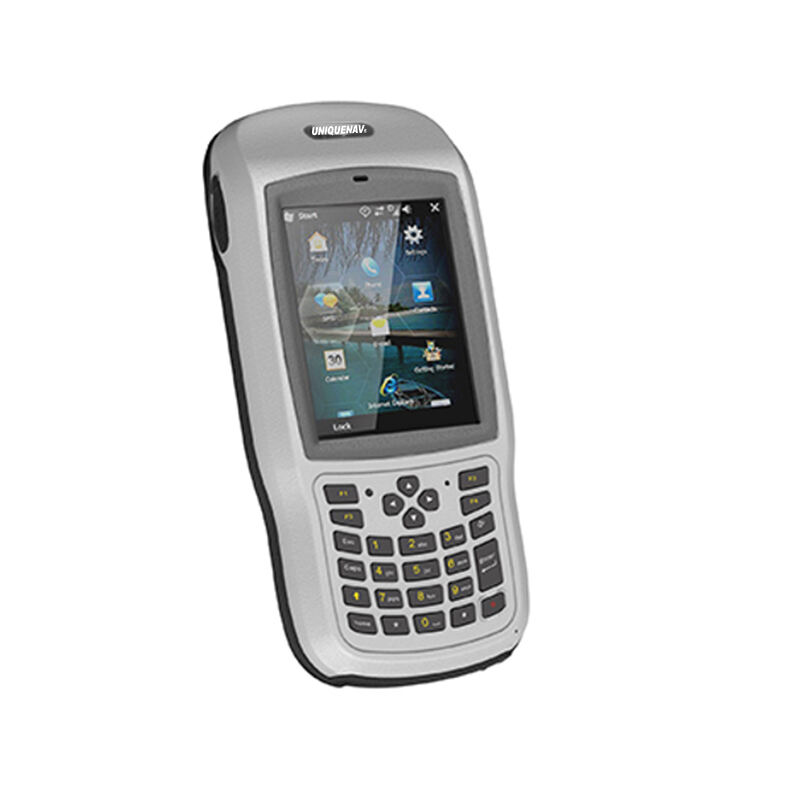
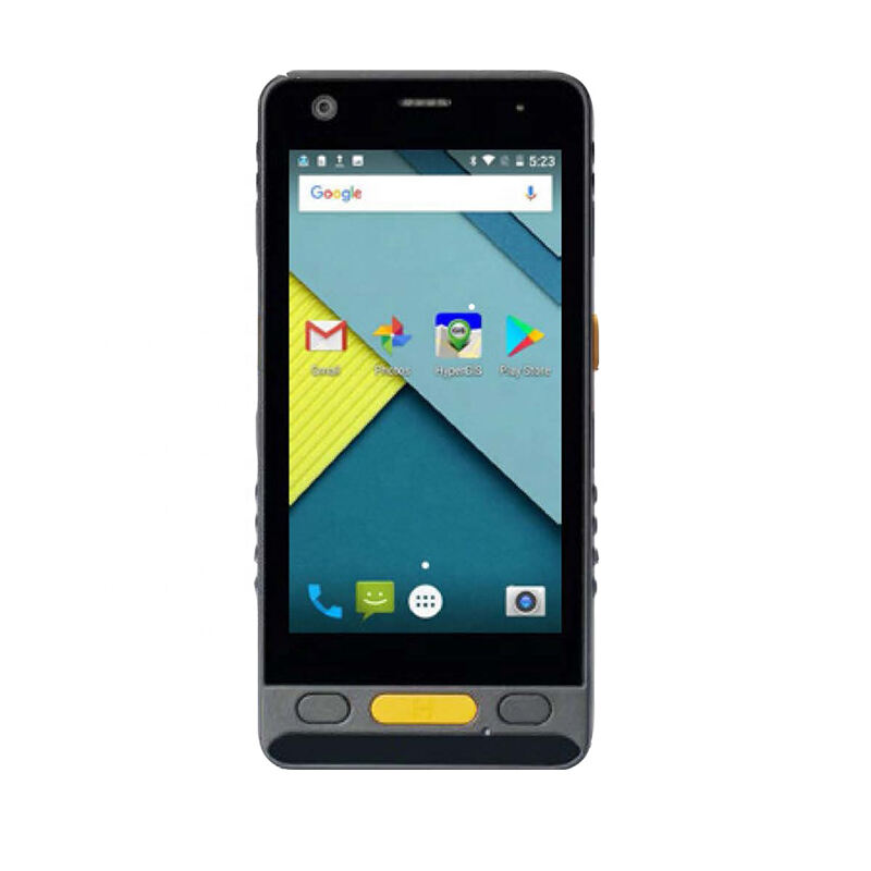
GPS field data collection represents a revolutionary approach to gathering, storing, and managing geographic information in real-world environments. This technology combines Global Positioning System capabilities with advanced data collection tools, enabling professionals across various industries to capture precise location-based information directly in the field. The system utilizes satellite navigation to determine exact coordinates while simultaneously recording detailed attributes about specific locations, objects, or phenomena. Modern GPS field data collection systems integrate sophisticated hardware components including high-precision receivers, ruggedized tablets or handheld devices, and specialized software applications designed for outdoor use. The primary functions encompass real-time positioning, data attribute recording, digital mapping, photo integration, and seamless data synchronization with office-based systems. Technological features include sub-meter accuracy positioning, offline data collection capabilities, customizable data forms, automatic coordinate capture, and robust data validation protocols. The system supports multiple coordinate systems and datum transformations, ensuring compatibility with existing geographic information systems. Advanced GPS field data collection platforms incorporate wireless connectivity options, enabling real-time data transmission and collaborative fieldwork among multiple team members. These systems typically feature weather-resistant designs, extended battery life, and intuitive user interfaces that minimize training requirements. The technology supports various data formats including points, lines, polygons, and complex geometric shapes, making it suitable for diverse mapping projects. Applications span numerous sectors including environmental monitoring, urban planning, infrastructure management, agricultural surveying, archaeological documentation, emergency response, utility mapping, and construction project management. The integration of GPS field data collection with cloud-based platforms enables instant data sharing, backup procedures, and multi-user access, transforming traditional surveying methodologies into streamlined digital workflows that enhance productivity and accuracy across professional applications.

New Product Releases

GPS field data collection delivers substantial benefits that transform traditional surveying and mapping workflows into efficient, accurate, and cost-effective operations. The primary advantage lies in dramatic time savings compared to conventional methods, as field teams can simultaneously capture location coordinates and associated data attributes in a single operation. This eliminates the need for separate coordinate recording and manual data entry processes that historically consumed significant project resources. Accuracy improvements represent another critical benefit, with modern GPS field data collection systems achieving sub-meter precision consistently, reducing measurement errors that often plague traditional surveying techniques. The technology enables real-time data validation, allowing field personnel to identify and correct inconsistencies immediately rather than discovering issues during post-processing phases. Cost reduction becomes evident through decreased labor requirements, as smaller teams can accomplish tasks that previously required multiple personnel and extended timeframes. The elimination of transcription errors significantly reduces project risks and associated correction costs. GPS field data collection systems enhance data quality through standardized collection protocols, ensuring consistent information capture across different field teams and project phases. The digital nature of collected data facilitates immediate integration with existing geographic information systems, eliminating manual digitization processes and reducing project completion times. Field personnel benefit from intuitive interfaces that require minimal technical expertise, reducing training costs and enabling rapid deployment of collection teams. The technology supports offline operation capabilities, ensuring data collection continues in remote areas without cellular or internet connectivity. Automatic backup features protect valuable field data against loss, while synchronization capabilities enable seamless data sharing among project stakeholders. GPS field data collection reduces equipment requirements by consolidating multiple functions into single devices, lowering hardware costs and simplifying field logistics. The technology enables better project management through real-time progress monitoring and quality control measures. Environmental benefits emerge through reduced paper consumption and digital workflow adoption, supporting sustainable business practices while maintaining operational efficiency.

Practical Tips

How Do Total Stations Support High-Accuracy Layout in Construction?

13

Jan

How Do Total Stations Support High-Accuracy Layout in Construction?

Construction projects demand exceptional precision when establishing accurate layout points and measurements across job sites. Modern surveying instruments have revolutionized how construction professionals approach dimensional control and spatial po...
View More
How Does RTK GPS Reduce Errors in Professional Survey Work?

13

Jan

How Does RTK GPS Reduce Errors in Professional Survey Work?

Professional surveying demands precision that can make the difference between project success and costly mistakes. Traditional GPS systems, while revolutionary, often fall short of the accuracy requirements needed for construction, engineering, and l...
View More
Why Are Digital Levels Preferred Over Traditional Bubble Levels?

11

Feb

Why Are Digital Levels Preferred Over Traditional Bubble Levels?

The construction and engineering industries have witnessed a significant transformation in measurement tools over the past decade. Among these advancements, digital levels have emerged as the preferred choice for professionals who demand precision, e...
View More
What Key Features Should You Check When Buying an Auto Level?

11

Feb

What Key Features Should You Check When Buying an Auto Level?

When precision matters most in construction and surveying projects, selecting the right auto level becomes a critical decision that can impact the success of your entire operation. An auto level serves as the backbone of accurate height measurements ...
View More

Get a Free Quote

Our representative will contact you soon.
Email
Name
Company Name
Message
0/1000

gps field data collection

Real-Time Precision and Accuracy Enhancement

Real-Time Precision and Accuracy Enhancement

GPS field data collection systems deliver unparalleled precision that fundamentally transforms data gathering accuracy standards across professional applications. Modern systems achieve sub-meter accuracy consistently, with premium configurations reaching centimeter-level precision through differential correction techniques and real-time kinematic positioning. This precision level represents a quantum leap from traditional measurement methods that often introduced significant margins of error. The technology employs sophisticated error correction algorithms that account for atmospheric interference, satellite geometry variations, and multipath signal distortion, ensuring reliable positioning data under diverse environmental conditions. Real-time accuracy verification features enable field personnel to assess coordinate quality instantly, identifying potential issues before they impact project outcomes. The system continuously monitors satellite constellation health, signal strength, and geometric dilution of precision factors, providing operators with confidence indicators for collected data points. Advanced GPS field data collection platforms integrate multiple satellite systems including GPS, GLONASS, Galileo, and BeiDou constellations, maximizing satellite availability and improving positioning accuracy in challenging environments such as urban canyons or dense forest canopies. The precision enhancement directly translates to reduced rework requirements, lower project costs, and improved deliverable quality for clients. Quality assurance protocols built into GPS field data collection systems automatically flag questionable measurements, preventing the incorporation of substandard data into project datasets. The accuracy improvements enable compliance with stringent industry standards and regulatory requirements that demand precise geographic information. Field teams benefit from confidence in their measurements, reducing the need for redundant data collection and verification procedures that traditionally consumed valuable project time. The precision capabilities of GPS field data collection systems support critical applications such as property boundary determination, infrastructure planning, and environmental monitoring where measurement accuracy directly impacts decision-making processes and legal compliance requirements.
Streamlined Workflow Integration and Efficiency

Streamlined Workflow Integration and Efficiency

GPS field data collection revolutionizes traditional surveying workflows by integrating multiple data gathering processes into unified, efficient operations that dramatically reduce project timelines and resource requirements. The technology eliminates traditional bottlenecks associated with separate coordinate measurement, data recording, and office-based digitization phases by combining these functions into seamless field operations. Modern systems feature intuitive interfaces that guide field personnel through standardized data collection protocols, ensuring consistent information capture regardless of operator experience levels. Customizable data forms enable organizations to tailor collection procedures to specific project requirements while maintaining standardization across field teams. The integration capabilities extend beyond basic coordinate capture to include photograph documentation, audio notes, sketches, and complex attribute data, creating comprehensive field records that support detailed project analysis. GPS field data collection systems synchronize automatically with office-based geographic information systems, enabling real-time project monitoring and immediate data availability for analysis and reporting purposes. Cloud-based integration features allow multiple field teams to contribute to shared datasets simultaneously, facilitating collaborative projects and reducing coordination overhead. The workflow efficiency gains become particularly evident in large-scale projects where traditional methods would require extensive post-processing and quality control procedures. Automated data validation protocols identify inconsistencies and missing information during collection phases, preventing costly rework cycles that traditionally occurred during office processing stages. The technology supports flexible work scheduling by enabling offline data collection in remote locations, with automatic synchronization occurring when connectivity becomes available. Project managers benefit from real-time progress tracking capabilities that provide visibility into collection status, quality metrics, and resource utilization patterns. The streamlined workflows reduce administrative overhead associated with data handling, file management, and version control processes that complicate traditional surveying projects. GPS field data collection systems enable rapid deployment of field teams with minimal setup requirements, supporting emergency response scenarios and time-critical projects where rapid data gathering becomes essential for effective decision-making.
Versatile Application Adaptability and Scalability

Versatile Application Adaptability and Scalability

GPS field data collection systems demonstrate remarkable versatility across diverse industry applications, providing scalable solutions that adapt to varying project requirements, organizational sizes, and technical specifications. The technology accommodates small-scale mapping projects involving single operators as effectively as large enterprise deployments requiring coordinated multi-team operations across extensive geographic areas. Environmental monitoring applications leverage GPS field data collection for tracking wildlife populations, documenting habitat conditions, monitoring pollution sources, and conducting ecological assessments with precise spatial referencing. Urban planning professionals utilize the technology for infrastructure inventory, zoning verification, development impact assessment, and community engagement initiatives that require accurate geographic documentation. Archaeological applications benefit from precise artifact location recording, site boundary documentation, and excavation progress tracking that supports research objectives and cultural preservation requirements. Emergency response organizations deploy GPS field data collection systems for incident documentation, resource allocation planning, damage assessment, and recovery operation coordination. The agricultural sector employs the technology for precision farming applications, crop monitoring, soil sampling coordination, and yield optimization strategies that depend on accurate spatial data. Utility companies leverage GPS field data collection for infrastructure mapping, maintenance scheduling, service area analysis, and regulatory compliance documentation. The scalability features enable organizations to expand system capabilities as project requirements evolve, adding users, devices, and functionality modules without disrupting existing operations. Customization options allow tailoring of data collection forms, validation rules, symbology standards, and reporting formats to match specific organizational workflows and industry standards. Integration capabilities support connection with existing enterprise systems including asset management platforms, customer relationship management systems, and financial reporting tools. The technology accommodates various skill levels through configurable interface complexity, enabling both technical specialists and general field personnel to contribute effectively to data collection initiatives. GPS field data collection systems support multi-language operations and international coordinate system requirements, facilitating global project deployment and cross-border collaboration initiatives that require standardized data collection protocols across diverse operational environments.

Get a Free Quote

Our representative will contact you soon.
Email
Name
Company Name
Message
0/1000