dgps system
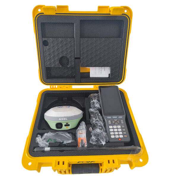
The DGPS system, or Differential Global Positioning System, represents a significant advancement in satellite-based navigation technology that addresses the inherent limitations of standard GPS. This sophisticated positioning solution enhances the accuracy of GPS signals by incorporating ground-based reference stations that continuously monitor satellite signals and calculate correction data. The DGPS system operates by establishing a network of fixed reference stations positioned at precisely surveyed locations, which receive GPS signals and compare the calculated positions with their known coordinates. When discrepancies are detected, these stations generate correction messages that are transmitted to DGPS-enabled receivers in the surrounding area. The primary function of the DGPS system involves real-time error correction, eliminating various sources of GPS inaccuracy including atmospheric delays, satellite clock errors, and orbital deviations. This correction process dramatically improves positioning precision from several meters down to sub-meter accuracy levels. Technologically, the DGPS system utilizes multiple communication channels including radio beacons, cellular networks, and satellite links to distribute correction data. Modern DGPS implementations feature advanced algorithms that process multiple correction sources simultaneously, ensuring optimal accuracy across diverse operational environments. The system supports various correction formats including RTCM standards, enabling compatibility with a wide range of receivers and applications. Key technological features include multi-constellation support, covering GPS, GLONASS, Galileo, and BeiDou satellites, which enhances reliability and availability. The DGPS system finds extensive applications across numerous industries including surveying, agriculture, marine navigation, aviation, and construction. In precision agriculture, farmers utilize DGPS systems for automated vehicle guidance, variable rate application, and field mapping. Marine vessels rely on DGPS for harbor approach, offshore operations, and hydrographic surveys. The construction industry employs DGPS systems for machine control, site surveying, and infrastructure development projects.