leveling instrument in civil engineering
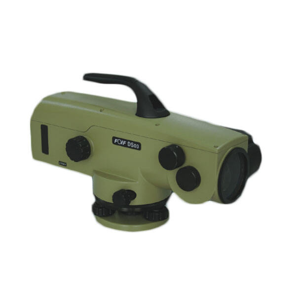
A leveling instrument in civil engineering represents a fundamental surveying tool designed to establish horizontal planes and measure height differences between various points on construction sites. This precision equipment operates by creating a level line of sight, enabling engineers and surveyors to determine accurate elevations across different terrains and project locations. The primary function of a leveling instrument in civil engineering involves establishing reference points, measuring vertical distances, and ensuring proper grading throughout construction projects. Modern leveling instruments incorporate advanced optical systems, automatic compensators, and digital displays to enhance measurement accuracy and operational efficiency. These sophisticated devices utilize precise bubble levels, telescopic lenses, and graduated staff readings to provide reliable elevation data essential for foundation work, road construction, and building projects. The technological features of contemporary leveling instruments in civil engineering include automatic leveling mechanisms that compensate for minor instrument tilting, ensuring consistent horizontal reference lines regardless of setup conditions. Many models feature digital readouts, data storage capabilities, and wireless connectivity options that streamline data collection and transfer processes. The optical systems employ high-quality lenses with magnification ranges typically between 20x to 32x, providing clear visibility of measurement targets at distances up to 100 meters or more. Applications of leveling instruments in civil engineering span numerous construction disciplines, from residential building foundations to large-scale infrastructure developments. These tools prove indispensable for establishing building elevations, setting up drainage systems, creating road profiles, and monitoring settlement in existing structures. Construction professionals rely on leveling instruments to ensure proper water flow in sewage systems, maintain consistent foundation heights, and verify compliance with architectural specifications. The versatility of leveling instruments in civil engineering extends to topographic mapping, where accurate elevation measurements contribute to detailed site analysis and design optimization throughout project lifecycles.