Professional Land Survey by Total Station - Precise Surveying Solutions & Digital Integration

All Categories

land survey by total station

A land survey by total station represents a revolutionary approach to modern surveying practices, combining electronic distance measurement with precise angular measurements in a single, integrated instrument. This sophisticated surveying method has transformed how professionals conduct topographic mapping, boundary determination, and construction layout projects across diverse terrains and applications. The total station integrates an electronic theodolite with an electronic distance meter, creating a powerful tool that measures horizontal and vertical angles alongside slope distances with remarkable accuracy. When performing a land survey by total station, surveyors can establish comprehensive coordinate systems that provide three-dimensional positioning data for any point within the survey area. The instrument operates through electromagnetic wave technology, typically using infrared laser beams to measure distances to reflective prisms or targets placed at survey points. Modern total stations feature advanced microprocessors that automatically calculate coordinates, elevations, and various geometric relationships in real-time. The land survey by total station process begins with establishing control points and reference stations, followed by systematic data collection throughout the survey area. Digital display screens show measurements instantly, while internal memory systems store thousands of survey points for later processing and analysis. Many total stations now include GPS integration, enabling surveyors to work in both local coordinate systems and global positioning frameworks. The technology supports multiple measurement modes, including reflectorless measurement capabilities that allow distance measurement to any visible surface up to several hundred meters away. Weather-resistant construction ensures reliable operation in challenging field conditions, while rechargeable battery systems provide extended operational periods. Data collection software integrated within the total station enables field personnel to perform complex calculations, generate preliminary maps, and ensure quality control during the survey process. The precision achieved through land survey by total station methods typically ranges from millimeter-level accuracy for construction applications to centimeter-level accuracy for general surveying purposes.

Popular Products

The land survey by total station offers numerous practical advantages that directly benefit construction companies, engineering firms, and property developers seeking accurate surveying solutions. Speed represents one of the most significant benefits, as surveyors can collect comprehensive data points in a fraction of the time required by traditional surveying methods. Where conventional surveys might take several days to complete, a land survey by total station can often finish the same work within hours, reducing project timelines and labor costs substantially. The enhanced accuracy of total station measurements eliminates costly errors that frequently occur with manual surveying techniques, preventing expensive rework and ensuring projects proceed smoothly from initial planning through final construction. Real-time data processing capabilities allow surveyors to verify measurements immediately, identifying and correcting any inconsistencies before leaving the survey site. This immediate validation saves significant time and resources that would otherwise be spent on return visits to collect missing or questionable data points. The digital nature of land survey by total station results produces seamless integration with computer-aided design software and building information modeling systems, streamlining the transition from field survey to project design and construction planning. Weather resistance built into modern total stations ensures surveys can continue during light rain, wind, or temperature variations that would halt traditional surveying operations, maintaining project schedules and reducing weather-related delays. The versatility of total station equipment allows the same instrument to handle multiple survey types, from simple boundary surveys to complex topographic mapping and construction staking, eliminating the need for multiple specialized instruments and reducing equipment costs. Battery-powered operation provides complete independence from external power sources, enabling surveys in remote locations where traditional equipment might be impractical. The reflectorless measurement capability of modern total stations allows surveyors to measure distances to inaccessible points, such as building corners, utility lines, or hazardous areas, without requiring personnel to access potentially dangerous locations. Automated measurement recording eliminates transcription errors common in manual data collection, while standardized digital formats ensure consistent data quality regardless of which surveyor operates the equipment. Training requirements for land survey by total station operation are generally less extensive than traditional surveying methods, allowing companies to deploy qualified operators more quickly and efficiently.

Tips And Tricks

How GNSS RTK Systems Deliver High-Precision Results

27

Nov

How GNSS RTK Systems Deliver High-Precision Results

Modern surveying and positioning applications demand exceptional accuracy that traditional GPS systems simply cannot deliver. Global Navigation Satellite System Real-Time Kinematic (GNSS RTK Systems) have revolutionized precision positioning by provi...
View More
Choosing the Best GNSS RTK System for Your Project

27

Nov

Choosing the Best GNSS RTK System for Your Project

When precision positioning is critical for your surveying, construction, or engineering project, selecting the right GNSS RTK system becomes a pivotal decision that can determine project success. Modern surveying demands centimeter-level accuracy, re...
View More
Top Tips for Using High Accuracy Handheld GPS in the Field

27

Nov

Top Tips for Using High Accuracy Handheld GPS in the Field

Professional fieldwork demands precision, reliability, and efficiency in positioning technology. Modern surveying, construction, and geospatial applications require positioning solutions that deliver centimeter-level accuracy while maintaining the po...
View More
Why Are Digital Levels Preferred Over Traditional Bubble Levels?

11

Feb

Why Are Digital Levels Preferred Over Traditional Bubble Levels?

The construction and engineering industries have witnessed a significant transformation in measurement tools over the past decade. Among these advancements, digital levels have emerged as the preferred choice for professionals who demand precision, e...
View More

Get a Free Quote

Our representative will contact you soon.
Email
Name
Company Name
Message
0/1000

land survey by total station

Unparalleled Measurement Precision and Reliability

Unparalleled Measurement Precision and Reliability

The land survey by total station delivers exceptional measurement precision that surpasses traditional surveying methods by significant margins, providing the accuracy and reliability that modern construction and engineering projects demand. Advanced electronic distance measurement technology within total stations achieves precision levels of plus or minus 1-3 millimeters for distance measurements and angular accuracy of 1-5 arc seconds, ensuring that survey data meets the most stringent professional standards. This remarkable precision stems from sophisticated laser measurement systems that calculate distances by measuring the time required for infrared signals to travel to reflective targets and return to the instrument. The integrated electronic theodolite component measures horizontal and vertical angles with digital precision, eliminating the reading errors and interpolation uncertainties inherent in optical instruments. Temperature and atmospheric pressure compensation features automatically adjust measurements for environmental conditions, ensuring consistent accuracy across varying weather conditions and site elevations. The land survey by total station process incorporates multiple measurement redundancy checks, where the instrument can measure the same point from different positions to verify accuracy and identify potential errors before data recording. Built-in quality control algorithms continuously monitor measurement consistency and alert operators to potential issues such as prism tracking problems, excessive atmospheric interference, or instrument instability. This real-time error detection capability prevents the accumulation of measurement errors that could compromise entire survey datasets. Professional-grade total stations feature dual-axis compensation systems that automatically correct for minor instrument leveling errors, maintaining measurement accuracy even when the instrument is not perfectly level. The precision of land survey by total station measurements directly translates to reduced construction tolerances, fewer material waste issues, and improved project outcomes for clients. When property boundaries require precise definition for legal purposes, the millimeter-level accuracy of total station surveys provides definitive documentation that withstands legal scrutiny and prevents boundary disputes. For construction layout applications, this precision ensures that building foundations, utility installations, and infrastructure elements are positioned exactly according to design specifications, preventing costly modifications and ensuring regulatory compliance.
Advanced Digital Integration and Workflow Efficiency

Advanced Digital Integration and Workflow Efficiency

The land survey by total station revolutionizes surveying workflows through comprehensive digital integration capabilities that seamlessly connect field data collection with office-based design and analysis software systems. Modern total stations feature internal data logging systems that can store thousands of survey points along with detailed attribute information, eliminating the need for manual field notes and reducing transcription errors that plague traditional surveying methods. Bluetooth and USB connectivity options enable instant data transfer to tablets, laptops, and mobile devices, allowing survey teams to process and analyze measurements while still in the field. This immediate data availability supports real-time decision-making and enables rapid identification of areas requiring additional measurements or verification. The land survey by total station process integrates directly with computer-aided design software, building information modeling platforms, and geographic information systems, creating seamless workflows from field measurement through final project delivery. Standardized data formats ensure compatibility across different software platforms, preventing data conversion issues and maintaining measurement integrity throughout the project lifecycle. Field software applications designed specifically for total station operation provide intuitive interfaces that guide operators through complex survey procedures while automatically performing coordinate calculations and quality control checks. These applications often include features such as digital mapping capabilities, code-based data collection systems, and automatic point numbering schemes that organize survey data efficiently for subsequent processing. The digital integration of land survey by total station systems supports collaborative workflows where multiple team members can access and work with survey data simultaneously, improving project coordination and reducing communication errors. Cloud-based data storage and sharing capabilities enable survey teams to upload field data instantly for review by remote team members, facilitating rapid project progress and quality assurance processes. Advanced total stations now incorporate artificial intelligence features that can automatically recognize survey targets, optimize measurement sequences, and suggest efficient data collection strategies based on project requirements. The comprehensive digital documentation produced by land survey by total station operations creates permanent project records that support long-term facility management, future renovation projects, and regulatory compliance requirements.
Exceptional Versatility and Operational Flexibility

Exceptional Versatility and Operational Flexibility

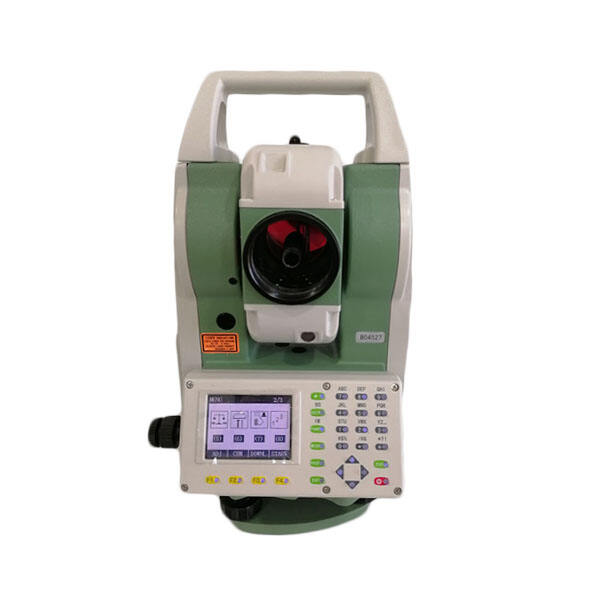
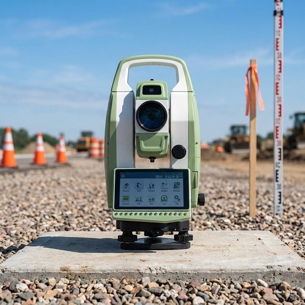
The land survey by total station demonstrates remarkable versatility that allows surveying professionals to handle diverse project requirements with a single, sophisticated instrument capable of adapting to various measurement challenges and site conditions. Unlike specialized surveying equipment designed for specific applications, total stations excel in multiple surveying disciplines including topographic mapping, boundary surveys, construction layout, monitoring applications, and as-built documentation projects. The reflectorless measurement capability of modern total stations enables surveyors to measure distances to any visible surface within several hundred meters, eliminating the need to place prisms or targets in inaccessible, hazardous, or restricted areas. This flexibility proves invaluable when surveying existing buildings, infrastructure facilities, or environmentally sensitive areas where physical access is limited or prohibited. The land survey by total station methodology accommodates both prism-based measurements for maximum accuracy and reflectorless measurements for operational convenience, allowing surveyors to select the optimal measurement approach for each specific situation. Motorized total stations feature automated target tracking and remote operation capabilities, enabling single-person survey operations that reduce labor costs and improve operational efficiency for routine measurement tasks. The robotic functionality allows the instrument to automatically locate and track prisms as survey personnel move throughout the site, maintaining continuous measurement capability without requiring constant instrument adjustment. Weather-resistant construction and extended battery life enable land survey by total station operations in challenging environmental conditions, from extreme temperatures to dusty construction sites, ensuring project continuity regardless of external factors. The modular design of many total station systems supports field-upgradeable components and software updates that extend instrument capabilities and maintain compatibility with evolving technology standards. Multiple measurement modes within total stations accommodate various survey requirements, from high-precision engineering applications requiring millimeter accuracy to general mapping projects where centimeter-level precision is sufficient. The land survey by total station approach supports both traditional surveying coordinate systems and modern GPS integration, enabling surveyors to work within existing local coordinate frameworks or establish new control networks linked to global positioning systems. Interchangeable batteries and field-chargeable power systems ensure continuous operation during extended survey projects, while rugged construction withstands the physical demands of construction site environments and transportation between multiple project locations.

Get a Free Quote

Our representative will contact you soon.
Email
Name
Company Name
Message
0/1000