Professional Total Station and GPS Surveying Solutions - Precision Measurement Technology

All Categories

total station and gps surveying

Total station and GPS surveying represent two revolutionary technologies that have transformed modern land surveying and construction practices. A total station combines electronic distance measurement (EDM) with angular measurement capabilities, creating an integrated instrument that measures horizontal and vertical angles along with slope distances to determine precise coordinates of surveyed points. This sophisticated device incorporates a theodolite for angle measurement and an EDM for distance calculation, enabling surveyors to collect comprehensive spatial data efficiently. GPS surveying utilizes satellite-based navigation systems to determine precise positioning coordinates through triangulation from multiple satellites orbiting Earth. The Global Positioning System provides real-time kinematic (RTK) positioning with centimeter-level accuracy, making it invaluable for various surveying applications. Modern total station and GPS surveying equipment feature advanced technological capabilities including automated target recognition, robotic operation modes, and seamless data integration with computer-aided design software. These instruments support multiple measurement modes, allowing surveyors to adapt their approach based on project requirements and environmental conditions. The integration of both technologies creates a comprehensive surveying solution that combines the precision of total station measurements with the efficiency and coverage capabilities of GPS positioning. Contemporary surveying projects benefit from dual-technology approaches where total station and GPS surveying complement each other to overcome individual limitations. Total stations excel in areas with obstructed satellite reception, such as dense urban environments or heavily forested regions, while GPS surveying provides rapid coordinate establishment across large open areas. The technological convergence of these systems enables seamless data transfer, coordinate system integration, and enhanced productivity through streamlined workflows. Professional surveyors utilize total station and GPS surveying for diverse applications including topographic mapping, construction layout, boundary determination, and infrastructure development projects requiring precise spatial measurements and reliable positioning data.

Popular Products

Total station and GPS surveying offer substantial advantages that revolutionize how professionals approach measurement and positioning tasks across various industries. These advanced technologies deliver exceptional accuracy levels that surpass traditional surveying methods, with total stations achieving millimeter precision in distance and angular measurements while GPS systems provide centimeter-level positioning accuracy through real-time kinematic corrections. The efficiency gains from implementing total station and GPS surveying are remarkable, as these instruments significantly reduce fieldwork time compared to conventional techniques. Surveyors can complete comprehensive site surveys in fractions of the time previously required, enabling faster project completion and reduced labor costs. The automated data collection capabilities eliminate manual recording errors while ensuring consistent measurement quality throughout the surveying process. Total station and GPS surveying systems integrate seamlessly with modern software platforms, allowing immediate data processing and analysis in the field. This integration enables real-time decision-making and reduces the need for return visits to collect additional measurements. The versatility of these technologies makes them suitable for diverse applications ranging from small residential lot surveys to large-scale infrastructure projects. GPS surveying excels in establishing control networks across vast areas, while total stations provide detailed measurements in complex environments where satellite reception may be limited. The combination approach maximizes productivity by leveraging each technology's strengths while minimizing their respective limitations. Weather resistance and durability ensure reliable operation in challenging environmental conditions, protecting equipment investments and maintaining project schedules regardless of weather variations. Modern total station and GPS surveying equipment features intuitive user interfaces that reduce training requirements and minimize operator errors. The ability to store large datasets internally and transfer information wirelessly enhances field productivity and data security. These technologies support various coordinate systems and datum transformations, ensuring compatibility with existing project requirements and regulatory standards. Cost-effectiveness becomes apparent through reduced surveying time, improved accuracy, and decreased likelihood of measurement disputes or rework requirements. Professional surveyors benefit from enhanced reputation and client satisfaction when delivering precise results efficiently using advanced total station and GPS surveying capabilities.

Tips And Tricks

Choosing the Best GNSS RTK System for Your Project

27

Nov

Choosing the Best GNSS RTK System for Your Project

When precision positioning is critical for your surveying, construction, or engineering project, selecting the right GNSS RTK system becomes a pivotal decision that can determine project success. Modern surveying demands centimeter-level accuracy, re...
View More
Top Tips for Using High Accuracy Handheld GPS in the Field

27

Nov

Top Tips for Using High Accuracy Handheld GPS in the Field

Professional fieldwork demands precision, reliability, and efficiency in positioning technology. Modern surveying, construction, and geospatial applications require positioning solutions that deliver centimeter-level accuracy while maintaining the po...
View More
What Should Engineers Check Before Choosing an RTK System?

22

Dec

What Should Engineers Check Before Choosing an RTK System?

Selecting the right RTK system represents one of the most critical decisions in modern surveying and construction projects. Engineers must navigate through numerous technical specifications, accuracy requirements, and operational considerations to en...
View More
Why Is RTK GNSS Essential for High-Accuracy Industrial Positioning?

22

Dec

Why Is RTK GNSS Essential for High-Accuracy Industrial Positioning?

In today's rapidly evolving industrial landscape, precise positioning has become the cornerstone of operational excellence across multiple sectors. RTK GNSS technology represents a quantum leap forward in positioning accuracy, delivering centimeter-l...
View More

Get a Free Quote

Our representative will contact you soon.
Email
Name
Company Name
Message
0/1000

total station and gps surveying

Unmatched Precision and Reliability in All Conditions

Unmatched Precision and Reliability in All Conditions

Total station and GPS surveying technologies deliver unparalleled measurement precision that forms the foundation of successful surveying projects across all industries. Modern total stations achieve angular accuracies of 1 arc second or better, while distance measurements maintain millimeter precision over ranges exceeding several kilometers. This exceptional accuracy ensures that construction projects meet stringent dimensional requirements and regulatory compliance standards. GPS surveying systems, when configured with real-time kinematic corrections, consistently provide horizontal positioning accuracies within 10 millimeters and vertical accuracies within 20 millimeters. The reliability of these measurements remains consistent across varying environmental conditions, from extreme temperatures to high humidity environments. Professional surveyors depend on this precision for critical applications including structural monitoring, where minute movements must be detected and measured accurately over time. The dual-frequency GPS receivers used in modern surveying eliminate ionospheric errors that previously affected measurement quality, while advanced total station compensators automatically correct for instrument tilting and environmental influences. This technological sophistication means that total station and GPS surveying results maintain their accuracy regardless of operator experience levels or challenging field conditions. Quality assurance features built into both systems provide immediate feedback on measurement reliability, alerting operators to potential issues before they affect project outcomes. The precision capabilities extend beyond basic positioning to include advanced applications such as machine control for construction equipment, where millimeter-level accuracy directly translates to material savings and improved construction quality. Redundant measurement systems within these instruments ensure that equipment failures do not compromise project schedules or measurement integrity, providing the reliability that professional surveyors require for mission-critical applications where accuracy cannot be compromised.
Revolutionary Efficiency and Productivity Enhancement

Revolutionary Efficiency and Productivity Enhancement

Total station and GPS surveying technologies transform surveying productivity through automated processes and intelligent measurement systems that dramatically reduce field time requirements. Advanced robotic total stations eliminate the need for traditional two-person survey crews by automatically tracking prism targets and executing measurement sequences without manual intervention. This automation enables single-operator workflows that maintain measurement quality while reducing labor costs and increasing daily productivity rates. GPS surveying further enhances efficiency by establishing coordinate positions instantly without requiring line-of-sight connections between measurement points, allowing surveyors to rapidly establish control networks across large areas. The combination of these technologies enables hybrid surveying approaches where GPS provides rapid area coverage while total stations deliver detailed measurements in challenging environments. Modern total station and GPS surveying systems feature intelligent measurement modes that automatically optimize settings based on environmental conditions and target characteristics, eliminating time-consuming manual adjustments. Wireless connectivity enables real-time data sharing between field crews and office personnel, facilitating immediate quality control review and project coordination. Cloud-based data management systems allow multiple team members to access current survey information simultaneously, improving project communication and reducing delays caused by data transfer bottlenecks. Battery technology improvements ensure full-day operation without interruption, while rapid charging capabilities minimize downtime between measurement sessions. The integration capabilities with construction and engineering software platforms eliminate duplicate data entry requirements, streamlining workflows from field measurement through final deliverable production. Automated stakeout functions guide construction personnel to precise locations using visual and audible indicators, reducing layout errors and improving construction efficiency. These productivity enhancements translate directly to competitive advantages for surveying professionals, enabling them to complete more projects with existing resources while maintaining superior quality standards that exceed client expectations and industry requirements.
Comprehensive Versatility Across Diverse Applications

Comprehensive Versatility Across Diverse Applications

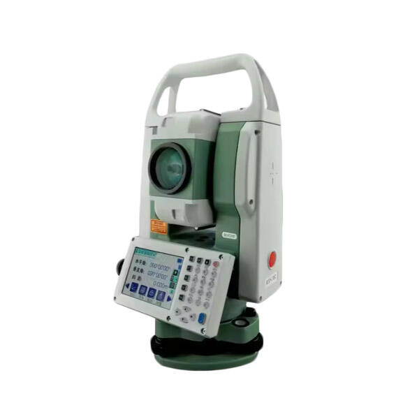
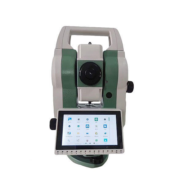
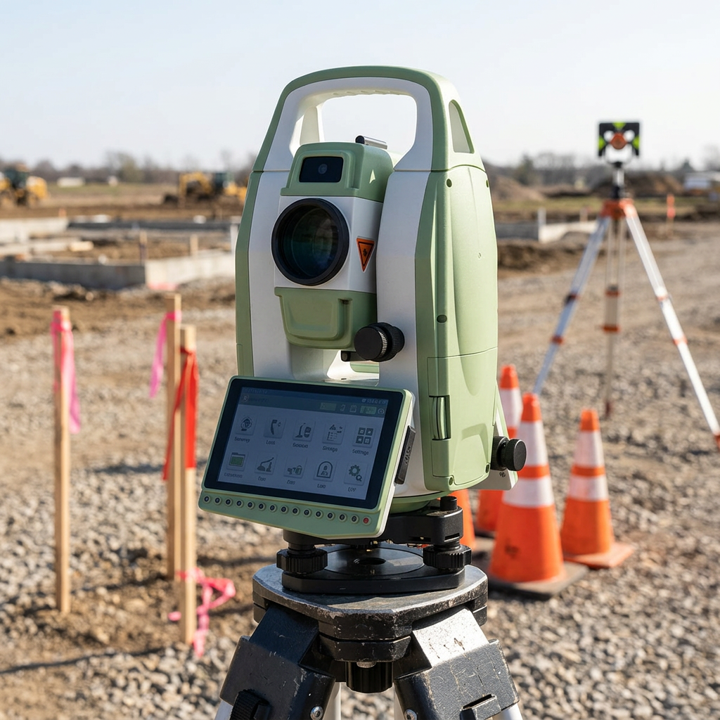
Total station and GPS surveying technologies provide unmatched versatility that adapts to virtually any measurement challenge across construction, engineering, mining, agriculture, and environmental monitoring applications. This adaptability stems from multiple measurement modes and configuration options that allow professionals to optimize their approach for specific project requirements and site conditions. Total stations excel in urban environments where buildings and structures obstruct satellite signals, providing reliable measurements for building surveys, infrastructure monitoring, and precise construction layout tasks. GPS surveying complements this capability by rapidly establishing coordinate networks across open areas, making it ideal for large-scale topographic mapping, agricultural field surveys, and environmental monitoring projects. The seamless integration between these technologies enables surveyors to switch between measurement methods as site conditions change, maintaining productivity throughout diverse project phases. Advanced total station and GPS surveying systems support multiple coordinate systems and datum transformations, ensuring compatibility with existing project data and regulatory requirements regardless of geographic location or local surveying standards. Specialized software applications expand measurement capabilities to include volume calculations, cross-sectional analysis, and three-dimensional modeling directly in the field. These systems accommodate various target types and measurement distances, from precise prism measurements at short ranges to reflectorless measurements on inaccessible surfaces at extended distances. Environmental monitoring applications benefit from long-term measurement stability and automated data logging capabilities that support continuous monitoring programs without manual intervention. Mining operations utilize the rugged construction and explosive-atmosphere certifications available in specialized models, while maintaining survey-grade accuracy in challenging underground conditions. Agricultural applications leverage GPS guidance capabilities for precision farming operations, optimizing field productivity while maintaining detailed records for regulatory compliance. The modular design of modern systems allows users to expand capabilities through additional sensors and accessories, protecting equipment investments while adapting to evolving project requirements and technological advances in the surveying industry.

Get a Free Quote

Our representative will contact you soon.
Email
Name
Company Name
Message
0/1000