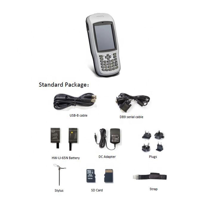
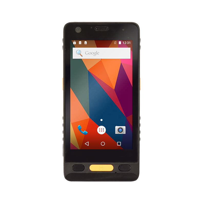
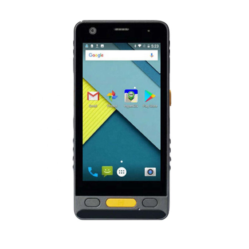
Professional GPS Data Collector: High-Precision Geospatial Data Collection Solution

All Categories

gps data collector

A GPS data collector is a sophisticated device designed for precise location-based data collection and mapping applications. This advanced tool combines high-precision GPS technology with robust data collection capabilities, enabling users to gather, store, and process geographic information with exceptional accuracy. The device features an integrated high-sensitivity GPS receiver, capable of tracking multiple satellite constellations including GPS, GLONASS, and Galileo, ensuring reliable positioning even in challenging environments. Modern GPS data collectors come equipped with powerful processors, ample storage capacity, and user-friendly interfaces, typically featuring a bright, sunlight-readable display that allows for clear visibility in outdoor conditions. These devices support various data collection formats and can seamlessly integrate with Geographic Information System (GIS) software platforms. They often include built-in cameras for photo documentation, Bluetooth connectivity for external sensor integration, and cellular capabilities for real-time data transmission. The rugged construction of these devices ensures reliability in harsh field conditions, with many models featuring water and dust resistance. Applications span across numerous sectors, including land surveying, environmental monitoring, utility mapping, agriculture, and urban planning, making them essential tools for professionals requiring accurate geospatial data collection.

New Products

GPS data collectors offer numerous practical advantages that make them indispensable tools for field operations. First, their superior accuracy levels, often achieving sub-meter precision, ensure reliable data collection for critical applications. This precision is particularly valuable in construction, surveying, and infrastructure projects where exact measurements are essential. The devices streamline workflow efficiency by eliminating manual recording processes, reducing human error, and saving considerable time in the field. Their robust design specifically addresses the challenges of outdoor work environments, featuring shock-resistant casings and weather-sealed components that protect against dust, water, and extreme temperatures. The integration capabilities of these devices are particularly noteworthy, as they can seamlessly connect with various sensors and software systems, enabling real-time data sharing and analysis. This connectivity facilitates immediate decision-making and reduces the need for repeated field visits. The user-friendly interface requires minimal training, making it accessible to team members with varying technical expertise. Battery life is optimized for full-day field operations, eliminating work interruptions. The devices also support multiple data collection methods, including point, line, and polygon features, along with attribute data entry, providing flexibility for diverse project requirements. The ability to customize data collection forms and workflows allows organizations to tailor the device to their specific needs, improving operational efficiency and data consistency. These advantages collectively result in significant cost savings through increased productivity, reduced errors, and improved data quality.

Tips And Tricks

What are the common error sources in GNSS RTK positioning and how to mitigate them?

21

Mar

What are the common error sources in GNSS RTK positioning and how to mitigate them?

View More
Auto Level vs. Digital Level: Choosing the Right Tool

21

Mar

Auto Level vs. Digital Level: Choosing the Right Tool

View More
What are the key differences between GNSS RTK and PPP?

25

Mar

What are the key differences between GNSS RTK and PPP?

View More
Applicable Scenarios and Selection Tips for Different Types of Total Stations

22

Apr

Applicable Scenarios and Selection Tips for Different Types of Total Stations

View More

Get a Free Quote

Our representative will contact you soon.
Email
Name
Company Name
Message
0/1000

gps data collector

Advanced Positioning Technology

Advanced Positioning Technology

The GPS data collector incorporates state-of-the-art positioning technology that sets new standards in location accuracy and reliability. The device utilizes multi-constellation satellite reception, simultaneously tracking signals from GPS, GLONASS, Galileo, and BeiDou systems. This comprehensive satellite coverage ensures consistent positioning even in challenging environments such as urban canyons or under dense canopy. The advanced receiver technology employs real-time kinematic (RTK) corrections, enabling centimeter-level accuracy when connected to correction services. The system's sophisticated algorithms continuously monitor satellite signals, automatically selecting the best combination for optimal positioning performance. This technology also includes advanced multipath mitigation techniques, reducing errors caused by signal reflection in complex environments.
Comprehensive Data Management

Comprehensive Data Management

The data management capabilities of the GPS data collector represent a complete solution for field data handling and processing. The system features an intuitive database structure that organizes collected data into logical projects and sessions, making information retrieval and analysis straightforward. Users can create custom data collection forms with drop-down menus, checkboxes, and text fields, ensuring standardized data entry across teams. The device supports various data formats and can directly export to common GIS and CAD software platforms. Real-time synchronization capabilities enable immediate data backup to cloud servers, eliminating the risk of data loss. The system also includes advanced quality control features that flag potential errors during data collection, ensuring data integrity from the point of capture.
Rugged Field Performance

Rugged Field Performance

The GPS data collector's rugged design ensures reliable performance in demanding field conditions. The device meets military-grade standards for durability, including resistance to drops from height, extreme temperatures, and complete protection against dust and water immersion. The high-capacity battery system is engineered for extended field operations, providing up to 12 hours of continuous use on a single charge. The sunlight-readable display features anti-glare technology and maintains visibility in bright outdoor conditions. The ergonomic design includes tactile buttons that can be operated while wearing gloves, and the balanced weight distribution reduces user fatigue during extended use. Additionally, the device includes hot-swappable batteries, allowing for uninterrupted operation during long field sessions.