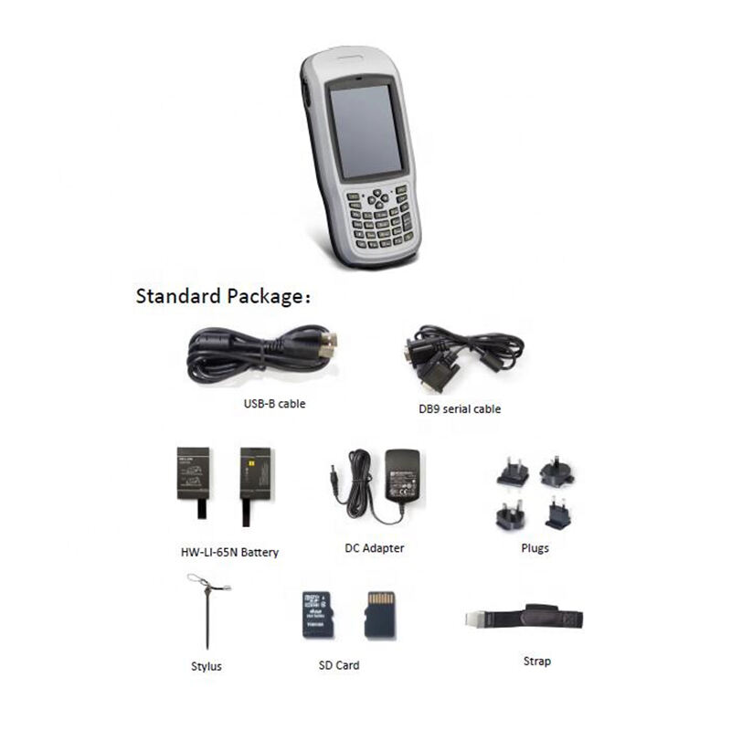
gis data collector
A GIS data collector is an advanced technological tool designed for gathering, storing, and managing geographic information system data in the field. This sophisticated device combines high precision GPS capabilities with robust data collection features, enabling users to capture accurate spatial information along with associated attributes. The system typically incorporates a rugged handheld device with an integrated GPS receiver, digital camera, and specialized software for data entry and management. Users can collect points, lines, and polygons while simultaneously recording essential attributes such as coordinates, elevation, time stamps, and custom field descriptions. Modern GIS data collectors often feature real time differential correction capabilities, ensuring submeter accuracy in positioning data. They support multiple data formats and seamlessly integrate with various GIS software platforms, making data transfer and post processing efficient and straightforward. These devices are equipped with powerful processors, ample storage capacity, and long lasting batteries to support extended field operations. Additionally, many models offer wireless connectivity options, enabling real time data synchronization with central databases and cloud storage systems.