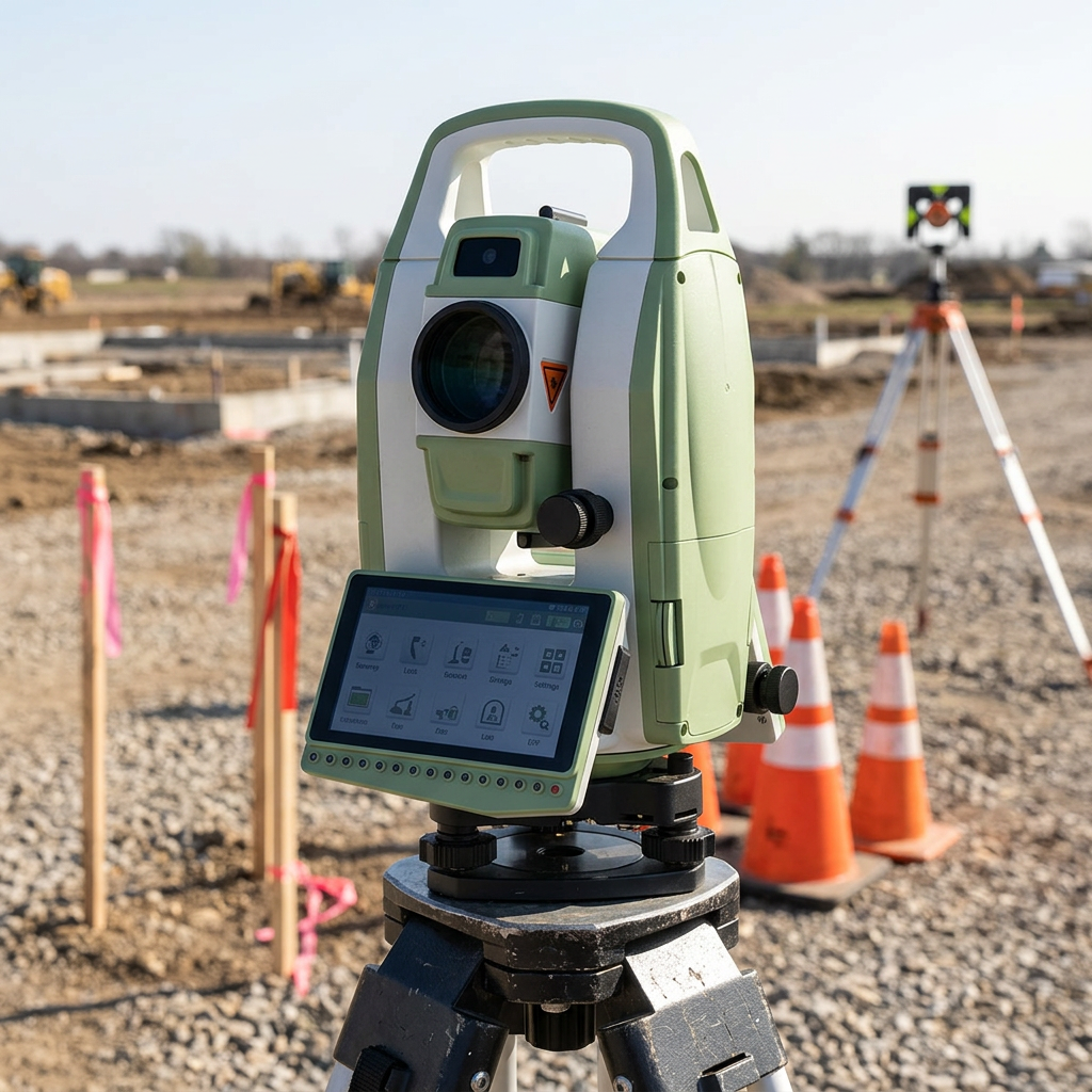
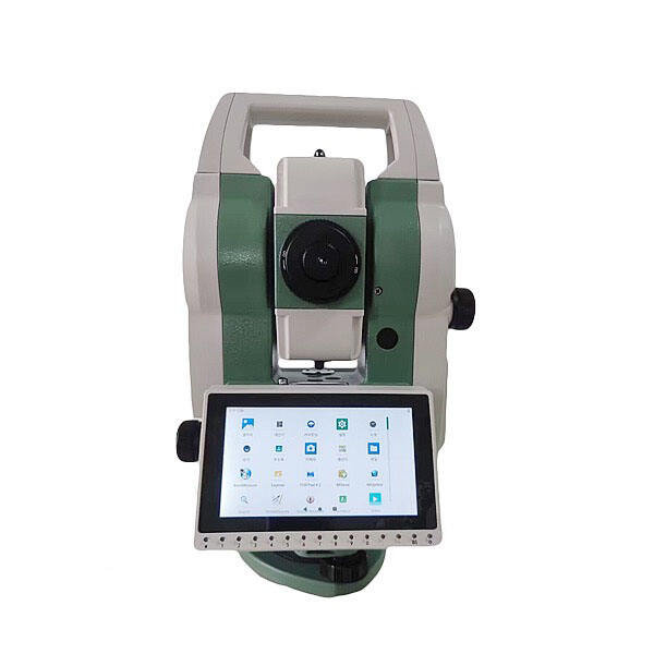
The total station has become one of the most essential instruments in modern surveying and measurement. By combining electronic distance measurement with angle measurement in a single device, the total station delivers speed, precision, and versatility that traditional optical instruments simply cannot match. Whether used on a construction site, in a mine, or across an open landscape, the total station has redefined how professionals capture and use spatial data.
Understanding the main applications of total station technology helps engineers, surveyors, and project managers select the right tool for the right job. The total station is not a one-dimensional instrument. Its range of use cases spans civil engineering, topographic mapping, industrial measurement, and more. This article explores where and how the total station is applied most effectively in real-world professional settings.
Total Station in Construction and Civil Engineering
Setting Out and Layout Control
One of the most critical applications of the total station in construction is setting out, also known as stakeout or layout. When a building or infrastructure project moves from design to physical execution, the total station is used to transfer coordinates from drawings to the ground. Surveyors use the total station to place reference points, mark column positions, define road alignments, and establish foundation boundaries with millimeter-level accuracy. Without a reliable total station, even a minor positional error can compound across an entire structure.
The total station enables setting out to be completed rapidly by a small crew. A single operator can manage the total station and communicate with a pole-holding technician to verify and record each layout point. This workflow keeps construction schedules tight and reduces the cost of rework caused by positional errors.
As-Built Surveys and Progress Monitoring
After construction work is completed or during active phases, the total station is used to conduct as-built surveys. These surveys confirm that structures have been built according to design specifications. The total station records actual point positions and compares them against design data, giving engineers objective evidence of compliance or deviation. In bridge construction, tunnel projects, and high-rise buildings, as-built verification using a total station is a standard quality assurance requirement.
Progress monitoring is another construction application where the total station adds significant value. By repeatedly measuring key reference points over time, the total station helps project teams track earthwork volumes, structural alignment, and surface elevations throughout the build cycle.
Total Station in Topographic and Boundary Surveying
Topographic Data Collection
Topographic surveying involves capturing the shape, elevation, and features of a land surface. The total station is widely used for this purpose because it measures both horizontal angles and vertical angles alongside distance, generating three-dimensional point data. Survey crews use the total station to record terrain features such as slopes, ridges, drainage channels, roads, and existing structures. This data feeds directly into digital terrain models and GIS platforms used by planners and engineers.
In areas where GNSS signals are blocked by dense vegetation, steep terrain, or urban canyons, the total station provides a reliable alternative. The total station operates independently of satellite signals, making it indispensable in environments where GNSS performance is degraded or unavailable. Surveyors frequently combine the total station with GNSS receivers to maximize efficiency across large and varied landscapes.
Cadastral and Boundary Surveys
Cadastral surveys define legal property boundaries, and the total station is a trusted instrument for this work. Land surveyors use the total station to precisely measure distances and angles between boundary markers, ensuring that property limits are accurately recorded and legally defensible. The total station generates precise angular and distance data that supports legal documentation, land registration, and dispute resolution. In high-density urban areas, the total station is especially valuable for confirming small parcel boundaries where precision is non-negotiable.
Total Station in Industrial and Specialized Applications
Industrial Alignment and Machine Installation
Beyond fieldwork, the total station plays a vital role in industrial environments where precise alignment is required. Large machinery, production equipment, turbines, and structural frameworks must be installed within extremely tight tolerances. The total station is used to verify alignment during installation and to monitor any shifts or deformations over time. In manufacturing plants and power facilities, the total station supports commissioning, maintenance inspections, and structural health monitoring with high repeatability.
Industrial-grade total station instruments often feature motorized drives and automated target tracking, allowing them to monitor moving or settling components without manual repositioning. This makes the total station particularly effective in deformation monitoring programs where continuous or repeated measurements are needed over extended periods.
Mining and Tunnel Surveying
In underground mining and tunnel construction, the total station is an essential tool due to confined spaces and limited satellite access. Surveyors use the total station to establish control networks inside tunnels, guide boring machine operations, and measure excavation progress. The total station helps ensure that tunnel segments align correctly and that safety clearances are maintained throughout the excavation process. Above ground, the total station supports open-pit mining by tracking bench positions, haul road alignments, and stockpile volumes.
Deformation monitoring is another critical mining application where the total station provides early warning of ground movement or slope instability. By repeatedly observing fixed prism targets, the total station detects subtle shifts that may indicate structural risk, allowing engineers to respond before problems become hazardous.
FAQ
What makes a total station different from a traditional theodolite?
A total station integrates electronic distance measurement with angle measurement in one device, whereas a traditional theodolite measures only angles. The total station stores and processes data digitally, speeds up fieldwork, and reduces human error. A theodolite requires separate distance measurement tools, making the total station a far more efficient and complete surveying solution.
Can a total station be used without a prism?
Yes, many modern total station instruments include reflectorless measurement capability, allowing them to measure distances to surfaces without a prism or reflective target. This total station feature is particularly useful for measuring building facades, inaccessible slopes, or hazardous areas where placing a prism is not practical or safe.
How accurate is a total station in field conditions?
A standard total station typically achieves angular accuracy of one to five arc-seconds and distance accuracy within a few millimeters per kilometer. Actual field performance of the total station depends on atmospheric conditions, instrument calibration, operator skill, and target type. Under controlled conditions, the total station delivers precision suitable for engineering, cadastral, and industrial applications alike.