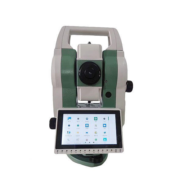
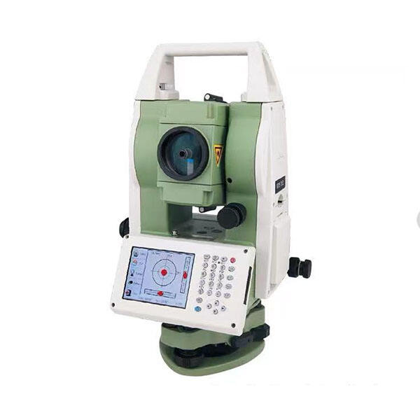
A total station is one of the most essential instruments in modern surveying, combining angle measurement, distance measurement, and data recording into a single compact device. Understanding how a total station achieves accurate measurements helps surveyors, engineers, and construction professionals make better decisions on-site and in the office. Accuracy is not accidental — it is the result of carefully engineered components working together in a precise sequence.
Every total station relies on a combination of optical, electronic, and computational systems to deliver reliable field data. Whether you are working on a construction layout, topographic survey, or infrastructure project, the total station must perform with consistency across varying conditions. This article explores the core mechanisms, contributing factors, and practical considerations that define total station measurement accuracy.
Core Mechanisms Behind Total Station Accuracy
Electronic Distance Measurement in a Total Station
The total station uses Electronic Distance Measurement, commonly referred to as EDM, to calculate distances with high precision. The EDM unit emits an infrared or laser beam toward a reflective prism or, in reflectorless models, directly onto a surface. The total station measures the phase difference or time-of-flight of the returning signal to compute the exact distance. This process eliminates the human error associated with traditional tape measurements and allows the total station to capture distances ranging from a few meters to several kilometers with millimeter-level accuracy.
The quality of the EDM component directly influences how well the total station performs in demanding environments. Factors such as atmospheric pressure, temperature, and humidity can affect the speed of light, which the total station compensates for using built-in atmospheric correction algorithms. When these corrections are applied correctly, the total station maintains consistent accuracy regardless of changing field conditions.
Angular Measurement Systems in the Total Station
Alongside distance, the total station measures both horizontal and vertical angles using glass circle encoders. These encoders are etched with fine graduations that the total station reads electronically to determine precise angular values. Modern total station instruments use absolute encoding, meaning the total station does not need to be re-initialized after a power cycle because the angular position is always known. The resolution of these encoders typically reaches arc-second level, giving the total station its capacity to detect very small angular deviations.
The total station also compensates for any residual tilt in the instrument through a dual-axis compensator. When the total station is not perfectly level, the compensator automatically calculates and applies corrections to both horizontal and vertical angle readings. This built-in intelligence means the total station continues to deliver accurate measurements even when the setup surface is slightly uneven.
Factors That Influence Total Station Measurement Performance
Instrument Calibration and Setup Quality
Proper calibration is a prerequisite for total station accuracy. The total station must be correctly set up over the survey control point, with the instrument height measured precisely and the horizontal circle oriented to a known reference. Any error in the centering or leveling of the total station at setup will propagate through every subsequent measurement. Regular calibration checks — including collimation error testing and EDM zero-error verification — keep the total station performing within its specified tolerances.
Operators should perform a two-face measurement routine when using the total station for critical work. This technique, where the total station takes readings in both face-left and face-right orientations, cancels out systematic errors in the instrument axes. By averaging these two sets of results, the total station produces a corrected output that is more reliable than single-face measurements alone.
Environmental and Atmospheric Conditions
The total station operates in outdoor environments where temperature gradients, heat shimmer, wind, and precipitation can all degrade measurement quality. Heat shimmer causes the EDM signal to refract unpredictably, which reduces the ability of the total station to lock onto the prism cleanly. Dust and moisture can scatter the emitted beam, increasing noise in the total station readings. Experienced surveyors choose measurement times carefully — early morning or overcast conditions are often preferred when using the total station in sensitive applications.
Atmospheric correction inputs, including temperature and pressure values entered into the total station, allow the instrument to adjust the speed-of-light calculation used in EDM distance computation. Neglecting these inputs can introduce systematic errors into total station results, particularly over long distances. Accurate atmospheric data entry is therefore a critical step in maximizing total station performance on every job.
How the Total Station Integrates Data for Reliable Results
On-Board Processing and Coordinate Calculation
The total station does not simply record raw angles and distances — it processes these values immediately to compute three-dimensional coordinates. Using the known position of the instrument station and the measured horizontal angle, vertical angle, and slope distance, the total station applies trigonometric formulas to derive the northing, easting, and elevation of each target point. This on-board calculation reduces the risk of post-processing errors and allows field teams to verify data in real time with the total station.
Many total station models support on-board software routines such as resection, stake-out, and road alignment calculations. These routines use the total station measurement engine to produce actionable outputs directly in the field, reducing reliance on separate computing equipment. The total station serves as both a measurement instrument and a field computing platform, streamlining workflows on complex projects.
Data Transfer and Integration with Survey Software
After field work is complete, total station data is transferred to office software via USB, Bluetooth, or direct cable connection. The total station stores point data in structured formats that are compatible with industry-standard CAD and GIS platforms. This seamless data flow means that the accuracy achieved by the total station in the field is fully preserved through to the final deliverable. Any total station measurement that was recorded with proper technique and calibration will translate directly into a reliable digital output.
FAQ
What is the typical accuracy range of a total station?
Most standard total station models achieve angular accuracy between 1 and 5 arc-seconds and distance accuracy within 1 to 3 millimeters plus a parts-per-million component. The exact accuracy of a total station depends on the instrument grade, calibration status, operator technique, and environmental conditions during measurement.
Does a reflectorless total station maintain the same accuracy as a prism-based model?
A reflectorless total station can measure distances without a prism by targeting surfaces directly, but its range and accuracy may be slightly lower than prism-based measurement in the same total station model. For the highest precision work, using a prism with the total station is generally recommended, especially over long distances or in low-light conditions.
How often should a total station be calibrated?
A total station should be calibrated at the start of every major project and rechecked periodically during extended field campaigns. If the total station has been subjected to physical impact, temperature extremes, or transport over rough terrain, an immediate calibration check is advisable. Routine calibration ensures the total station continues to perform within its stated accuracy specifications.