
 EN
EN
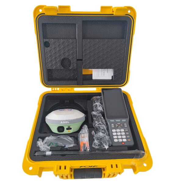
Surveying accuracy has always been the cornerstone of reliable fieldwork, and the introduction of RTK GNSS technology has fundamentally changed what professionals can achieve in the field. Traditional GNSS receivers, while useful for general positioning, carry inherent errors that accumulate from atmospheric interference, satellite geometry, and signal multipath effects. These errors can push positional readings off by several meters — a margin that is simply unacceptable in construction stakeout, cadastral boundary work, or precision agriculture. RTK GNSS addresses this challenge head-on by delivering centimeter-level accuracy in real time, transforming how surveyors collect, verify, and trust their data.

Understanding how RTK GNSS improves surveying accuracy requires looking at both the underlying technology and the practical workflow it enables. This is not simply a matter of better hardware — it is a systematic correction mechanism that eliminates the dominant sources of positional error before they ever reach the surveyor's data log. Whether you are working on a large infrastructure corridor or a small urban plot, RTK GNSS provides the kind of repeatable, verifiable precision that modern surveying demands. The sections below break down exactly how this improvement happens, from signal correction to field application.
The Core Mechanism Behind RTK GNSS Accuracy
How Real-Time Kinematic Correction Works
RTK GNSS operates on a differential correction principle. A base station receiver is placed at a known, precisely surveyed location and continuously tracks the same satellites as the rover unit carried by the surveyor. Because the base station knows its exact position, it can calculate the error in each satellite signal it receives at any given moment. These corrections are then transmitted to the rover in real time — typically via radio link or cellular network — allowing the rover to apply them instantly to its own position calculations.
The result is that both the base and rover experience nearly identical atmospheric and orbital errors, since they are observing the same satellites from relatively close distances. By differencing the observations, those shared errors cancel out. What remains is a position solution accurate to within 1–2 centimeters horizontally and 2–3 centimeters vertically under good conditions. This is the fundamental reason RTK GNSS outperforms standalone GNSS by orders of magnitude in surveying contexts.
The correction process relies on carrier-phase measurements rather than the coarser code-phase measurements used by standard GPS receivers. Carrier-phase tracking measures the phase of the satellite's radio wave itself, which has a much shorter wavelength and therefore provides far finer resolution. Resolving the integer ambiguity in these phase measurements — known as 'fixing' — is what enables RTK GNSS to achieve its characteristic centimeter-level precision.
The Role of Integer Ambiguity Resolution
One of the most technically significant steps in RTK GNSS processing is integer ambiguity resolution. When a receiver begins tracking a satellite signal, it does not know how many complete wavelengths of the carrier signal lie between the satellite and the antenna. This unknown integer count is the ambiguity. Until it is resolved to a fixed integer value, the position solution remains in a less accurate 'float' state.
Modern RTK GNSS engines use sophisticated algorithms — such as LAMBDA and its variants — to resolve these ambiguities rapidly, often within seconds of acquiring sufficient satellite signals. Once the ambiguities are fixed, the system locks into its high-accuracy mode and maintains it as long as signal tracking is uninterrupted. A fixed RTK GNSS solution is the gold standard for field surveying because it provides both high accuracy and high confidence in that accuracy.
If signal obstruction causes a loss of lock — for example, when passing under a tree canopy or near a tall building — the receiver must re-initialize and re-fix the ambiguities. High-quality RTK GNSS systems are designed to re-fix quickly, minimizing downtime in the field. The speed and reliability of ambiguity resolution is therefore a key differentiator in professional-grade RTK GNSS equipment.
How RTK GNSS Eliminates the Major Sources of Surveying Error
Atmospheric and Ionospheric Error Reduction
GNSS signals travel through the ionosphere and troposphere before reaching a receiver on the ground. Both layers introduce delays that distort the apparent travel time of the signal, which translates directly into positional error. For a standalone receiver, these delays can introduce errors of several meters, and they vary with time of day, season, and solar activity. RTK GNSS neutralizes this problem through its differential architecture.
Because the base station and rover are typically within 10 to 30 kilometers of each other, they experience nearly identical atmospheric conditions. The corrections broadcast by the base station effectively model and remove the atmospheric delay component from the rover's solution. This is why baseline length matters in RTK GNSS — as the distance between base and rover increases, the atmospheric conditions diverge, and the correction quality degrades. Keeping baselines short is a practical discipline that preserves the accuracy advantage of RTK GNSS.
Network RTK solutions, which use a network of reference stations to model atmospheric conditions across a wider area, extend the effective baseline range while maintaining accuracy. These systems interpolate corrections for the rover's specific location using data from multiple reference stations, making RTK GNSS practical even in regions where setting up a local base station is not feasible.
Multipath and Signal Quality Management
Multipath occurs when GNSS signals reflect off surfaces such as buildings, vehicles, or water before reaching the antenna, causing the receiver to track a delayed version of the signal. This introduces a systematic bias into the position solution that differential correction alone cannot fully remove, because multipath is highly localized and not shared between the base and rover. Managing multipath is therefore a hardware and site-selection challenge as much as a processing one.
Professional RTK GNSS antennas are designed with ground planes and choke rings that attenuate signals arriving from low elevation angles, where multipath is most severe. Signal processing algorithms within the receiver also apply multipath mitigation techniques that identify and down-weight suspicious observations. Surveyors using RTK GNSS are trained to avoid placing the rover antenna near reflective surfaces and to observe from open-sky positions whenever possible.
The combination of hardware design, signal processing, and field discipline means that a well-operated RTK GNSS system can achieve its rated accuracy even in moderately challenging environments. Understanding the limits of multipath mitigation also helps surveyors recognize when a position fix may be less reliable and when additional observations or redundancy checks are warranted.
Practical Accuracy Improvements in Real Surveying Workflows
Stakeout and Construction Layout
In construction stakeout, the surveyor's task is to mark physical locations on the ground that correspond to design coordinates. Errors in stakeout propagate directly into the built structure, making accuracy non-negotiable. RTK GNSS has become the preferred tool for this work because it allows a single operator to navigate to a design point and stake it out with centimeter confidence, without the line-of-sight constraints of total station work.
The real-time nature of RTK GNSS means the surveyor receives immediate feedback on how close they are to the target point. Modern RTK GNSS controllers display the residual distance and direction to the design coordinate, guiding the operator to the exact location. This interactive workflow is faster and less prone to transcription errors than traditional methods, and the accuracy delivered by RTK GNSS ensures that the staked position matches the design intent within acceptable tolerances.
For large infrastructure projects — roads, pipelines, utility corridors — RTK GNSS enables continuous stakeout along alignments without resetting instrument stations. The productivity gain is substantial, and the accuracy is consistent across the entire project extent, provided the base station setup and baseline management are handled correctly.
Topographic Survey and Data Collection
Topographic surveys require the collection of large numbers of ground points to model terrain, drainage, and existing features. RTK GNSS excels in this application because it allows rapid point collection — often at rates of one point per second or faster — while maintaining centimeter-level accuracy for each observation. A surveyor can cover large areas in a single day that would take multiple days with conventional total station methods.
The accuracy improvement from RTK GNSS in topographic work is most visible in the quality of derived products such as digital terrain models and contour maps. When ground points are accurate to within 2–3 centimeters vertically, the resulting terrain model faithfully represents the actual ground surface, enabling reliable volume calculations, drainage analysis, and design decisions. Errors in the source data propagate into every downstream product, so the accuracy of RTK GNSS at the collection stage has compounding value.
RTK GNSS also supports tilt compensation in modern handheld receivers, allowing the surveyor to collect accurate points without holding the pole perfectly vertical. This feature reduces setup time at each point and improves safety in difficult terrain, while maintaining the accuracy standards that RTK GNSS is known for.
Factors That Influence RTK GNSS Accuracy in the Field
Satellite Geometry and Signal Availability
The accuracy of any RTK GNSS solution depends partly on the geometry of the satellites being tracked. When satellites are spread across the sky in a favorable pattern, the geometry is strong and the position solution is well-constrained. When satellites cluster in one part of the sky — as can happen in urban canyons or at certain times of day — the geometry weakens and accuracy degrades. The Dilution of Precision (DOP) value reported by RTK GNSS receivers quantifies this geometric effect.
Modern RTK GNSS receivers track signals from multiple constellations simultaneously — GPS, GLONASS, Galileo, BeiDou, and others — which dramatically increases the number of available satellites at any location and time. More satellites mean better geometry, faster ambiguity resolution, and more robust performance in challenging environments. Multi-constellation support is now a standard expectation for professional RTK GNSS equipment used in demanding surveying applications.
Surveyors planning fieldwork with RTK GNSS routinely use satellite prediction software to identify optimal observation windows and flag periods of poor geometry. This planning discipline ensures that the accuracy potential of RTK GNSS is fully realized in the field rather than compromised by avoidable geometric conditions.
Base Station Setup and Coordinate Quality
The accuracy of an RTK GNSS survey is ultimately anchored to the accuracy of the base station's known position. If the base station coordinates contain an error, that error will be transferred to every rover observation in the survey. This is why establishing the base station on a precisely known control point — or deriving its position through a static GNSS observation tied to a national geodetic network — is a fundamental requirement of rigorous RTK GNSS practice.
When using network RTK services, the coordinate reference frame is maintained by the network operator, and the surveyor connects to it via a data link. The quality of the network's reference frame and the density of its reference stations both influence the accuracy delivered to the rover. Understanding the coordinate reference system in use and ensuring it matches the project's requirements is an essential step that experienced RTK GNSS practitioners never overlook.
Errors introduced at the base station level are systematic — they shift the entire survey in a consistent direction — which makes them particularly insidious because they do not show up as internal inconsistencies within the dataset. Independent check points observed against a separate control network are the standard method for detecting and quantifying base station errors in RTK GNSS surveys.
FAQ
What level of accuracy can RTK GNSS achieve in typical surveying conditions?
Under good conditions — open sky, short baseline, fixed ambiguities — RTK GNSS typically achieves horizontal accuracy of 1–2 centimeters and vertical accuracy of 2–3 centimeters. These figures represent the precision of individual point observations and are sufficient for most engineering survey, construction stakeout, and cadastral applications. Accuracy can degrade in challenging environments such as urban canyons, dense vegetation, or long baselines, so field conditions and system setup both play important roles in achieving the rated performance.
How does RTK GNSS differ from post-processed GNSS in terms of accuracy?
RTK GNSS delivers its corrections and accuracy in real time, allowing the surveyor to verify position quality immediately in the field. Post-processed GNSS applies corrections after data collection using software, which can achieve similar or slightly better accuracy but requires additional office processing time. RTK GNSS is preferred when immediate results are needed — such as stakeout or real-time quality control — while post-processing is sometimes used for static control surveys where the highest possible accuracy is required and field time is less constrained.
Can RTK GNSS be used effectively in areas with poor satellite visibility?
RTK GNSS performance degrades in environments with limited sky visibility, such as deep urban canyons, forested areas, or sites surrounded by tall structures. Multi-constellation receivers mitigate this by tracking more satellites from different orbital planes, improving geometry even when some signals are blocked. In severely obstructed environments, RTK GNSS may need to be supplemented with total station measurements or other positioning methods. Tilt-compensated RTK GNSS receivers also help in difficult terrain by reducing the need for precise pole verticality, improving efficiency without sacrificing accuracy where signals are available.
How important is the baseline length between base and rover for RTK GNSS accuracy?
Baseline length is a significant factor in RTK GNSS accuracy because longer baselines mean the base and rover experience increasingly different atmospheric conditions, reducing the effectiveness of the differential correction. As a general guideline, accuracy degrades by roughly 1 part per million of baseline length beyond the nominal specification. For most practical surveying, keeping baselines under 10–15 kilometers preserves centimeter-level accuracy. Network RTK services address this limitation by using multiple reference stations to model atmospheric gradients across wider areas, effectively extending the usable range of RTK GNSS without sacrificing accuracy.
Table of Contents
- The Core Mechanism Behind RTK GNSS Accuracy
- How RTK GNSS Eliminates the Major Sources of Surveying Error
- Practical Accuracy Improvements in Real Surveying Workflows
- Factors That Influence RTK GNSS Accuracy in the Field
-
FAQ
- What level of accuracy can RTK GNSS achieve in typical surveying conditions?
- How does RTK GNSS differ from post-processed GNSS in terms of accuracy?
- Can RTK GNSS be used effectively in areas with poor satellite visibility?
- How important is the baseline length between base and rover for RTK GNSS accuracy?