
 EN
EN
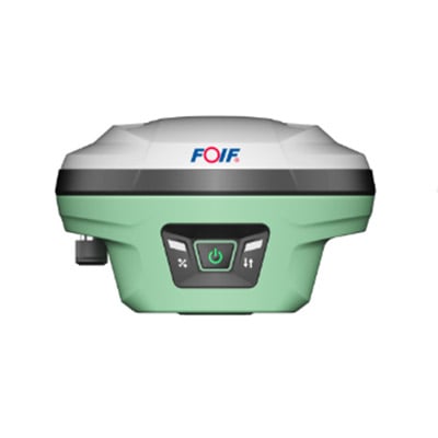
Positioning accuracy has always been a critical challenge in surveying, construction, and precision agriculture. Traditional GNSS-based RTK systems have served these industries well for decades, but they come with inherent limitations when working in environments with signal obstructions, reflective surfaces, or complex vertical structures. laser RTK represents a significant evolution in positioning technology, combining the satellite-based corrections of conventional RTK with laser-based distance and angle measurement to deliver a level of accuracy that was previously difficult to achieve in challenging field conditions.

Understanding how laser RTK improves positioning accuracy requires looking at both the technical mechanisms behind the technology and the practical scenarios where those improvements matter most. This article breaks down the core principles, the specific accuracy gains, and the operational contexts where laser RTK delivers measurable advantages over conventional positioning approaches.
The Fundamental Mechanism Behind Laser RTK Accuracy
How Laser Measurement Complements GNSS RTK
Standard RTK positioning relies on real-time differential corrections transmitted from a base station to a rover receiver. This approach can achieve horizontal accuracies in the centimeter range under open-sky conditions. However, vertical accuracy and performance near obstructions remain persistent weaknesses. Laser RTK addresses these gaps by integrating a laser rangefinder or laser scanning module directly into the positioning workflow.
The laser component measures precise distances and angles to reference targets or surfaces, providing an independent geometric constraint that supplements the satellite-derived position. When GNSS signals are degraded or the satellite geometry is poor, the laser measurement continues to contribute reliable spatial data. This fusion of two independent measurement sources is the core reason laser RTK achieves superior accuracy compared to either technology used alone.
The integration is not simply additive. Advanced sensor fusion algorithms weigh the contributions of each measurement source based on their current reliability, dynamically adjusting how much the system trusts GNSS versus laser data at any given moment. This adaptive weighting is what makes laser RTK robust across a wide range of field conditions.
The Role of Laser in Vertical Positioning
Vertical accuracy is consistently the weakest dimension in GNSS-based positioning. Satellite geometry means that height determination is inherently less precise than horizontal positioning, often by a factor of two or three. Laser RTK significantly narrows this gap by using laser-derived height references that are independent of satellite elevation angles.
When a laser RTK system is deployed near a known reference surface or a precisely surveyed target, the laser can directly measure the vertical offset with millimeter-level precision. This measurement is then used to constrain and correct the GNSS-derived height, producing vertical accuracies that approach or match horizontal performance. For applications like floor levelness surveys, structural monitoring, or precision grading, this improvement in vertical accuracy is transformative.
The practical implication is that laser RTK enables workflows that previously required separate leveling instruments or total stations to be completed with a single integrated device, reducing both equipment complexity and the potential for errors introduced by combining data from multiple instruments.
Accuracy Improvements in Obstructed and Complex Environments
Performance Near Buildings and Infrastructure
Urban surveying and construction layout work frequently involve environments where satellite signals are partially blocked by buildings, bridges, or other structures. In these conditions, conventional RTK performance degrades significantly, with position errors growing as the number of visible satellites decreases and multipath reflections corrupt the signal. Laser RTK maintains reliable accuracy in these environments by using laser measurements to anchor the position solution when GNSS alone is insufficient.
A laser RTK system operating near a building facade can use the laser to measure precise distances to the structure, establishing a geometric relationship that stabilizes the position estimate even when only a limited number of satellites are visible. This capability is particularly valuable for tasks like setting out column positions, verifying as-built dimensions, or conducting topographic surveys in dense urban areas.
The result is that laser RTK extends the operational envelope of high-accuracy positioning into environments where conventional RTK would require the surveyor to move to a more open location, take multiple observations, or accept degraded accuracy. This directly translates to faster fieldwork and more reliable data collection.
Handling Multipath and Signal Interference
Multipath interference occurs when satellite signals reflect off surfaces before reaching the receiver antenna, causing the receiver to calculate an incorrect position. It is one of the most common sources of RTK error in real-world field conditions. Laser RTK reduces the impact of multipath by providing an independent measurement that is entirely unaffected by radio frequency interference or signal reflection.
Because the laser operates in the optical domain rather than the radio frequency domain, it is immune to the electromagnetic interference that degrades GNSS performance near power lines, radio towers, or electronic equipment. This makes laser RTK a reliable choice for industrial site surveys, utility corridor mapping, and other applications where RF interference is a concern.
When the sensor fusion algorithm detects that GNSS accuracy is being compromised by multipath or interference, it automatically increases the weight given to laser measurements in the position solution. This seamless transition between dominant measurement sources is invisible to the operator but critical to maintaining consistent accuracy throughout the survey.
Practical Accuracy Specifications and What They Mean in the Field
Centimeter-Level Accuracy in Real Operating Conditions
The accuracy specifications published for laser RTK systems reflect performance under realistic field conditions rather than ideal laboratory settings. Typical laser RTK systems achieve horizontal accuracies of 1 to 2 centimeters and vertical accuracies of 2 to 3 centimeters in standard open-sky conditions, with the laser component helping to maintain these figures even as conditions deteriorate.
What distinguishes laser RTK from conventional RTK is not necessarily the peak accuracy under ideal conditions but the consistency of accuracy across a broader range of environments. A conventional RTK system might achieve 1-centimeter accuracy in an open field but degrade to 5 or 10 centimeters near obstructions. A laser RTK system maintains accuracy much closer to its rated specification across a wider range of scenarios, which is what matters most for professional survey and construction applications.
This consistency has direct economic value. When accuracy is predictable, surveyors can plan workflows with confidence, reduce the need for repeat measurements, and deliver results that meet project specifications without costly rework. The reliability of laser RTK accuracy is as important as the absolute accuracy figure itself.
Accuracy at Extended Ranges and Difficult Angles
Laser RTK systems are designed to maintain accuracy across a range of measurement distances and target angles. The laser component typically operates effectively at distances from a few meters to several hundred meters, depending on the system design and target reflectivity. At longer ranges, the laser measurement contributes a geometric constraint that helps prevent the position solution from drifting, which is a common issue with GNSS-only systems during extended observation periods.
For applications like monitoring structural deformation, tracking machine positions on large construction sites, or conducting corridor surveys along roads and railways, the ability of laser RTK to maintain accuracy at extended ranges is a significant operational advantage. The system can be set up at a convenient location and used to accurately position points across a wide area without the need to reposition the equipment frequently.
The angular measurement capability of the laser also contributes to accuracy when targets cannot be accessed directly. By measuring the angle and distance to a target from a known position, laser RTK can calculate the target's coordinates with high precision even when the target itself is inaccessible, expanding the range of survey tasks that can be completed efficiently.
Application Scenarios Where Laser RTK Delivers the Greatest Accuracy Gains
Construction Layout and As-Built Verification
Construction layout requires placing points on the ground or on structures with centimeter-level accuracy to ensure that buildings, roads, and utilities are built according to design specifications. Laser RTK is particularly well suited to this application because it combines the flexibility of GNSS positioning with the precision of laser measurement, allowing layout work to proceed efficiently even in partially obstructed environments.
As-built verification, which involves measuring the actual positions of constructed elements and comparing them to design coordinates, benefits from laser RTK's ability to measure points on surfaces that cannot be physically accessed with a conventional survey rod. The laser can measure the position of a wall face, a beam soffit, or a pipe invert from a safe distance, providing accurate as-built data without requiring scaffolding or other access equipment.
The combination of GNSS and laser measurement in a single laser RTK device also simplifies the data collection workflow, reducing the number of instrument setups required and minimizing the opportunities for errors to accumulate across multiple measurement steps.
Precision Agriculture and Land Grading
In precision agriculture, laser RTK is used to guide land grading equipment with the accuracy needed to create the precise surface slopes required for efficient irrigation and drainage. The improved vertical accuracy of laser RTK compared to conventional RTK is directly relevant here, as even small errors in surface elevation can result in water pooling or inadequate drainage across large field areas.
Laser RTK guidance systems allow grading equipment to maintain the designed surface profile with centimeter-level vertical accuracy, reducing the volume of earthwork required and improving the uniformity of the finished surface. This translates to lower fuel and equipment costs, better crop yields, and more efficient water use, all of which have direct economic value for agricultural operations.
The robustness of laser RTK in partially obstructed environments is also relevant in agricultural settings, where tree lines, farm buildings, and terrain features can create localized GNSS signal degradation. Laser RTK maintains reliable accuracy in these areas, ensuring that the guidance system performs consistently across the entire field rather than only in open areas.
Integration and Workflow Considerations for Laser RTK Deployment
System Setup and Calibration for Maximum Accuracy
Achieving the full accuracy potential of laser RTK requires careful attention to system setup and calibration. The laser and GNSS components must be precisely aligned and their relative offsets accurately characterized so that the sensor fusion algorithm can correctly combine their measurements. Most professional laser RTK systems include automated calibration routines that guide the operator through this process, but understanding the underlying requirements helps ensure that calibration is performed correctly.
Base station placement is also important for laser RTK accuracy. The base station should be positioned on a stable, well-surveyed point with good sky visibility to provide high-quality differential corrections to the rover. When using a network RTK service rather than a local base station, the quality and latency of the correction data stream directly affect the accuracy of the laser RTK position solution.
Regular verification of laser RTK accuracy against known control points is good practice, particularly at the start of each working day and after any significant change in operating conditions. This verification confirms that the system is performing within specification and provides confidence in the data being collected.
Data Integration and Post-Processing Options
Laser RTK systems typically output position data in standard formats that can be directly imported into survey software, CAD platforms, and GIS systems. This compatibility simplifies the data integration workflow and allows laser RTK data to be combined with data from other sources, such as total stations, level instruments, or aerial surveys, within a unified project coordinate system.
Post-processing options are available for applications where real-time accuracy is not required or where the highest possible accuracy is needed. Post-processed laser RTK data can achieve accuracies that exceed real-time performance by allowing more sophisticated algorithms to be applied to the raw measurement data after collection. This is particularly relevant for monitoring applications where data is collected over extended periods and processed in batch.
The availability of both real-time and post-processed accuracy options makes laser RTK a flexible platform that can be adapted to a wide range of project requirements, from rapid construction layout to high-precision deformation monitoring.
FAQ
What makes laser RTK more accurate than standard RTK in obstructed environments?
Laser RTK adds an independent laser measurement source that is unaffected by satellite signal obstructions or multipath interference. When GNSS accuracy degrades near buildings or other obstructions, the laser component continues to provide reliable geometric constraints, and the sensor fusion algorithm maintains overall positioning accuracy by increasing the weight given to laser measurements. This dual-source approach is what allows laser RTK to perform consistently in environments where standard RTK would produce degraded results.
How does laser RTK improve vertical accuracy specifically?
GNSS-based positioning is inherently less accurate in the vertical dimension due to satellite geometry limitations. Laser RTK addresses this by using laser-derived height measurements referenced to known surfaces or targets, which are independent of satellite elevation angles. These laser height measurements constrain and correct the GNSS-derived height, bringing vertical accuracy much closer to horizontal accuracy levels. This improvement is particularly significant for applications like floor surveys, structural monitoring, and precision grading.
Is laser RTK suitable for use in precision agriculture applications?
Yes, laser RTK is well suited to precision agriculture, particularly for land grading and surface management applications where accurate vertical positioning is critical. The improved vertical accuracy of laser RTK compared to conventional RTK allows grading equipment to maintain designed surface profiles with centimeter-level precision, improving irrigation efficiency and reducing earthwork volumes. The robustness of laser RTK in partially obstructed environments also ensures consistent performance across fields with trees, buildings, or terrain features that would degrade standard RTK accuracy.
What should operators check to ensure laser RTK delivers its rated accuracy in the field?
Operators should verify that the laser and GNSS components are properly calibrated and that their relative offsets are correctly characterized in the system settings. Base station placement on a stable, well-surveyed point with good sky visibility is important for high-quality differential corrections. Regular accuracy verification against known control points at the start of each working day confirms that the system is performing within specification. Ensuring that the correction data stream from a network RTK service has low latency and high reliability is also important for maintaining consistent laser RTK accuracy throughout the working day.
Table of Contents
- The Fundamental Mechanism Behind Laser RTK Accuracy
- Accuracy Improvements in Obstructed and Complex Environments
- Practical Accuracy Specifications and What They Mean in the Field
- Application Scenarios Where Laser RTK Delivers the Greatest Accuracy Gains
- Integration and Workflow Considerations for Laser RTK Deployment
- FAQ