
 EN
EN
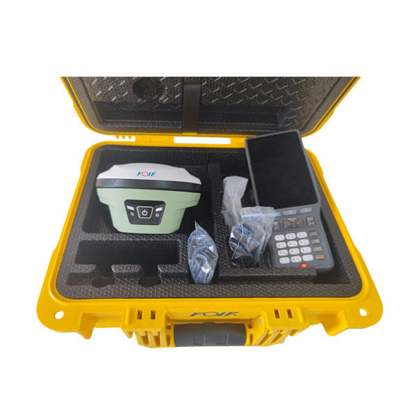
Survey professionals depend on precision to produce reliable geospatial data, and the accuracy of a GNSS receiver directly determines the quality of those results. Whether conducting boundary surveys, topographic mapping, or infrastructure monitoring, even minor positioning errors from a GNSS receiver can cascade through project workflows, creating costly discrepancies in final deliverables. Understanding how GNSS receiver accuracy influences survey outcomes is essential for practitioners who need to justify equipment choices, interpret measurement uncertainties, and maintain professional standards in an industry where centimeter-level precision is no longer optional but expected.
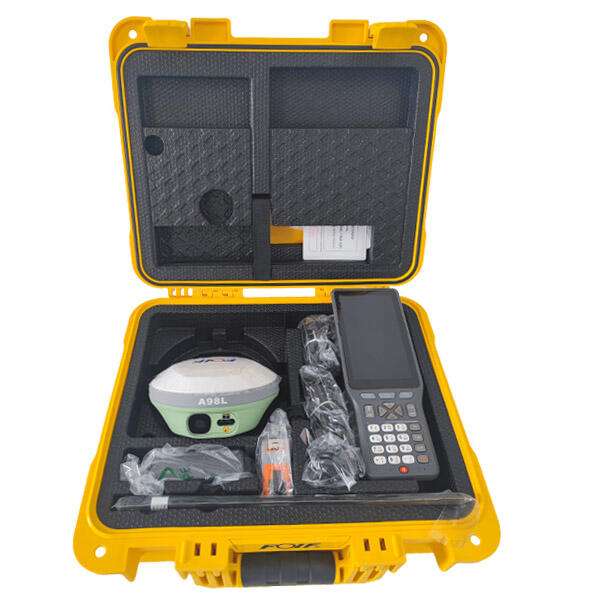
The relationship between GNSS receiver accuracy and survey results extends beyond simple coordinate precision. It affects observation planning, data processing strategies, quality assurance protocols, and ultimately the legal defensibility of survey products. Modern surveying demands not only understanding nominal accuracy specifications but also recognizing how environmental factors, observation methods, and equipment capabilities interact to produce the final positional solution. This article examines the specific mechanisms through which GNSS receiver accuracy shapes survey outcomes, explores the practical implications for different survey types, and provides guidance for managing accuracy-related challenges in real-world field conditions.
Understanding GNSS Receiver Accuracy and Its Components
Defining Accuracy in GNSS Survey Context
GNSS receiver accuracy represents the degree of conformity between measured positions and true ground coordinates, typically expressed as horizontal and vertical components. For survey-grade applications, accuracy specifications distinguish between absolute positioning, which references global coordinate systems, and relative positioning, which measures distances between points with higher precision through differential techniques. A professional GNSS receiver might achieve absolute accuracies of several meters in standard positioning mode but deliver centimeter-level relative accuracy when used with RTK corrections or post-processing methods. This distinction is fundamental because most surveying tasks rely on relative measurements where baseline quality determines final accuracy.
The accuracy performance of a GNSS receiver depends on multiple subsystems working in concert. The receiver's signal tracking capabilities determine how effectively it can lock onto satellite signals under challenging conditions such as canopy cover or urban canyons. Internal processing algorithms influence how efficiently the receiver resolves carrier phase ambiguities, which is essential for achieving high-precision results in RTK and static survey modes. Antenna quality affects multipath rejection and phase center stability, directly impacting measurement repeatability. Survey professionals must recognize that published accuracy specifications represent optimal conditions, and actual field performance may degrade significantly when satellite geometry weakens, atmospheric conditions deteriorate, or electromagnetic interference increases.
Error Sources That Limit GNSS Receiver Performance
Systematic and random errors affect every GNSS receiver measurement, and understanding these sources is crucial for interpreting how accuracy limitations propagate into survey results. Satellite orbit errors introduce positioning biases that can reach several meters in uncorrected autonomous mode, though these largely cancel in differential surveying when baselines remain under twenty kilometers. Atmospheric delays caused by ionospheric and tropospheric refraction create signal path variations that translate into vertical and horizontal positioning errors, with effects varying by satellite elevation angle and local weather conditions. A survey-grade GNSS receiver employs dual-frequency or multi-frequency tracking to model and remove much of the ionospheric delay, significantly improving accuracy compared to single-frequency devices.
Multipath interference represents one of the most challenging error sources because it varies with the immediate environment around each survey point. When GNSS signals reflect off buildings, vehicles, or metal structures before reaching the receiver antenna, the delayed signals corrupt the direct signal measurements and degrade position solutions. A high-quality GNSS receiver implements advanced signal processing and employs ground plane antennas to suppress multipath effects, but physical site conditions ultimately determine the severity of this error source. Receiver noise introduces random variations in code and carrier phase measurements, with better receiver electronics producing lower noise levels and consequently better accuracy. Clock errors in both satellites and receivers create timing offsets that must be estimated or eliminated through differential processing to achieve survey-grade results.
Accuracy Specifications and Their Practical Meaning
Manufacturers specify GNSS receiver accuracy using statistical expressions such as root mean square error or confidence levels, but interpreting these figures requires understanding the underlying assumptions. An RTK accuracy specification of eight millimeters plus one part per million horizontal accuracy indicates that measurement uncertainty grows with baseline length, a critical factor when planning survey networks. The one-sigma, two-sigma, or 95 percent confidence level used in specifications dramatically affects the practical meaning of accuracy claims, with 95 percent confidence levels providing approximately twice the uncertainty value of one-sigma expressions. Survey professionals must ensure they compare specifications using consistent statistical measures to make valid equipment evaluations.
Real-world accuracy achieved by a GNSS receiver in survey applications depends heavily on observation duration, satellite availability, baseline length, and atmospheric conditions at the time of measurement. Static survey sessions lasting one to two hours typically achieve sub-centimeter accuracy for horizontal positions because extended observation periods average out short-term errors and improve ambiguity resolution reliability. Rapid static and kinematic methods sacrifice observation duration for operational speed, accepting slightly degraded accuracy in exchange for dramatically increased productivity. The accuracy of a GNSS receiver in these fast survey modes depends critically on the number of satellites tracked, the quality of correction data received, and the geometric strength of the satellite constellation at observation time.
Direct Impact on Survey Precision and Coordinate Quality
How Receiver Accuracy Affects Coordinate Uncertainty
The positioning accuracy of a GNSS receiver directly translates into uncertainty in the final coordinates assigned to survey points, affecting every downstream use of that spatial data. When a receiver achieves horizontal accuracy of ten millimeters with 95 percent confidence, approximately one in twenty observations may exhibit errors exceeding that threshold, creating potential outliers in the survey dataset. This statistical reality means that survey workflows must incorporate quality control procedures to identify and address measurements that fall outside expected accuracy bounds. Coordinate uncertainty propagates through coordinate transformations, datum adjustments, and least-squares network adjustments, sometimes amplifying initial measurement errors depending on network geometry and observation redundancy.
Vertical accuracy from a GNSS receiver typically degrades compared to horizontal precision, often by a factor of two or three, because satellite geometry provides weaker constraints in the vertical dimension. This vertical accuracy limitation significantly impacts surveys requiring elevation data, such as topographic mapping, volume calculations, and drainage design. When a project requires five-centimeter vertical accuracy but the GNSS receiver delivers fifteen-centimeter vertical precision, the survey simply cannot meet project specifications regardless of field techniques employed. Understanding these accuracy limitations before fieldwork begins allows survey managers to select appropriate equipment, plan supplementary observations, or incorporate leveling measurements where GNSS vertical accuracy proves insufficient.
Measurement Repeatability and Consistency
A GNSS receiver with superior accuracy inherently provides better measurement repeatability, which is essential when surveys require multiple occupation of the same control points or when quality assurance protocols demand redundant observations. Repeatability testing involves occupying a known survey point multiple times and evaluating the spread of resulting coordinates, with tighter clustering indicating better receiver performance. Poor repeatability suggests the GNSS receiver suffers from excessive noise, inadequate multipath rejection, or unstable phase center characteristics, any of which compromise survey quality. Professional survey standards often specify maximum allowable differences between repeat measurements, and receiver accuracy directly determines whether these tolerances can be reliably met.
Consistency between different GNSS receiver units matters enormously in surveys where multiple crews work simultaneously or when equipment must be replaced during long-term monitoring projects. If two nominally identical receivers exhibit systematically different accuracy characteristics, combining their measurements in network adjustments can introduce biases that degrade overall survey quality. Manufacturers address consistency through careful antenna calibration, standardized signal processing, and quality control during production, but field verification remains essential. Survey organizations should periodically conduct comparative baseline measurements between their GNSS receiver units to identify any systematic differences that might compromise project results.
Accuracy Requirements for Different Survey Types
Cadastral boundary surveys demand the highest relative accuracy because property line positions carry legal significance and must withstand scrutiny during title disputes or encroachment claims. A GNSS receiver used for boundary surveying typically must achieve horizontal accuracies better than two centimeters to compete with traditional total station methods and to meet surveying board regulations in many jurisdictions. The vertical accuracy from the receiver matters less for boundary work but becomes critical when establishing elevation certificates for flood insurance or when monumenting property corners where vertical position forms part of the legal description.
Topographic mapping and engineering surveys require balanced horizontal and vertical accuracy appropriate to the map scale and project design tolerances. A GNSS receiver supporting corridor mapping at one-foot contour intervals might require vertical accuracy of ten to fifteen centimeters, while architectural site planning could tolerate slightly coarser precision. Construction staking applications impose the most stringent real-time accuracy demands on a GNSS receiver because layout errors translate directly into built infrastructure defects. Network RTK or post-processed kinematic methods must deliver consistent two-centimeter horizontal accuracy to support grade staking, structural layout, and machine control applications where physical construction proceeds based on GNSS-derived coordinates.
Effects on Survey Network Geometry and Adjustment
How Accuracy Influences Network Design
The accuracy capability of a GNSS receiver fundamentally shapes survey network design by determining feasible baseline lengths, required observation redundancy, and acceptable network geometry. When using a receiver capable of one-centimeter plus two parts-per-million baseline accuracy, establishing control points at ten-kilometer spacing introduces an additional two-centimeter uncertainty component from the distance-dependent error term. This accuracy degradation with distance requires surveyors to densify control networks or accept larger position uncertainties for points farther from reference stations. Understanding these accuracy-distance relationships allows rational decisions about control point spacing that balance field efficiency against coordinate quality requirements.
Survey network strength depends on observation redundancy, which provides multiple independent measurements to the same points and enables statistical detection of measurement blunders. A high-accuracy GNSS receiver can sometimes achieve project requirements with less redundancy than a lower-accuracy unit because individual measurements carry smaller uncertainties and contribute more information to the network solution. However, relying on minimal redundancy sacrifices the quality assurance benefits of repeat observations and leaves the survey vulnerable to undetected errors. Professional practice typically specifies minimum redundancy requirements regardless of receiver accuracy, recognizing that field conditions may degrade nominal equipment performance and that independent verification protects against systematic errors that single observations cannot reveal.
Least Squares Adjustment and Error Propagation
Network adjustment software processes GNSS receiver observations using least squares algorithms that weight measurements according to their expected accuracy, with higher-accuracy observations receiving greater influence in determining final adjusted coordinates. When a surveyor assigns overly optimistic accuracy values to GNSS receiver measurements during adjustment setup, the software may inadequately account for actual measurement uncertainty, producing adjusted coordinates with unrealistic precision estimates. Conversely, excessively conservative accuracy estimates can cause the adjustment to underweight perfectly valid GNSS observations, forcing undue reliance on less-accurate measurements and degrading overall network quality. Properly characterizing GNSS receiver accuracy for adjustment processing requires understanding the relationship between manufacturer specifications, field conditions during observations, and the statistical measures used by adjustment software.
Error propagation through network adjustments amplifies or dampens initial GNSS receiver measurement uncertainties depending on network configuration and observation distribution. Well-designed networks with strong geometric figures and adequate redundancy can sometimes improve upon individual measurement accuracy through statistical averaging effects, particularly when multiple baselines converge on each point from different directions. Poorly configured networks with weak geometry or insufficient redundancy may actually amplify GNSS receiver errors, producing final coordinates with greater uncertainty than the original measurements. Survey professionals must analyze network precision estimates generated by adjustment software to verify that GNSS receiver accuracy limitations have not created unacceptable uncertainty in critical points.
Detecting and Managing Systematic Errors
Systematic errors in GNSS receiver measurements can escape detection when survey networks lack adequate redundancy or when all observations share common error sources. Antenna height measurement blunders represent a particularly insidious systematic error because they affect all observations from a setup identically, making detection through repeat point occupations ineffective. A one-centimeter error in antenna height measurement introduces a one-centimeter vertical position error regardless of GNSS receiver accuracy, demonstrating that careful field procedures matter as much as equipment precision. Incorporating independent measurements such as conventional leveling or total station observations into survey networks provides heterogeneous data that can reveal systematic GNSS errors through adjustment residual analysis.
Coordinate datum inconsistencies between base station networks and survey control can create systematic biases that masquerade as GNSS receiver accuracy problems. When real-time corrections come from a base station network aligned to one reference frame realization while project control occupies monuments in a different realization, systematic coordinate shifts of several centimeters may occur despite perfect receiver performance. Survey professionals must verify datum consistency throughout the positioning workflow, ensuring that base station coordinates, project control, and delivered products all reference the same geodetic framework. Failure to manage these datum issues results in apparent accuracy problems that no improvement in GNSS receiver quality can address.
Real-World Implications for Survey Deliverables
Impact on Mapping Products and GIS Data
GNSS receiver accuracy directly determines the spatial quality of mapping products and GIS databases created from survey measurements. Feature mapping for utility asset management requires sufficient accuracy to support safe excavation planning, with positional errors potentially leading to utility strikes if underground infrastructure locations prove unreliable. A GNSS receiver achieving sub-meter horizontal accuracy typically satisfies utility mapping requirements for general planning purposes, but damage prevention during excavation often demands decimeter-level accuracy to maintain adequate clearance margins around buried facilities. The vertical accuracy from the receiver affects depth calculations when combined with surface elevation data, influencing decisions about excavation methods and equipment selection.
Cadastral mapping databases depend on GNSS receiver accuracy to maintain property boundary representations that align with legal descriptions and monumented positions. When GIS parcel layers exhibit systematic offsets from true ground positions due to insufficient receiver accuracy during initial data capture, downstream users encounter problems ranging from inefficient field location of property corners to inappropriate land use decisions based on incorrect spatial relationships. Updating legacy cadastral data with modern GNSS receiver observations can actually introduce apparent discrepancies when new high-accuracy measurements conflict with older, less-accurate spatial data, requiring careful change management and metadata documentation to prevent confusion among data users.
Construction Layout and Machine Control Applications
Construction staking based on GNSS receiver positions transfers survey accuracy directly into built infrastructure, making receiver precision a critical factor in construction quality. When a surveyor stakes building corners using a receiver with three-centimeter horizontal accuracy, the constructed foundation may exhibit cumulative positioning errors that affect structural alignment, door and window openings, and connections to adjacent construction elements. Real-time kinematic positioning from a high-accuracy GNSS receiver enables construction crews to achieve design geometry within typical construction tolerances, reducing rework and improving project schedules. The vertical accuracy of the receiver becomes particularly critical for grading operations where drainage performance depends on precise slope control and elevation management.
Machine control systems that guide bulldozers, excavators, and graders based on GNSS receiver positions magnify the importance of receiver accuracy because positioning errors translate directly into earthwork quantity variations and grade conformance issues. A GNSS receiver providing consistent two-centimeter vertical accuracy enables automated grading equipment to construct road subgrades and building pads that meet specifications without extensive manual checking and rework. When receiver accuracy degrades due to poor satellite visibility or site-specific interference, machine control systems may produce wavy or inconsistent grades that require manual correction, eliminating much of the productivity benefit these systems provide. Construction managers must understand GNSS receiver accuracy limitations and plan machine control operations for times and locations where positioning performance meets project requirements.
Monitoring and Deformation Surveys
Structural monitoring and deformation surveys demand exceptional GNSS receiver accuracy because the measurements aim to detect subtle position changes that indicate movement in dams, bridges, landslides, or other monitored features. When monitoring applications require detection of five-millimeter horizontal movements, the GNSS receiver must achieve accuracy substantially better than the target detection threshold to distinguish genuine deformation from measurement noise. Long-term monitoring campaigns using continuous GNSS stations can achieve millimeter-level precision through extended averaging, but campaign-style surveys that periodically reoccupy monitoring points face greater challenges in separating actual movement from measurement variability.
The time-series analysis required for deformation monitoring amplifies the importance of GNSS receiver stability and measurement consistency. If receiver accuracy varies seasonally due to atmospheric effects or changes in satellite constellation geometry, the monitoring system may report apparent deformations that actually represent measurement artifacts rather than structural movement. Survey professionals must implement robust quality control procedures that include occupation of stable reference points, statistical outlier detection, and comparison of GNSS results with independent measurement techniques such as total station networks or InSAR data. Understanding the GNSS receiver accuracy envelope under various environmental conditions allows realistic interpretation of monitoring results and prevents false alarms that undermine confidence in the surveillance system.
Strategies for Optimizing GNSS Receiver Accuracy in Survey Work
Field Procedures and Observation Planning
Maximizing GNSS receiver accuracy begins with thoughtful observation planning that accounts for satellite availability, atmospheric conditions, and site-specific interference sources. Survey professionals should consult satellite visibility forecasts to schedule fieldwork during periods when constellation geometry provides optimal positioning dilution of precision values, typically when satellite distribution spans the visible sky hemisphere rather than clustering in one region. Avoiding observations during periods of elevated ionospheric activity, which can be monitored through space weather services, reduces atmospheric error contributions that degrade receiver accuracy. The time of day affects atmospheric conditions, with morning hours often providing more stable tropospheric refraction than afternoon periods when solar heating creates turbulent conditions.
Proper GNSS receiver setup requires careful attention to antenna leveling, height measurement, and monument centering to ensure that equipment limitations do not introduce errors that compromise inherent receiver accuracy. Using fixed-height range poles or precisely measured tripod setups eliminates antenna height measurement blunders that can create systematic vertical errors. Ensuring the antenna phase center precisely aligns with the survey monument or ground mark removes centering errors that degrade horizontal accuracy. Extended observation durations improve GNSS receiver performance by allowing averaging of short-term errors and providing more epochs for ambiguity resolution verification, with diminishing returns beyond certain session lengths depending on baseline distance and receiver technology.
Selecting Appropriate Correction Methods
The differential correction method employed with a GNSS receiver fundamentally affects achieved accuracy, with post-processed static solutions generally providing superior precision compared to real-time kinematic methods for the same observation duration. Survey applications requiring maximum accuracy often justify static observation sessions with post-processing, accepting reduced productivity in exchange for enhanced coordinate quality. Network RTK services that provide corrections based on multiple reference stations typically deliver better accuracy and reliability than single-base RTK because network solutions model regional error sources more effectively and provide redundancy against individual base station problems. Survey managers must match correction methods to project accuracy requirements, recognizing that real-time techniques may prove inadequate when survey specifications demand better than two-centimeter precision under challenging field conditions.
Base station proximity significantly influences the accuracy achieved by a GNSS receiver operating in differential mode because distance-dependent errors grow with baseline length. Establishing project-specific base stations within ten kilometers of survey areas generally provides better accuracy than relying on distant reference stations, particularly in regions with significant ionospheric activity or complex tropospheric conditions. When using correction services from commercial or public networks, survey professionals should verify base station distribution and understand network processing algorithms to assess whether the service adequately supports project accuracy requirements. Some applications may benefit from combining multiple correction sources or implementing fallback strategies when primary correction data becomes unavailable due to communication interruptions.
Quality Assurance and Verification Procedures
Implementing systematic quality assurance procedures helps identify situations where GNSS receiver accuracy falls short of expectations due to field conditions or equipment problems. Routine occupation of established control points before beginning daily survey operations provides confidence checks that verify receiver performance and detect systematic errors before they contaminate project data. Recording multiple independent observations at key project points enables statistical assessment of measurement consistency and provides redundancy that supports error detection during post-survey processing. Survey crews should establish internal tolerances for repeat measurements and investigate any situations where observed variability exceeds expected values based on receiver specifications and field conditions.
Comparing GNSS receiver results with independent measurement techniques provides the most robust verification of positioning accuracy. Conventional traverse or total station measurements connecting GNSS-positioned control points reveal systematic errors that might escape detection through GNSS-only procedures. Leveling observations verify GNSS vertical accuracy and identify situations where geoid model uncertainties or atmospheric conditions have degraded height measurements. When survey projects involve construction layout or boundary monumentation, field-checking critical dimensions with tape measurements or total station observations confirms that GNSS receiver accuracy has proven adequate for the application. These verification procedures require additional field time but provide essential quality assurance that protects professional liability and ensures client satisfaction with survey deliverables.
FAQ
What accuracy level should a GNSS receiver provide for boundary surveying?
Boundary surveying typically requires a GNSS receiver capable of achieving horizontal accuracies better than two centimeters in relative positioning mode to meet professional standards and regulatory requirements in most jurisdictions. This accuracy level allows survey-grade receivers to compete effectively with total station methods while providing the efficiency benefits of satellite positioning. The specific accuracy requirement may vary depending on local surveying regulations, property value, and urban versus rural settings, with some cadastral applications demanding even tighter precision. Survey professionals should verify requirements with their licensing board and consider project-specific factors when selecting equipment for boundary work.
How does baseline length affect GNSS receiver accuracy in differential surveying?
GNSS receiver accuracy degrades with increasing baseline length due to distance-dependent error sources such as orbital uncertainties and atmospheric delay decorrelation between the base and rover positions. Manufacturer specifications typically express this relationship as a fixed component plus a proportional term, such as one centimeter plus two parts per million, meaning a ten-kilometer baseline adds two centimeters of uncertainty beyond the baseline accuracy. For optimal results, survey-grade receivers should operate within ten to fifteen kilometers of base stations when centimeter-level accuracy is required, though modern multi-frequency receivers with ionospheric modeling can extend this range under favorable conditions. Network RTK systems mitigate baseline length effects by interpolating corrections from multiple reference stations, providing more consistent accuracy across larger areas.
Can weather conditions significantly affect GNSS receiver accuracy during surveys?
Weather conditions influence GNSS receiver accuracy primarily through their effects on atmospheric signal propagation, with water vapor content affecting tropospheric delays and ionospheric storms creating signal disturbances. Heavy precipitation can attenuate satellite signals and increase multipath effects, while temperature inversions and rapid weather fronts create atmospheric gradients that modeling algorithms struggle to predict accurately. Survey professionals generally experience the best GNSS receiver performance during stable weather periods with clear skies, while accuracy may degrade during severe weather events or periods of high ionospheric activity caused by solar storms. Multi-frequency receivers with advanced atmospheric modeling provide superior performance under challenging weather conditions compared to single-frequency units, making weather sensitivity an important consideration when selecting survey equipment.
How often should GNSS receiver accuracy be verified through calibration or testing?
Professional survey organizations should verify GNSS receiver accuracy at least annually through baseline testing on certified calibration ranges or by occupying monuments with precisely known coordinates. More frequent verification may be warranted after equipment repairs, firmware updates, or when quality control procedures reveal unexpected measurement variability. Baseline testing involves measuring known distances between established control points and comparing GNSS receiver results with published values, providing empirical verification of both horizontal and vertical accuracy under actual field conditions. Survey firms should also conduct comparison testing between different receiver units in their equipment inventory to identify systematic differences that might affect project results when multiple crews work simultaneously. Documentation of these verification procedures demonstrates professional diligence and supports quality assurance claims in the event of survey disputes.
Table of Contents
- Understanding GNSS Receiver Accuracy and Its Components
- Direct Impact on Survey Precision and Coordinate Quality
- Effects on Survey Network Geometry and Adjustment
- Real-World Implications for Survey Deliverables
- Strategies for Optimizing GNSS Receiver Accuracy in Survey Work
-
FAQ
- What accuracy level should a GNSS receiver provide for boundary surveying?
- How does baseline length affect GNSS receiver accuracy in differential surveying?
- Can weather conditions significantly affect GNSS receiver accuracy during surveys?
- How often should GNSS receiver accuracy be verified through calibration or testing?