Understanding Modern Precision Positioning Technology
The landscape of precision positioning has evolved dramatically with the advent of RTK GPS solutions. These sophisticated systems have revolutionized various industries by providing centimeter-level accuracy that was previously unattainable with traditional GPS technology. From agriculture to construction, the implementation of an RTK GPS solution has become crucial for businesses seeking to optimize their operations and maintain a competitive edge.
Today's RTK GPS solutions combine advanced satellite technology with real-time corrections, enabling unprecedented accuracy in positioning and navigation. This technology has become increasingly accessible, making it essential for professionals to understand the key factors that influence their selection of an appropriate system.
Core Components of RTK GPS Systems
Base Station Requirements
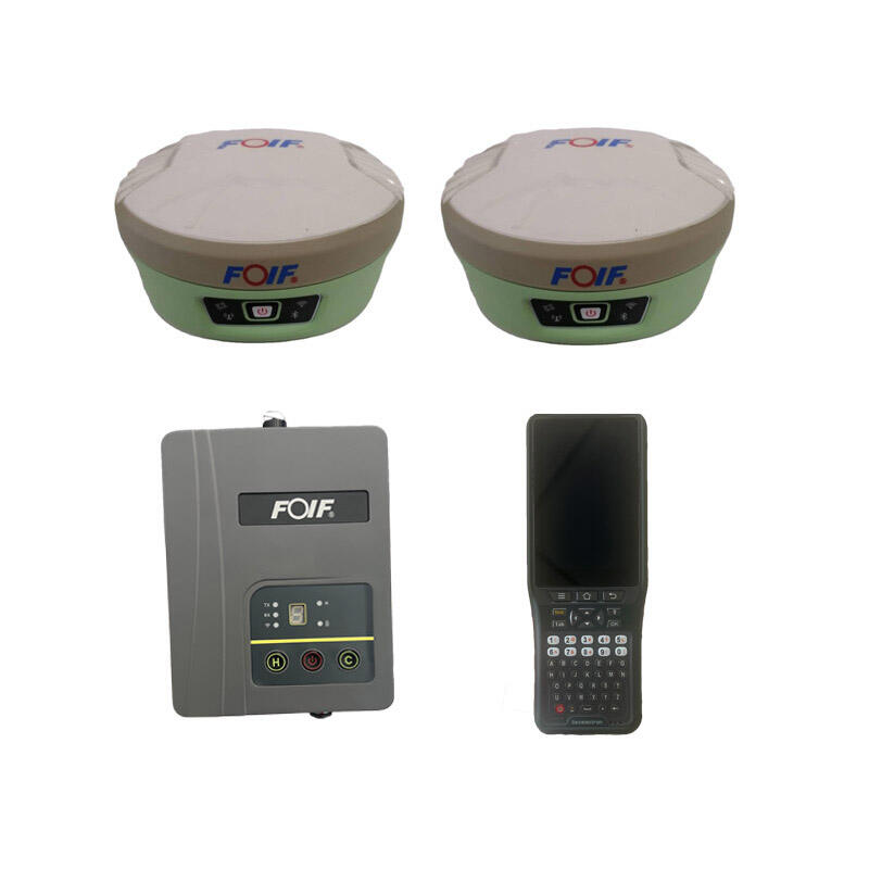
At the heart of any RTK GPS solution lies the base station, a crucial component that provides correction data to achieve high accuracy. The base station must be installed at a known fixed location and requires a clear view of the sky to track satellite signals effectively. Modern base stations are equipped with advanced receivers capable of tracking multiple satellite constellations, enhancing reliability and accuracy.
The quality of the base station directly impacts the overall performance of your RTK GPS solution. High-end base stations offer superior signal processing capabilities, better multipath mitigation, and more robust communication options. When selecting a base station, consider factors such as power requirements, environmental protection, and connectivity options to ensure optimal performance in your specific operating environment.
Rover Units and Mobile Components
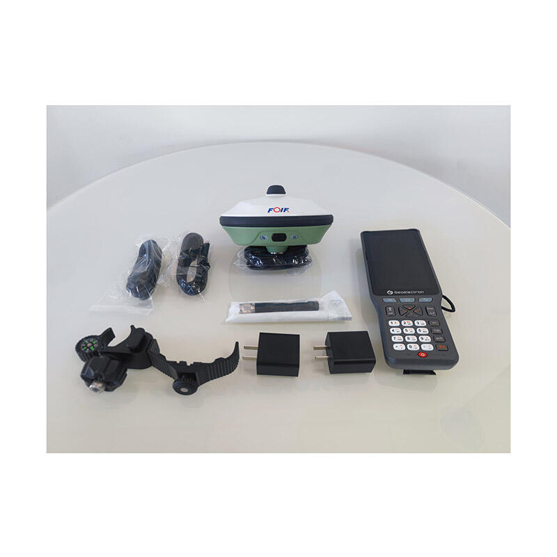
Rover units represent the mobile aspect of an RTK GPS solution, designed to receive correction data from the base station and provide precise positioning information in real-time. Modern rovers are increasingly compact and versatile, offering features such as integrated radio modems, cellular connectivity, and extended battery life.
The selection of appropriate rover units depends heavily on your specific application requirements. Factors such as update rate, initialization time, and environmental durability should be carefully evaluated. Many advanced rovers now include built-in sensors for tilt compensation and inertial measurement, expanding their capabilities beyond basic positioning.

Communication Infrastructure Considerations
Data Link Options
The reliability of data transmission between base station and rover is critical for any RTK GPS solution. Modern systems offer various communication options, including radio links, cellular networks, and internet-based protocols. Each method has its advantages and limitations, making it essential to choose the most suitable option for your operational environment.
Radio links provide excellent reliability in areas with limited cellular coverage but require line-of-sight and are subject to distance limitations. Cellular and internet-based solutions offer greater flexibility and range but depend on network availability and quality. Some advanced systems now incorporate multiple communication methods for redundancy and improved reliability.
Network Coverage Requirements
The effectiveness of your RTK GPS solution often depends on the quality and availability of network coverage in your operating area. Network RTK solutions rely on cellular or internet connectivity to receive correction data from permanent reference station networks. Understanding the coverage requirements and available infrastructure in your region is crucial for selecting the most appropriate system.
Consider implementing backup communication methods or local base stations in areas with unreliable network coverage. Modern RTK GPS solutions often include intelligent switching between different communication modes to maintain continuous operation.
Application-Specific Features
Industry-Specific Requirements
Different industries have unique requirements for their RTK GPS solution implementations. Agricultural applications often need wide-area coverage and integration with automatic guidance systems. Construction and surveying applications may require higher update rates and enhanced accuracy for precise measurements.
Understanding your industry-specific needs helps in selecting appropriate features and capabilities. Modern RTK GPS solutions often include specialized software and workflows designed for specific industries, improving efficiency and ease of use.
Integration Capabilities
The ability to integrate an RTK GPS solution with existing equipment and software systems is crucial for many applications. Modern solutions offer various integration options, including standard protocols and custom interfaces. Consider the compatibility requirements with your current technology infrastructure when selecting a system.
Many RTK GPS solutions now provide APIs and development tools for custom integration projects. This flexibility allows organizations to create tailored solutions that meet their specific operational requirements while maintaining high accuracy and reliability.
Performance and Reliability Factors
Accuracy Specifications
Understanding the accuracy requirements for your application is fundamental in selecting an appropriate RTK GPS solution. While most systems offer centimeter-level accuracy, the actual performance can vary depending on environmental conditions and system configuration. Consider both horizontal and vertical accuracy specifications, as well as initialization times and reliability under different operating conditions.
Modern RTK GPS solutions often include advanced error monitoring and quality control features to maintain consistent accuracy. These systems can provide real-time accuracy estimates and alerts when performance falls below specified thresholds.
Environmental Considerations
The operating environment significantly impacts the performance of an RTK GPS solution. Factors such as multipath interference, satellite visibility, and atmospheric conditions can affect accuracy and reliability. Choose equipment designed to withstand the environmental challenges specific to your application, including temperature extremes, moisture, and vibration.
Advanced RTK GPS solutions incorporate various technologies to mitigate environmental challenges, such as advanced multipath mitigation algorithms and robust housing designs. Consider these features when selecting equipment for challenging environments.
Frequently Asked Questions
How does RTK GPS differ from standard GPS?
RTK GPS solutions provide centimeter-level accuracy through real-time correction data, while standard GPS typically offers meter-level accuracy. The improved precision is achieved through sophisticated algorithms and communication between base stations and rovers, making RTK GPS ideal for applications requiring high accuracy.
What factors affect RTK GPS accuracy?
Several factors influence RTK GPS accuracy, including satellite visibility, multipath interference, atmospheric conditions, and the quality of correction data. The distance between base station and rover, communication reliability, and environmental obstacles can also impact system performance.
How much maintenance does an RTK GPS system require?
RTK GPS solutions typically require regular firmware updates, periodic calibration checks, and maintenance of communication infrastructure. Base stations need stable mounting and clear sky view, while rovers may require battery maintenance and occasional hardware updates to maintain optimal performance.

