Professional RTK GPS Systems: High-Precision Positioning Solutions for Industry Leaders

All Categories

rtk gps systems for sale

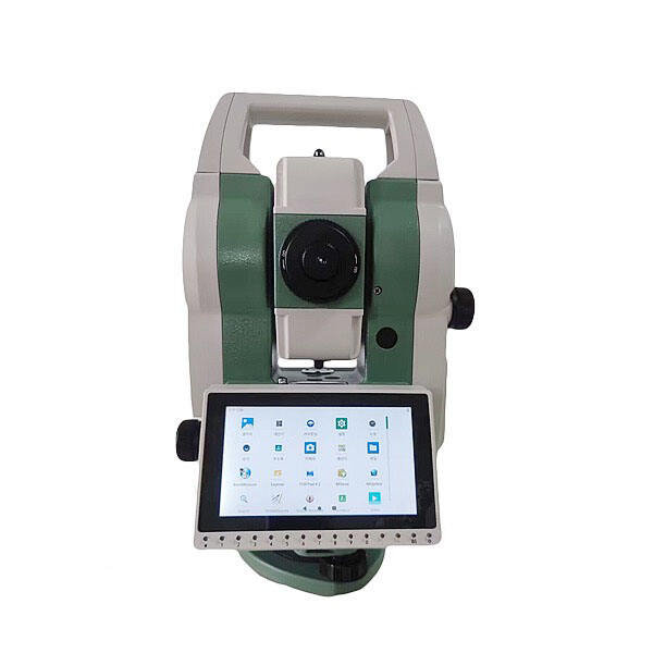
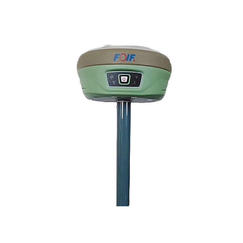
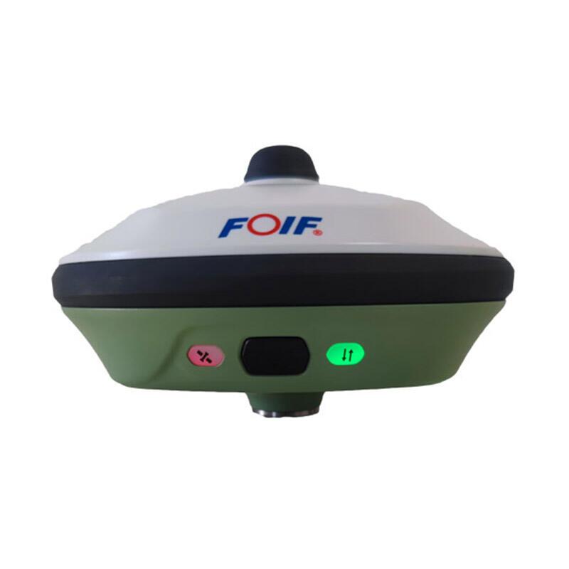
RTK GPS systems for sale represent cutting-edge positioning technology that delivers centimeter-level accuracy for various professional applications. These advanced systems utilize Real-Time Kinematic positioning, combining standard GPS signals with correctional data from base stations to achieve unprecedented precision. Modern RTK GPS systems typically include a base station, rover receivers, and sophisticated software for data processing and analysis. These systems operate by comparing satellite signals received at both the base station and rover units, calculating precise positions in real-time. The technology incorporates multiple satellite constellations, including GPS, GLONASS, Galileo, and BeiDou, ensuring optimal coverage and reliability. Contemporary RTK GPS systems feature user-friendly interfaces, robust build quality for field operations, and extended battery life for prolonged use. They offer seamless integration with various software platforms and support multiple data formats, making them versatile tools for surveying, construction, agriculture, and scientific research. The systems also include advanced error correction capabilities, multipath mitigation, and rapid initialization times, ensuring reliable performance even in challenging environments.

New Product Releases

RTK GPS systems offer numerous compelling advantages that make them indispensable tools for professional users. First, their exceptional accuracy, achieving positioning precision down to 1-2 centimeters, revolutionizes various field operations. This precision enables users to perform highly accurate surveys, implement precise machine control systems, and conduct detailed topographic mapping with confidence. The systems' real-time capability eliminates the need for post-processing in most applications, significantly improving workflow efficiency and reducing project timelines. Modern RTK GPS systems feature robust wireless connectivity options, including cellular, radio, and internet-based corrections, providing flexibility in different working environments. The multi-constellation support ensures reliable performance even in challenging conditions, such as urban canyons or areas with partial sky visibility. These systems offer remarkable return on investment through increased productivity, reduced labor costs, and minimized errors in field operations. Their user-friendly interfaces reduce training requirements, allowing teams to become operational quickly. The systems' durability and weather-resistant design ensure reliable performance in harsh environmental conditions, while their modular nature allows for easy upgrades and maintenance. Advanced data management features enable seamless integration with existing workflow systems, improving project coordination and data sharing capabilities. The systems also support various industry-standard data formats, ensuring compatibility with different software platforms and tools.

Latest News

How to choose the right RTK GNSS equipment?

22

Apr

How to choose the right RTK GNSS equipment?

View More
What are the common error sources and solutions when using RTK GNSS?

22

Apr

What are the common error sources and solutions when using RTK GNSS?

View More
Applicable Scenarios and Selection Tips for Different Types of Total Stations

22

Apr

Applicable Scenarios and Selection Tips for Different Types of Total Stations

View More
Laser RTK vs GNSS: Which One Is Better?

22

Apr

Laser RTK vs GNSS: Which One Is Better?

View More

Get a Free Quote

Our representative will contact you soon.
Email
Name
Company Name
Message
0/1000

rtk gps systems for sale

Advanced Positioning Technology

Advanced Positioning Technology

Modern RTK GPS systems incorporate state-of-the-art positioning technology that sets new standards in accuracy and reliability. The systems utilize sophisticated algorithms to process signals from multiple satellite constellations simultaneously, ensuring optimal coverage and reduced initialization times. Advanced error correction mechanisms actively compensate for atmospheric effects, multipath interference, and other potential sources of error. The technology includes intelligent signal tracking that maintains lock even during brief satellite signal interruptions, ensuring continuous operation. These systems feature innovative tilt compensation capabilities, allowing accurate measurements even when the rover is not perfectly level, significantly improving field efficiency and reducing operation time.
Comprehensive Software Integration

Comprehensive Software Integration

The software suite accompanying RTK GPS systems provides a complete solution for data collection, processing, and management. It features intuitive interfaces that streamline workflow processes and reduce the learning curve for new users. The software includes advanced quality control tools that monitor measurement reliability in real-time, ensuring data integrity throughout operations. Built-in project planning tools help optimize survey strategies and improve efficiency. The systems support automatic data backup and synchronization, preventing data loss and enabling seamless collaboration among team members. Integration capabilities extend to popular CAD and GIS platforms, allowing for efficient data export and analysis.
Versatile Application Support

Versatile Application Support

RTK GPS systems demonstrate exceptional versatility across various professional applications. In construction, they enable precise machine control and stake-out operations, significantly reducing rework and improving project accuracy. For agricultural applications, these systems support precise field mapping, automated guidance, and variable rate application of inputs, optimizing farm operations and reducing costs. In surveying and mapping, they facilitate rapid data collection for topographic surveys, boundary determinations, and as-built documentation. The systems also excel in scientific applications, supporting precise positioning for environmental monitoring, geological studies, and research projects. Their ability to maintain accuracy in different terrains and conditions makes them valuable tools for infrastructure development and maintenance projects.