Android GPS RTK Systems: Professional Precision Positioning Technology for Mobile Surveying and Navigation

All Categories

android gps rtk

Android GPS RTK technology represents a revolutionary advancement in positioning systems that combines the accessibility of Android devices with the precision of Real-Time Kinematic satellite navigation. This sophisticated system integrates seamlessly with Android smartphones and tablets, transforming standard mobile devices into professional-grade surveying and navigation tools. The android GPS RTK system operates by receiving signals from multiple satellite constellations, including GPS, GLONASS, Galileo, and BeiDou, while simultaneously processing correction data from reference stations to achieve centimeter-level accuracy. Unlike traditional GPS systems that provide accuracy within several meters, android GPS RTK delivers positioning precision down to 1-3 centimeters, making it invaluable for applications requiring extreme accuracy. The system consists of a mobile receiver unit that connects wirelessly to Android devices through Bluetooth or Wi-Fi connectivity, paired with specialized software applications that process and display real-time positioning data. Key technological features include multi-frequency signal reception, advanced signal processing algorithms, and robust connectivity options for receiving correction data via cellular networks, radio links, or internet connections. The android GPS RTK system supports various coordinate systems and datum transformations, ensuring compatibility with existing surveying workflows and mapping standards. Modern implementations feature hot-swappable batteries for extended field operations, rugged weatherproof housing suitable for outdoor environments, and intuitive touchscreen interfaces optimized for Android platforms. The technology incorporates advanced interference mitigation techniques to maintain accuracy in challenging environments with signal obstructions or electromagnetic interference. Data logging capabilities allow users to record positioning information for post-processing analysis, while cloud synchronization features enable seamless data sharing across multiple devices and team members. The system's modular design permits easy integration with external sensors and accessories, expanding functionality for specialized applications such as machine guidance, structural monitoring, and precision agriculture operations.

New Product Releases

The android GPS RTK system delivers exceptional value through its remarkable precision capabilities, consistently achieving centimeter-level accuracy that surpasses traditional GPS systems by significant margins. This enhanced precision directly translates to improved productivity for professionals who require exact positioning measurements, eliminating costly resurveys and reducing project timelines substantially. Users experience dramatic cost savings compared to traditional surveying equipment, as android GPS RTK systems cost significantly less than dedicated survey-grade instruments while delivering comparable accuracy levels. The system's compatibility with existing Android devices eliminates the need for expensive proprietary hardware, allowing organizations to leverage their current mobile technology investments effectively. Real-time positioning updates provide immediate feedback, enabling users to make informed decisions on-site without delays associated with post-processing workflows. The intuitive Android interface ensures rapid learning curves for new users, reducing training costs and accelerating team productivity from day one of implementation. Wireless connectivity eliminates cumbersome cables and connectors, streamlining field operations and reducing equipment failure points that often plague traditional systems. Battery life optimization extends working hours in the field, with many android GPS RTK units providing full-day operation on single charges, minimizing downtime for battery changes. The system's lightweight design reduces user fatigue during extended field sessions, improving comfort and accuracy throughout long working days. Cloud-based data management facilitates instant sharing of positioning information across project teams, enhancing collaboration and coordination among stakeholders. Automatic software updates ensure users always have access to the latest features and improvements without manual intervention or expensive upgrade cycles. Multi-constellation satellite support increases reliability and accuracy by accessing signals from various satellite systems simultaneously, maintaining precision even in challenging environments with limited sky visibility. Weather-resistant construction enables continuous operation in harsh outdoor conditions, protecting valuable equipment investments while ensuring consistent performance regardless of environmental factors. Integration capabilities with popular surveying software platforms streamline existing workflows, allowing seamless adoption without disrupting established procedures or requiring extensive system overhauls.

Latest News

GNSS RTK vs. Traditional Surveying: What’s the Difference?

27

Nov

GNSS RTK vs. Traditional Surveying: What’s the Difference?

Modern surveying has undergone a revolutionary transformation with the introduction of Global Navigation Satellite Systems (GNSS) technology, particularly Real-Time Kinematic (RTK) positioning. While traditional surveying methods have served the cons...
View More
How Can RTK Improve Surveying Precision for Large Construction Sites?

22

Dec

How Can RTK Improve Surveying Precision for Large Construction Sites?

Modern construction projects demand unprecedented accuracy and efficiency, particularly when dealing with expansive development sites spanning hundreds of acres. Traditional surveying methods often fall short when faced with the complexities of large...
View More
What Should You Evaluate Before Purchasing a Total Station?

13

Jan

What Should You Evaluate Before Purchasing a Total Station?

When investing in surveying equipment, selecting the right total station represents one of the most critical decisions for engineering professionals, construction teams, and surveying companies. A total station serves as the backbone of precise measu...
View More
How Does a Theodolite Compare to Total Stations in Practical Use?

11

Feb

How Does a Theodolite Compare to Total Stations in Practical Use?

Surveying professionals and construction engineers face critical decisions when selecting measurement instruments for their projects. The choice between traditional surveying tools and modern integrated systems can significantly impact project effici...
View More

Get a Free Quote

Our representative will contact you soon.
Email
Name
Company Name
Message
0/1000

android gps rtk

Centimeter-Level Precision Technology

Centimeter-Level Precision Technology

The android GPS RTK system revolutionizes mobile positioning through its advanced centimeter-level precision technology, delivering accuracy levels previously available only through expensive dedicated surveying equipment. This remarkable precision stems from sophisticated Real-Time Kinematic processing algorithms that analyze carrier phase measurements from multiple satellite signals simultaneously, correcting for atmospheric delays, satellite orbit errors, and clock discrepancies in real-time. The system processes correction data from nearby reference stations or virtual reference networks, applying these corrections instantly to achieve positioning accuracy typically within 1-3 centimeters horizontally and 2-5 centimeters vertically. This level of precision opens new possibilities for mobile applications across diverse industries, from construction layout and boundary surveys to precision agriculture and infrastructure monitoring. The technology maintains its accuracy even during dynamic operations, tracking position continuously while users move through work sites or survey areas. Advanced signal processing capabilities filter out multipath interference and atmospheric disturbances that commonly affect standard GPS receivers, ensuring consistent performance in challenging environments such as urban canyons or areas with dense vegetation. The android GPS RTK system supports multiple measurement modes, including static positioning for highest accuracy, rapid static for efficient point surveys, and kinematic tracking for continuous positioning during movement. Quality indicators and accuracy estimates provide real-time feedback about positioning reliability, allowing users to make informed decisions about measurement validity and data quality. The system's ability to work with various coordinate systems and map projections ensures seamless integration with existing surveying workflows and geographic information systems. Calibration procedures are simplified through automated processes that guide users through setup requirements, eliminating complex manual configurations that often challenge traditional RTK systems. This precision technology transforms Android devices into professional-grade surveying instruments, democratizing access to high-accuracy positioning technology while maintaining the familiar interface and connectivity options that users expect from mobile platforms.
Seamless Android Integration and User Experience

Seamless Android Integration and User Experience

The android GPS RTK system excels through its seamless integration with Android devices, creating an intuitive and efficient user experience that leverages familiar mobile interfaces while delivering professional-grade surveying capabilities. This integration transforms standard smartphones and tablets into powerful positioning instruments without sacrificing the convenience and accessibility that Android users expect from mobile applications. The system utilizes optimized Android applications specifically designed for surveying and positioning workflows, featuring touch-friendly interfaces that work effectively even while wearing gloves in field conditions. These applications provide comprehensive data visualization tools, including real-time maps, satellite constellation displays, and positioning quality indicators that keep users informed about system status and measurement reliability. Bluetooth and Wi-Fi connectivity options ensure flexible connection methods between Android devices and RTK receivers, eliminating cable management issues while maintaining reliable data transmission in various field conditions. The android GPS RTK software integrates seamlessly with popular cloud storage services and surveying platforms, enabling automatic data backup and synchronization across multiple devices and team members. Advanced features include customizable measurement workflows, automated point naming conventions, and flexible data export formats that accommodate various professional requirements and existing software systems. The system takes advantage of Android's built-in sensors, incorporating accelerometer and gyroscope data to enhance positioning stability and provide additional measurement validation. Multi-user collaboration features allow project teams to share real-time positioning data, coordinate field activities, and maintain synchronized databases across multiple android GPS RTK units operating simultaneously. Battery management optimization ensures extended field operations by intelligently managing power consumption between the Android device and RTK receiver, providing full-day operation capabilities. The familiar Android ecosystem enables easy software updates, application customization, and integration with third-party tools that enhance surveying workflows. Voice command capabilities and hands-free operation options improve productivity in situations where manual interaction with the device is challenging or impractical, such as when operating heavy machinery or working in hazardous environments.
Versatile Multi-Industry Applications and Cost Efficiency

Versatile Multi-Industry Applications and Cost Efficiency

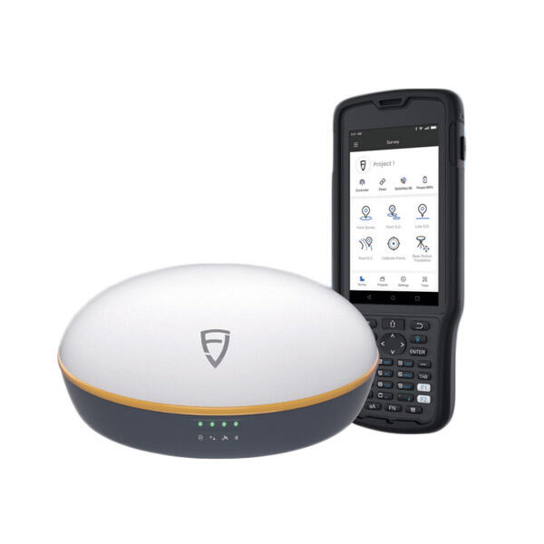
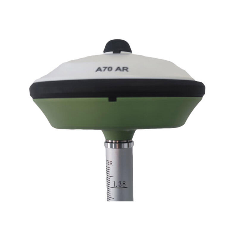
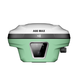
The android GPS RTK system demonstrates exceptional versatility through its wide-ranging applications across multiple industries, delivering professional-grade positioning solutions at a fraction of traditional equipment costs while maintaining the flexibility to adapt to diverse operational requirements. In construction and engineering sectors, the system provides precise layout capabilities for building foundations, utility installations, and infrastructure development, significantly reducing surveying costs while improving project accuracy and timeline management. Agricultural applications benefit from centimeter-level precision for field mapping, crop monitoring, and precision planting operations, enabling farmers to optimize resource usage and increase yields through data-driven decision making. Land surveying professionals utilize android GPS RTK systems for boundary surveys, topographic mapping, and cadastral work, achieving professional accuracy standards while reducing equipment investments and operational expenses. Environmental monitoring projects leverage the system's precision for tracking coastal erosion, monitoring structural movements, and conducting ecological surveys where accurate positioning is critical for long-term data analysis. Mining and quarrying operations employ android GPS RTK technology for volume calculations, equipment guidance, and safety monitoring, improving operational efficiency while maintaining precise material tracking and site management. The system's cost efficiency stems from eliminating expensive proprietary hardware requirements while leveraging existing Android device investments, reducing total ownership costs by up to 70 percent compared to traditional RTK systems. Maintenance costs remain minimal due to the system's robust design and software-based functionality, avoiding expensive annual calibration requirements common with dedicated surveying instruments. Training expenses decrease substantially because users already familiar with Android interfaces require minimal additional instruction to operate android GPS RTK systems effectively. The technology's scalability allows organizations to deploy multiple units cost-effectively, enabling larger survey teams and simultaneous multi-site operations without proportional increases in equipment budgets. Rental and leasing options provide flexible acquisition strategies for seasonal operations or project-specific requirements, further reducing financial barriers for small businesses and independent professionals. Return on investment typically occurs within months rather than years due to increased productivity, reduced survey times, and elimination of resurvey requirements that commonly affect less accurate positioning systems.

Get a Free Quote

Our representative will contact you soon.
Email
Name
Company Name
Message
0/1000