
 EN
EN
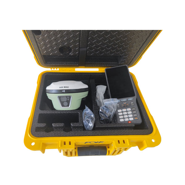
Selecting the right RTK GPS system requires understanding multiple technical dimensions that directly impact field performance, cost efficiency, and project outcomes. RTK GPS technology has become essential across surveying, construction, precision agriculture, and autonomous systems, yet the decision process remains complex because RTK GPS solutions vary significantly in accuracy specifications, signal acquisition speed, correction delivery method, and system architecture. This guide walks through the core technical criteria that matter most when evaluating RTK GPS options, helping you align system capabilities with your operational requirements and budget constraints.

The foundation of any RTK GPS selection process begins with understanding how RTK GPS works and what technical specifications genuinely influence real-world accuracy. RTK GPS combines base station corrections with rover receivers to achieve centimeter-level positioning, but the actual performance depends on hardware quality, correction network infrastructure, signal processing algorithms, and environmental conditions. Knowing which technical criteria drive system performance allows you to prioritize investments appropriately and avoid overpaying for unnecessary features while ensuring you do not compromise on essential capabilities.
Accuracy Specifications and Position Confidence
Horizontal and Vertical Accuracy Ratings
RTK GPS accuracy specifications typically express both horizontal and vertical positioning confidence, usually stated as 'centimeters plus parts per million' of baseline distance. A typical RTK GPS specification might claim '2 cm plus 1 ppm' horizontally and '3 cm plus 1 ppm' vertically, meaning the error grows slightly as your rover moves farther from the base station. When selecting RTK GPS systems, verify that published accuracy figures represent 68% confidence intervals (one standard deviation) under realistic field conditions, not ideal laboratory environments. Some RTK GPS vendors report optimistic specifications; therefore, request validation data for your specific operating region and ask about typical accuracy performance in local conditions.
Time to First Fix and Convergence Performance
RTK GPS receivers require initialization time to resolve integer ambiguities, a critical performance metric called 'time to first fix' or TTFF. Modern RTK GPS systems achieve reliable fixes within 10–30 seconds under good signal conditions, but this varies by receiver architecture, antenna design, and correction source quality. Convergence reliability describes how often RTK GPS achieves a complete fix on first attempt versus requiring multiple restart cycles. When comparing RTK GPS options, confirm that TTFF remains consistent across different sky conditions, and ask vendors for real-world initialization statistics from deployed systems. RTK GPS systems with faster convergence reduce downtime and improve field crew productivity, particularly in survey workflows requiring frequent receiver relocation.
Signal Reception, Correction Methods, and Network Reliability
GNSS Signal Support and Multi-Constellation Coverage
RTK GPS systems receive signals from multiple positioning satellites across GPS, GLONASS, Galileo, BeiDou, and other constellations. RTK GPS receivers supporting more constellations achieve faster convergence, better performance in urban or canopy-limited environments, and improved geometric strength for ambiguity resolution. Verify that your RTK GPS hardware tracks L1 and L2 frequency bands minimum; dual-frequency RTK GPS receivers provide ionospheric correction and deliver superior performance compared to single-frequency systems. When evaluating RTK GPS options in challenging environments like dense forests, urban canyons, or regions with poor correction network coverage, prioritize multi-constellation RTK GPS receivers with robust signal filtering algorithms.
Correction Data Delivery and Network Architecture
RTK GPS corrections reach rovers through multiple delivery channels: local radio modems, cellular networks (4G/5G), satellite links, or networked base stations using standardized protocols like NTRIP or RTCM. Network-RTK or VRS-based RTK GPS eliminates the need for independent base station setup, reducing equipment cost but introducing network latency and subscription dependencies. When selecting RTK GPS infrastructure, evaluate whether your operating region has reliable correction network coverage from national or regional RTK GPS providers. Confirm correction update rates (typically 1–10 Hz) match your application requirements; higher update rates improve velocity estimation and trajectory smoothness for moving platforms. RTK GPS systems using redundant correction delivery methods provide fallback capability if one channel fails.
Hardware Integration, Power Efficiency, and Total Cost of Ownership
Receiver Architecture and Interface Flexibility
RTK GPS receivers vary significantly in form factor, processing power, and integration options. Compact rover receivers suitable for handheld survey instruments differ from integrated systems mounted on UAVs, construction equipment, or autonomous vehicles. Evaluate whether your RTK GPS hardware offers standard interfaces like CAN, serial, Ethernet, or wireless protocols compatible with your downstream systems. Some RTK GPS solutions integrate GNSS receivers, IMU sensors, and processing into unified modules, while others require separate integration of RTK GPS components. RTK GPS system flexibility in software configuration and firmware updates influences long-term compatibility and performance scaling as your operations evolve.
Power Consumption, Operating Temperature, and Field Durability
RTK GPS receivers consume between 1–5 watts depending on architecture and constellation tracking; embedded systems and UAV-integrated RTK GPS units often prioritize low-power variants consuming under 2 watts. Confirm operating temperature specifications align with your geographic deployment regions; RTK GPS hardware rated only to 0°C performs poorly in arctic or high-elevation winter operations. Humidity and dust rating (IP classification) indicates RTK GPS durability during construction or outdoor survey work. When calculating total RTK GPS cost of ownership, include correction subscription fees, base station or network infrastructure costs, site preparation, integration expenses, and replacement costs for damaged receivers over typical 5–10 year asset lifecycles.
FAQ
What is the most important technical factor when choosing RTK GPS?
Accuracy specification aligned with your project tolerance represents the foundational decision criterion for RTK GPS selection. However, accuracy alone does not guarantee field success; RTK GPS convergence reliability, correction network availability, and system integration capability equally impact practical performance. Balance accuracy requirements with correction infrastructure certainty and receiver robustness to environmental conditions in your specific operating region.
How do I verify RTK GPS accuracy specifications from vendors?
Request independent validation reports and ask vendors for case studies showing RTK GPS performance in conditions matching your planned deployment. Compare specifications against industry standards published by surveying organizations, and request confidence interval definitions (68% versus 95%). Ask about typical accuracy degradation when operating far from correction base stations or in signal-challenged environments; realistic RTK GPS specifications should acknowledge these limitations transparently.
Should I prioritize network-based RTK GPS or base-station-based RTK GPS?
Network-RTK eliminates capital expense and setup complexity, making it ideal for organizations deploying RTK GPS across wide geographic areas with reliable cellular or internet connectivity. Base-station-based RTK GPS provides operational independence and consistent performance where network coverage remains unreliable or latency unacceptable. Evaluate your specific operational geography, budget, and infrastructure constraints; many organizations benefit from hybrid RTK GPS deployments supporting both methods depending on project requirements.