
 EN
EN

Urban canyons, deep gorges, and dense corridor environments are among the most demanding settings for any gnss receiver. Tall buildings and steep rock walls block direct satellite signals, create severe multipath interference, and cause rapid signal fading that can reduce positioning accuracy to an unacceptable level. Choosing the right gnss receiver for these environments means understanding which technical specifications directly influence performance when the sky view is limited and signal geometry is poor.
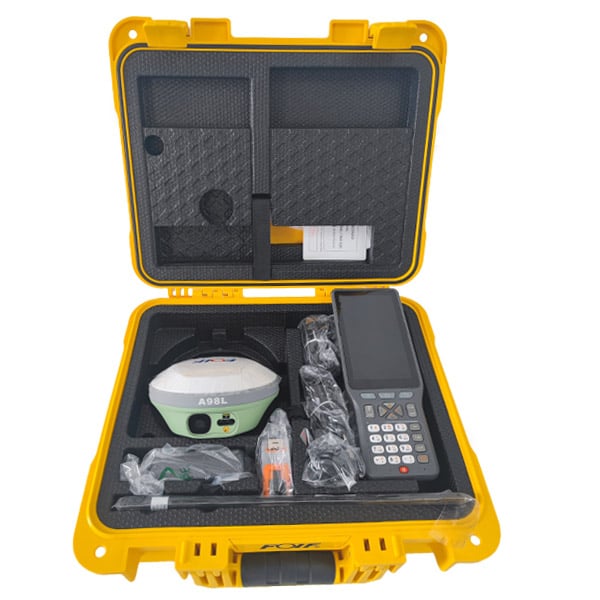
A gnss receiver that delivers strong performance on open terrain may fail completely in a canyon setting. The specifications that matter in open-sky conditions are not always the same ones that govern reliability in constrained environments. This article explains the key gnss receiver specifications that determine how well a device maintains position lock, filters multipath errors, and sustains accuracy when satellite availability is restricted by the surrounding terrain or built structures.
Signal Tracking and Sensitivity Specifications
Receiver Sensitivity and Acquisition Thresholds
One of the most critical specifications for a gnss receiver used in canyon environments is tracking sensitivity, typically expressed in dBm. A gnss receiver with a tracking sensitivity of -165 dBm or better can hold lock on satellites that would be invisible to a standard consumer-grade gnss receiver. In canyons, signals arrive at very low elevations, pass through more atmosphere, and are frequently attenuated by reflective surfaces. A highly sensitive gnss receiver captures these marginal signals and maintains a usable position solution even when only a few satellites are visible above the horizon.
Acquisition sensitivity is equally important because a gnss receiver must frequently reacquire satellites after brief blockages caused by building edges, overhangs, or cliff faces. A gnss receiver with fast reacquisition capability reduces the time-to-first-fix after signal interruptions, which is essential for dynamic applications such as vehicle navigation, surveying, and autonomous systems operating in confined corridors.
Multi-Constellation and Multi-Frequency Support
A gnss receiver that supports multiple satellite constellations, including GPS, GLONASS, Galileo, and BeiDou, has access to a much larger pool of satellites at any given moment. In a canyon, the visible sky is often reduced to a narrow strip directly overhead. A single-constellation gnss receiver may see only two or three satellites in that window, while a multi-constellation gnss receiver can see eight or more. More satellites means better dilution of precision values and a more stable position solution. Multi-frequency support, particularly L1 and L5, allows the gnss receiver to correct ionospheric delay errors more precisely, which directly improves positioning accuracy in difficult signal environments.
Multipath Mitigation and Signal Processing Capabilities
Multipath Detection Algorithms
Multipath is the primary source of positioning error in canyon environments. A signal that bounces off a building face or canyon wall before reaching the gnss receiver arrives slightly later than a direct-path signal, introducing a false range measurement. A gnss receiver equipped with advanced multipath mitigation algorithms can identify and reject or down-weight reflected signals, preserving the integrity of the position solution. The quality of these algorithms varies significantly between gnss receiver models, and this specification is one of the most decisive factors when evaluating a gnss receiver for urban or canyon deployment.
Some gnss receiver designs use narrow correlator spacing in the signal tracking loop to reduce multipath susceptibility. Others apply carrier-phase smoothing of pseudorange measurements to suppress short-term multipath noise. A gnss receiver that combines multiple mitigation techniques delivers better overall performance than one that relies on a single approach. When evaluating a gnss receiver for canyon use, requesting detailed multipath performance data from controlled testing environments is strongly recommended.
Carrier-to-Noise Density Monitoring
A capable gnss receiver continuously monitors the carrier-to-noise density ratio, commonly written as C/N0, for each tracked satellite signal. In canyon environments, a sudden drop in C/N0 often indicates that a direct signal has been replaced by a reflected path. A gnss receiver that uses C/N0 thresholds as a quality gate for individual satellite measurements can exclude degraded signals before they corrupt the position solution. This real-time signal quality monitoring is a specification that separates professional-grade gnss receiver hardware from simpler positioning modules not designed for challenging terrain.
Complementary Technologies That Strengthen Canyon Performance
Inertial Measurement Unit Integration
A gnss receiver that incorporates a tightly coupled inertial measurement unit, or IMU, can maintain position and velocity output during periods when satellite coverage is insufficient for a standalone gnss receiver solution. In a canyon, satellite availability can drop below the minimum required for a gnss receiver to compute a position fix. A gnss receiver with integrated inertial sensors bridges these gaps by propagating the last known position using accelerometer and gyroscope data. The tightly coupled architecture shares raw satellite measurements with the inertial processing engine, which means the gnss receiver continues to benefit from any available satellite signal even when fewer than four are visible.
The quality of the IMU integrated into a gnss receiver matters considerably. A gnss receiver paired with a tactical-grade IMU will experience much less position drift during satellite outages than one using a consumer-grade MEMS sensor. For applications that require continuous reliable output through long canyon stretches, evaluating the gnss receiver and its inertial subsystem together as a combined unit is essential.
Real-Time Kinematic and Correction Services
A gnss receiver that supports real-time kinematic processing, or RTK, can achieve centimeter-level accuracy by using correction data transmitted from a known reference station or through a network correction service. In canyon environments where multipath is unavoidable, RTK-capable gnss receiver hardware uses carrier-phase measurements, which are far less susceptible to multipath than pseudorange measurements at longer ranges. When combined with robust multipath mitigation, an RTK gnss receiver can deliver reliable high-accuracy output in urban corridors that would defeat a standard gnss receiver relying on pseudorange-only positioning.
FAQ
What minimum number of constellations should a canyon-rated gnss receiver support?
A gnss receiver intended for canyon use should support at least three constellations, with four being preferable. More constellations give the gnss receiver access to more satellites in a restricted sky view, improving geometry and reducing the risk of dropping below the minimum satellite count needed for a reliable position fix.
Does antenna quality affect gnss receiver performance in canyons?
Yes, antenna quality has a significant impact. A high-gain, low-noise antenna improves the effective sensitivity of the gnss receiver and helps suppress multipath signals arriving from low elevation angles. Choosing an antenna matched to the operating frequencies of the gnss receiver is just as important as the receiver hardware specifications themselves.
How does RTK improve gnss receiver accuracy in urban canyon settings?
RTK allows the gnss receiver to use carrier-phase measurements, which are inherently more precise and more resistant to multipath distortion than code-based pseudorange measurements. When the gnss receiver resolves integer ambiguities correctly, it achieves centimeter-level accuracy that remains robust even when some satellite signals are partially obscured or reflected by nearby structures.