A GIS data collector is a specialized field device designed to capture, record, and manage geographic and attribute information directly in the field. Unlike general-purpose tablets or smartphones, a purpose-built GIS data collector integrates high-accuracy positioning technology with rugged hardware and dedicated data collection software, enabling professionals to gather spatial data with precision and reliability. Whether you are mapping infrastructure, conducting environmental surveys, or managing utility assets, understanding what a GIS data collector is and how it operates is fundamental to planning efficient, accurate field workflows.
The growing demand for spatially accurate information across industries such as utilities, transportation, agriculture, and natural resource management has made the GIS data collector an indispensable tool. Modern devices combine multi-constellation GNSS receivers, rugged enclosures, long-lasting batteries, and sophisticated software platforms to deliver centimeter-level accuracy in some of the most demanding environments on earth. This article explains the definition, core components, working mechanisms, and practical applications of a GIS data collector so that field professionals and procurement teams can make informed decisions.
Defining the GIS Data Collector
Core Purpose and Role in Spatial Data Workflows
A GIS data collector serves as the bridge between the physical world and a digital geographic information system. Its primary role is to allow field workers to record the precise location of real-world features — trees, manholes, pipelines, road signs, or property boundaries — along with descriptive attribute data such as condition, material, diameter, or ownership. This combination of positional and descriptive data is what makes the information useful inside a GIS platform for analysis, planning, and reporting.
Without a dedicated GIS data collector, field teams would need to rely on paper forms, manual GPS coordinates, or consumer-grade devices that lack the accuracy, durability, and integration capabilities required for professional spatial data projects. The device enables a seamless, end-to-end digital workflow from data capture in the field to data consumption in the office or cloud environment.
A well-designed GIS data collector is not just a hardware unit — it is a complete data acquisition ecosystem. It encompasses the receiver hardware, antenna technology, an operating system, field data collection software, and connectivity options that together make systematic, accurate, and efficient spatial data capture possible.
How a GIS Data Collector Differs from a Standard GPS Unit
Standard GPS units — whether handheld navigation devices or smartphone apps — are designed primarily for navigation, not for data collection with high positional accuracy. A professional GIS data collector is engineered around different priorities: sub-meter or even centimeter-level positional accuracy, structured attribute data entry, integration with GIS databases, and the ability to work reliably in harsh outdoor conditions.
Consumer GPS devices typically provide three to five meter accuracy under open sky conditions, which is sufficient for turn-by-turn navigation but far too imprecise for infrastructure mapping, cadastral surveying, or asset management. A GIS data collector uses advanced GNSS signal processing, error correction techniques, and high-quality antennas to reduce positional error dramatically, often to within a few centimeters when real-time correction services are applied.
The attribute data entry capabilities also distinguish a GIS data collector from a simple GPS. Field workers can complete digital forms, capture photos linked to geographic coordinates, scan barcodes, and synchronize collected records with enterprise databases — all within one unified field device.
Core Components of a GIS Data Collector
GNSS Receiver and Antenna Technology
At the heart of every GIS data collector is its GNSS receiver and antenna system. Modern receivers track multiple satellite constellations simultaneously — GPS, GLONASS, Galileo, and BeiDou — which significantly increases satellite availability, especially in challenging environments such as urban canyons, forests, and areas with obstructed sky views. More satellite signals mean better geometry, faster position fixes, and greater overall accuracy.
The antenna is equally important. A high-quality choke ring or geodetic-grade antenna reduces multipath errors caused by signals reflecting off buildings or terrain. Many professional GIS data collector designs integrate the antenna directly into the unit for portability, while others support external antennas on range poles for improved sky exposure during field surveys.
Signal correction is applied through techniques such as SBAS, RTCM-based RTK, or post-processing using reference station data. The correction method chosen depends on the accuracy requirement of the project, with RTK corrections delivering the highest real-time positional accuracy for demanding applications.
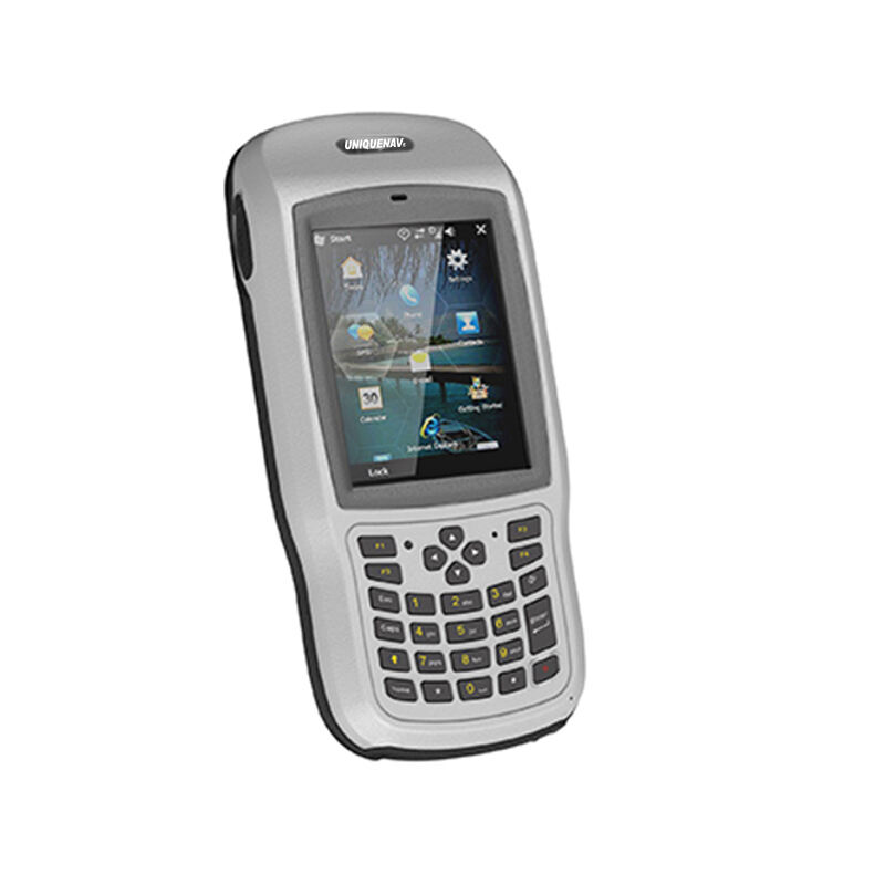
Rugged Hardware and Field-Ready Design
A GIS data collector must survive the physical demands of fieldwork. This means resistance to dust, water ingress, vibration, drops, and temperature extremes. Industry-standard certifications such as IP67 or MIL-STD-810G testing ratings indicate that a device has been validated against these conditions and can be trusted in real-world field deployments.
The display is a critical hardware element. Outdoor-readable screens with high brightness levels allow the operator to view maps, forms, and coordinates even in direct sunlight. Touchscreen interfaces that respond to gloved hands or wet fingers are important ergonomic features that improve usability in the field without slowing productivity.
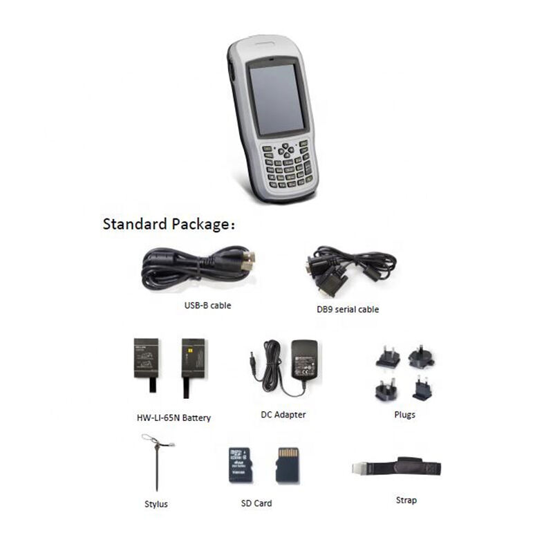
Battery life is another defining characteristic of a capable GIS data collector. Field shifts can last eight to twelve hours or more, and the ability to conduct a full day of data collection without needing to recharge or swap batteries is a practical necessity. Extended battery options and hot-swappable battery systems are features that experienced field teams prioritize when selecting a device.
How a GIS Data Collector Works in the Field
The Data Capture Workflow
The operational workflow of a GIS data collector typically begins before the field session with project configuration. A GIS technician or project manager designs the data collection schema — the layers, feature types, and attribute fields that will be captured — and loads this schema onto the device along with any existing base maps, imagery, or reference data. This preparation ensures that field workers collect consistent, structured data aligned with the organization's GIS standards.
Once in the field, the operator activates the GNSS receiver and allows it to acquire satellite signals and achieve a stable position fix. If a correction service is available, the device connects to the correction stream via cellular data, radio link, or satellite to improve positional accuracy in real time. The operator then navigates to the feature of interest using the on-screen map and positions the device or the antenna directly over or adjacent to the feature being recorded.
Data entry proceeds through a digital form displayed on the screen. The operator fills in attribute values, selects from predefined pick lists, captures photographs, and records the position — all in a single coordinated workflow. The GIS data collector timestamps and geotags every record automatically, creating a reliable audit trail of when and where each observation was made.
Error Correction and Accuracy Enhancement
Achieving high positional accuracy with a GIS data collector depends on the error correction strategy employed. The most common approach for real-time accuracy is RTK, or Real-Time Kinematic positioning. In RTK mode, the GIS data collector receives correction data from a nearby reference station or a network of reference stations, allowing it to compute positions accurate to within two to three centimeters horizontally. This level of accuracy is suitable for utility mapping, boundary surveys, and construction stakeout.
For projects where real-time corrections are not available, post-processing is an alternative. The GIS data collector logs raw GNSS observations during the field session, and these raw files are later processed in office software against data from a nearby reference station. Post-processing can achieve comparable accuracy to RTK and is often used in remote areas where cellular or radio connectivity is limited.
SBAS correction systems such as WAAS, EGNOS, and MSAS provide a simpler, free-to-use accuracy enhancement that typically improves positions to sub-meter accuracy without requiring a local reference station. This is a practical option for applications where one-meter accuracy is sufficient, such as natural resource inventories or preliminary infrastructure surveys.
Software Integration and Data Management
Field Data Collection Software
The software running on a GIS data collector is as important as the hardware. Field data collection platforms enable the creation of custom forms, integration with base maps and satellite imagery, and real-time visualization of collected data overlaid on the map. Well-designed software guides field workers through data entry, enforces validation rules to prevent incomplete records, and supports offline operation where connectivity is unavailable.
Many GIS data collector software platforms support industry-standard GIS data formats, allowing collected data to be imported directly into desktop and enterprise GIS systems without complex conversion steps. Support for formats such as Shapefile, GeoJSON, GeoPackage, and ESRI File Geodatabase ensures compatibility with the widest range of GIS analysis environments.
Advanced platforms also support feature editing — allowing field workers not only to collect new features but also to update or correct existing GIS records in the field. This capability is especially valuable for asset management programs where field inspections need to update the status, condition, or attributes of previously mapped features.
Data Synchronization and Enterprise Integration
A modern GIS data collector is designed to fit into an organization's broader data management infrastructure. Cloud synchronization capabilities allow field-collected data to be pushed to a central server or cloud GIS platform the moment connectivity is restored, enabling near real-time visibility of field progress for project managers and office-based analysts.
Integration with enterprise asset management systems, work order platforms, and spatial databases means that data captured by a GIS data collector can trigger automated workflows — such as generating a maintenance work order when a damaged asset is recorded, or updating an inventory record when a new installation is mapped. This level of integration elevates the GIS data collector from a simple capture device to a critical node in a connected field operations ecosystem.
Security features including user authentication, data encryption, and audit logging ensure that sensitive spatial data collected in the field is protected throughout its lifecycle. Organizations managing critical infrastructure, classified land records, or commercially sensitive asset inventories depend on these security capabilities to maintain data integrity and regulatory compliance.
Common Applications of a GIS Data Collector
Utility and Infrastructure Asset Management
One of the most widespread uses of a GIS data collector is utility and infrastructure asset management. Electric power companies, water utilities, telecom providers, and municipal governments use GIS data collector devices to map and maintain the location and condition of their physical assets — poles, cables, pipes, valves, meters, and related infrastructure. Accurate spatial records support maintenance planning, outage response, regulatory reporting, and capital investment decisions.
The precision offered by a professional GIS data collector is particularly important in dense urban environments where assets are closely spaced and the consequences of incorrect positioning — such as mislabeled underground pipes — can be significant. Sub-meter or centimeter-level accuracy ensures that field-collected asset records are reliable enough for construction, excavation, and engineering design purposes.
Environmental Survey and Natural Resource Monitoring
Environmental scientists, foresters, wildlife biologists, and conservation planners rely on the GIS data collector to record the location and attributes of ecological features. Invasive species distributions, wetland boundaries, soil sample sites, nesting locations, and vegetation plot data are all examples of information routinely captured with a GIS data collector in the field.
The ability to attach photographs, voice notes, and sensor readings to each spatial record makes the GIS data collector a versatile environmental monitoring tool. Field teams can document conditions at the time of observation, creating a rich, georeferenced dataset that supports trend analysis, impact assessment, and regulatory compliance over time.
In remote and challenging terrain — dense forests, wetlands, steep slopes — the rugged construction and long battery life of a professional GIS data collector are essential. Devices that can operate reliably for a full field day without connectivity or recharging support are preferred for environmental survey work far from infrastructure.
FAQ
What level of accuracy can a GIS data collector achieve?
The accuracy of a GIS data collector depends on the correction method used. Without corrections, a multi-constellation GNSS receiver typically achieves one to three meters of horizontal accuracy. With SBAS corrections, accuracy improves to sub-meter levels. Using RTK corrections from a reference station or correction network, a professional GIS data collector can achieve two to three centimeter accuracy in real time, which is suitable for engineering-grade mapping and asset management applications.
Can a GIS data collector work without internet connectivity?
Yes, a GIS data collector is specifically designed to work in offline environments. Field data collection software stores project data, forms, and base maps locally on the device, allowing full data capture without any cellular or Wi-Fi connection. Some correction methods such as SBAS also function without internet access. Once connectivity is restored, collected data is synchronized to the office or cloud platform. This offline capability is essential for fieldwork in remote areas, underground environments, or regions with poor network coverage.
What is the difference between a GIS data collector and a total station?
A GIS data collector is a GNSS-based device that determines position by receiving signals from satellites and optionally applying corrections from reference stations. A total station is an optical-electronic surveying instrument that measures angles and distances from a known point to calculate coordinates. GIS data collector devices are faster and more mobile for large-area mapping tasks, while total stations offer very high accuracy in constrained environments where GNSS signals may be blocked, such as indoors or in dense urban settings. Many modern surveying workflows use both instruments in combination.
How do I choose the right GIS data collector for my project?
Selecting the right GIS data collector depends on several factors: the accuracy requirements of your project, the environmental conditions in which the device will be used, the software platforms your organization relies on, connectivity needs, and budget. For projects requiring sub-centimeter accuracy, look for a device supporting RTK with multi-constellation, multi-frequency GNSS. For rugged environments, prioritize MIL-SPEC and IP-rated devices with long battery life. Always verify that the hardware is compatible with the GIS data collection software your team uses, and consider the availability of technical support and firmware updates over the device lifecycle.