
 EN
EN
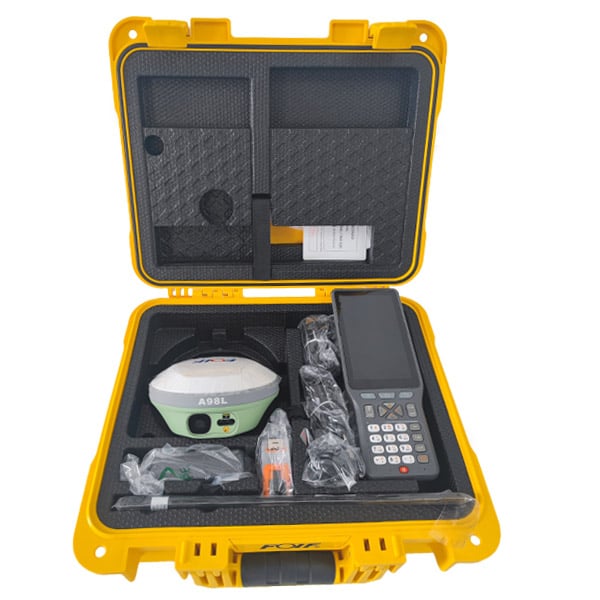
Geodetic monitoring demands uncompromising precision, and RTK technology stands as the foundation enabling surveyors and geotechnical engineers to achieve centimeter-level accuracy across demanding applications. Whether monitoring structural deformation, subsidence, or infrastructure stability, RTK represents the essential advancement that transforms raw satellite positioning into actionable intelligence for critical monitoring projects. Understanding how RTK functions within modern geodetic workflows helps organizations make informed decisions about equipment investment and deployment strategy.
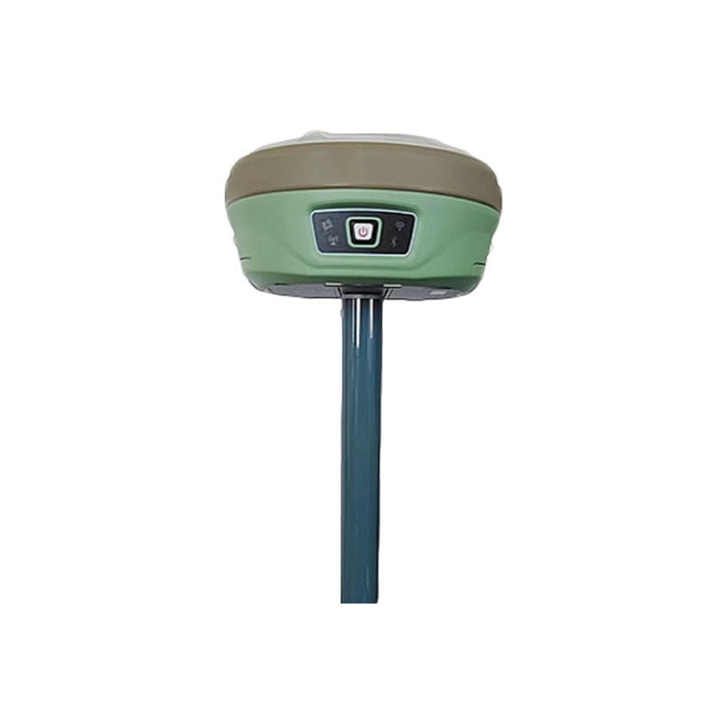
The integration of choke ring antenna technology with RTK systems creates a synergy that elevates monitoring performance beyond conventional approaches. RTK antennas equipped with choke rings mitigate multipath signal interference, a primary source of positional error in urban and complex terrain environments. This advancement means that geodetic monitoring projects can now operate reliably in previously challenging locations, expanding the scope of what professional surveyors can accomplish with confidence.
How RTK Enhances Geodetic Monitoring Accuracy
Real-Time Kinematic Positioning Fundamentals
RTK operates by leveraging a base station and rover configuration where the base station continuously transmits correction data to the rover receiver in real time. This correction mechanism allows RTK to resolve integer ambiguities in satellite signals, achieving horizontal accuracies within two to five centimeters and vertical accuracies approaching similar tolerances. For geodetic monitoring applications requiring continuous tracking of structural movement or ground deformation, RTK delivers the instantaneous, precise positioning that traditional methods cannot match.
The RTK workflow begins with establishing a fixed base station at a known coordinate location. The base station calculates atmospheric and orbital corrections by comparing predicted satellite signals with observed signals. RTK rovers then receive both the satellite signals and the correction stream from the base station, enabling them to compute their position with extraordinary precision. This methodology transforms surveying from a post-processing exercise into a real-time decision-making tool.
Signal Reliability and Atmospheric Mitigation
Multipath interference occurs when satellite signals reflect off nearby structures, water bodies, or terrain before reaching the antenna. RTK antennas with choke ring design reject reflected signals by isolating the antenna from ground-based reflections. The choke ring structure acts as a physical shield, allowing direct satellite signals to dominate while suppressing multipath components that degrade RTK performance. This architectural feature proves invaluable during geodetic monitoring in urban zones, near infrastructure, or in valleys where reflections are unavoidable.
Atmospheric conditions also influence RTK accuracy through ionospheric delay and tropospheric refraction. While RTK corrections address these delays, antenna design quality directly impacts the baseline accuracy of measurements. RTK antennas engineered for signal clarity and multipath rejection maintain consistency regardless of environmental pressure, ensuring that geodetic monitoring data remains trustworthy across seasonal variations and weather changes.
RTK Applications in Geodetic Monitoring Projects
Structural Health and Deformation Monitoring
Bridges, dams, and tall structures require continuous deformation monitoring to detect early-stage failures or stress patterns. RTK technology enables engineers to establish monitoring networks where multiple RTK rovers simultaneously track specific points on structures. The real-time positioning capability of RTK allows instant detection of millimeter-scale movements, triggering immediate alerts when thresholds are exceeded. This capability transforms passive inspection routines into active, data-driven asset management systems.
RTK antennas with choke ring technology enhance the reliability of such monitoring networks by maintaining signal integrity even when monuments are located on or near structural surfaces. For example, monitoring strain gauges mounted on steel bridge girders becomes more robust when RTK systems reject electromagnetic reflections from metal structures. The combination of RTK positioning and choke ring antenna design ensures that deformation data collected over months or years maintains consistency and trustworthiness.
Ground Subsidence and Hazard Assessment
Mining operations, groundwater extraction zones, and coastal areas face subsidence risks requiring precise vertical measurement over time. RTK establishes baseline networks across sensitive areas, and repeated RTK surveys quantify ground settlement with centimeter precision. When subsidence monitoring relies on RTK technology, project managers gain early warning of accelerating movement, enabling proactive mitigation before catastrophic failure occurs. The vertical accuracy of RTK complements horizontal accuracy, providing three-dimensional insight into ground behavior.
Deploying RTK systems for subsidence monitoring requires antenna stability and signal consistency across seasonal cycles. RTK antennas with choke ring construction maintain phase center stability, meaning the effective position of signal reception remains constant regardless of temperature fluctuations or rain events. This thermal and environmental robustness ensures that RTK measurements collected in summer baseline campaigns remain comparable to winter follow-up surveys without artificial drift artifacts.
RTK Implementation and System Considerations
Network Architecture and Correction Delivery
Modern RTK systems employ network RTK configurations where multiple base stations feed correction data to a central processor, which then broadcasts unified RTK corrections to all rovers in the region. This architecture expands RTK coverage beyond the direct line-of-sight limitations of traditional single-base RTK. For large-scale geodetic monitoring networks covering entire infrastructure corridors or monitoring areas spanning multiple kilometers, network RTK ensures consistent accuracy everywhere the monitoring points are located.
Selecting appropriate RTK antennas becomes critical when designing network-based monitoring systems. RTK antennas that perform uniformly across the frequency bands used by correction services and navigation systems ensure that all monuments in the monitoring network behave identically. This uniformity simplifies data processing and eliminates systematic biases that could corrupt trend analysis over multi-year geodetic monitoring campaigns.
Operational Deployment and Data Management
RTK implementation for geodetic monitoring requires careful planning of base station placement, correction data infrastructure, and rover logistics. Base stations must be positioned at stable reference points, typically tied into national geodetic networks to ensure results align with authoritative coordinate systems. RTK rovers then operate remotely, typically via cellular or radio link to receive RTK corrections. Data management systems must log RTK positions at consistent intervals, archive the correction streams, and perform post-processing validation to ensure quality assurance.
The operational success of RTK depends on antenna orientation and installation quality. RTK antennas must maintain consistent orientation and unobstructed sky visibility to maximize satellite signal availability. Installation on choke ring-equipped antennas provides additional insurance against multipath interference that could otherwise corrupt measurements even when sky visibility is adequate. For geodetic monitoring projects operating over multiple years, robust antenna installation and regular verification of physical stability become essential maintenance activities.
FAQ
What is the typical accuracy achievable with RTK systems for geodetic monitoring?
RTK systems typically achieve horizontal accuracies between two and five centimeters and vertical accuracies of similar magnitude, depending on atmospheric conditions, base station proximity, and antenna quality. For geodetic monitoring applications, this accuracy level enables detection of structural movements, ground subsidence, and deformation patterns that would remain invisible to lower-precision positioning methods. The real-time RTK delivery of these measurements means that changes become apparent immediately rather than after post-processing delays.
How do choke ring antennas improve RTK performance in challenging environments?
Choke ring antennas suppress multipath signals through physical design that rejects reflected satellite signals while accepting direct signals. In urban environments, near water bodies, or near large metal structures, multipath interference commonly degrades RTK accuracy by several centimeters. By deploying RTK antennas with choke ring technology, geodetic monitoring networks maintain accuracy even in these challenging locations. The RTK solution becomes more reliable because multipath rejection reduces the residual errors that correction systems must compensate.
Can RTK monitoring systems operate continuously over extended time periods?
Yes, RTK systems can operate continuously for months or years once properly installed and maintained. Geodetic monitoring networks using RTK technology log positions at regular intervals, building historical datasets that reveal deformation trends and movement patterns. The key to successful long-term RTK monitoring is ensuring that base station infrastructure remains stable, correction data delivery continues reliably, and antenna installations are protected from environmental damage. RTK antennas with robust choke ring construction maintain performance throughout extended deployment, supporting multi-year geodetic monitoring projects without degradation.