
Revolutionizing Modern Surveying with Advanced Satellite Technology
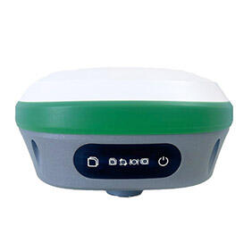
The surveying industry has witnessed a remarkable transformation with the advent of GNSS receivers. These sophisticated devices have fundamentally changed how professionals approach precision measurement and data collection in the field. By harnessing signals from multiple satellite constellations, GNSS receivers deliver unprecedented accuracy and efficiency in surveying operations.
The integration of GNSS receivers into surveying workflows represents a paradigm shift from traditional methods. These advanced tools enable surveyors to capture precise positioning data in real-time, dramatically reducing project timelines while maintaining exceptional accuracy standards. The technology's evolution continues to push boundaries, offering new possibilities for both seasoned professionals and emerging surveying applications.
Understanding GNSS Technology Fundamentals
Core Components and Functionality
GNSS receivers comprise several sophisticated components working in harmony to deliver precise positioning information. At their heart lies the antenna, designed to capture signals from multiple satellite systems including GPS, GLONASS, Galileo, and BeiDou. The receiver's processing unit interprets these signals, calculating position coordinates with remarkable precision.
Modern GNSS receivers incorporate advanced error correction algorithms and real-time processing capabilities. These features enable them to account for atmospheric interference, multipath errors, and other factors that could impact accuracy. The integration of multiple satellite constellations ensures redundancy and improved performance, particularly in challenging environments.
Signal Processing and Accuracy Levels
The precision of GNSS receivers depends heavily on sophisticated signal processing techniques. RTK (Real-Time Kinematic) technology enables centimeter-level accuracy by comparing satellite signals received at both base and rover stations. This differential correction process eliminates common errors and provides surveyors with highly reliable positioning data.
Advanced GNSS receivers can achieve horizontal accuracy within 8mm and vertical accuracy within 15mm under optimal conditions. This level of precision makes them invaluable for applications ranging from boundary surveys to construction stakeout and topographic mapping.
Applications Across Industry Sectors
Construction and Infrastructure Development
In the construction industry, GNSS receivers have become indispensable tools for site planning and execution. They enable precise layout of buildings, roads, and utilities, ensuring that construction proceeds according to exact specifications. The technology's ability to maintain accuracy across large sites has revolutionized infrastructure development projects.
Project managers utilize GNSS receivers for real-time progress monitoring and quality control. The technology allows them to verify earthwork volumes, track equipment movement, and ensure compliance with design specifications throughout the construction process.
Environmental Monitoring and Resource Management
Environmental scientists and resource managers rely on GNSS receivers for accurate mapping and monitoring of natural resources. The technology enables precise tracking of environmental changes, wildlife movements, and habitat boundaries. This data proves crucial for conservation efforts and sustainable resource management.
Water resource management particularly benefits from GNSS technology. Surveyors use these devices to map watershed boundaries, monitor coastal erosion, and plan water infrastructure projects with unprecedented precision.
Technological Advancements and Future Prospects
Integration with Emerging Technologies
The evolution of GNSS receivers continues with integration into broader technological ecosystems. Machine learning algorithms enhance signal processing capabilities, while cloud connectivity enables real-time data sharing and processing. The combination with other technologies like LiDAR and photogrammetry creates powerful surveying solutions.
Augmented reality applications paired with GNSS receivers offer innovative ways to visualize survey data in the field. This integration helps surveyors identify features, navigate sites, and make informed decisions with greater efficiency.
Future Development Trends
The future of GNSS receivers looks promising with several emerging trends. Miniaturization of components will lead to more compact and versatile devices, while improved battery technology will extend field operation times. Enhanced signal processing capabilities will further improve accuracy and reliability in challenging environments.
The introduction of new satellite constellations and signals will expand the capabilities of GNSS receivers. These developments will enable better performance in urban canyons, under canopy, and in other traditionally difficult surveying environments.
Best Practices for Professional Implementation
Equipment Selection and Setup
Choosing the right GNSS receiver requires careful consideration of project requirements and environmental conditions. Professionals must evaluate factors such as required accuracy levels, operation environment, and integration capabilities with existing systems. The selected equipment should balance performance needs with budget constraints.
Proper setup and calibration are crucial for optimal performance. This includes establishing clear sky view when possible, maintaining stable base station positions, and implementing appropriate quality control measures throughout the surveying process.
Data Management and Quality Control
Effective data management strategies are essential when working with GNSS receivers. Surveyors must implement robust workflows for data collection, processing, and storage. Regular validation of measurements and implementation of redundancy checks ensure the highest quality results.
Quality control procedures should include regular equipment maintenance, firmware updates, and operator training. Documentation of survey conditions and methodologies helps maintain transparency and accountability in professional practice.
Frequently Asked Questions
How do weather conditions affect GNSS receiver accuracy?
Weather conditions can impact GNSS receiver performance in several ways. Heavy cloud cover, rain, or snow generally have minimal effect on accuracy. However, severe atmospheric conditions, particularly ionospheric disturbances, can affect signal quality. Modern GNSS receivers incorporate advanced algorithms to compensate for these environmental factors.
What is the typical battery life of professional GNSS receivers?
Professional GNSS receivers typically operate for 8-12 hours on a single battery charge under normal conditions. Many models feature hot-swappable batteries for extended field operations. Battery life can vary depending on factors such as sampling rate, wireless connectivity usage, and environmental conditions.
How often should GNSS receivers be calibrated?
Professional GNSS receivers should undergo regular calibration and verification, typically annually or according to manufacturer specifications. However, more frequent checks may be necessary for high-precision applications or after any significant impact or environmental exposure. Many modern receivers also include built-in calibration monitoring and alert systems.