
 EN
EN
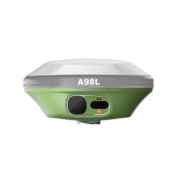
In the modern construction landscape, precision is no longer a luxury—it is the baseline for profitability. The transition from traditional string lines and manual stakes to digital site management has centered entirely on the capabilities of the GNSS Receiver. These devices serve as the "eyes" of the jobsite, providing the high-accuracy positioning data required for everything from initial site surveys to the final grading of complex surfaces. However, not all receivers are created equal, and the features that matter in a static surveying environment often differ significantly from those required in the heat of heavy civil engineering.

Selecting the right GNSS Receiver for construction use involves balancing ruggedness with technological sophistication. A jobsite is a chaotic environment characterized by heavy machinery, dust, vibration, and significant physical obstructions. Therefore, the internal architecture of the receiver must be capable of maintaining a stable "fix" under conditions that would render standard consumer-grade GPS units useless. Understanding which specific features drive productivity on-site is essential for any project manager looking to minimize rework and maximize machine uptime.
High-Precision Positioning and Multi-Constellation Support
The most critical feature of any construction-grade GNSS Receiver is its ability to track multiple satellite constellations simultaneously. While "GPS" is the most commonly used term, a professional receiver should utilize the full Global Navigation Satellite System (GNSS), which includes GLONASS (Russia), Galileo (Europe), and BeiDou (China). Accessing a higher number of satellites ensures that the receiver can maintain a high-accuracy position even when parts of the sky are blocked by tall buildings, dense tree canopies, or large earthmoving equipment.
Beyond constellation support, the integration of Real-Time Kinematic (RTK) technology is non-negotiable for construction. RTK allows the receiver to correct atmospheric errors in real-time by communicating with a base station or a network of reference stations (VRS). This reduces positioning error from several meters down to the centimeter level. For construction tasks like laying pipe or verifying subgrade elevations, this level of precision ensures that the physical build matches the digital CAD design perfectly, preventing the costly "dig-it-up-and-fix-it" cycle that plagues unmanaged sites.
Comparison of Essential GNSS Features for Jobsite Tiers
To assist in the procurement process, it is helpful to categorize features based on the intensity and specific requirements of the construction application. The following table highlights the key differences between entry-level layout tools and high-end machine control receivers.
| Feature Category | Basic Site Layout | Heavy Earthmoving / Grading | Structural Steel & Concrete |
| Accuracy Level | Sub-decimeter (3-5cm) | High Precision (1-2cm) | Millimeter (with Laser/Total Station) |
| Constellation Support | GPS + GLONASS | Full Multi-GNSS (All 4) | Full Multi-GNSS + L5 Band |
| Ruggedness Rating | IP67 (Dust/Water) | IP68 + High Vibration Rating | IP68 + MIL-STD Impact |
| Tilt Compensation | Optional | Essential (IMU-based) | Specialized |
| Connectivity | Bluetooth / WiFi | UHF Radio + 4G/5G Internal | Dual-Frequency Internal Radio |
IMU-Based Tilt Compensation and Workflow Speed
In the past, surveyors and site foremen had to keep the range pole perfectly level using a physical bubble vial to get an accurate measurement. This was time-consuming and prone to human error, especially in windy conditions or on steep slopes. One of the most transformative features of a modern GNSS Receiver is the integration of an Inertial Measurement Unit (IMU). IMU-based tilt compensation allows the user to take accurate points while the pole is tilted at an angle—sometimes up to 60 degrees.
This feature does more than just increase speed; it enhances safety. A worker can measure the location of a trench or a busy roadway without having to stand directly in the danger zone, simply by reaching the pole out to the point of interest. Because IMUs are immune to magnetic interference, unlike older electronic compasses, they can be used safely around large steel structures and heavy vehicles. For a construction team, this means faster topo-surveys and more efficient stakeouts, directly impacting the project's bottom line by reducing the time spent on manual measurement tasks.
Ruggedization and Battery Life in Harsh Environments
A GNSS Receiver on a construction site is subjected to conditions that would destroy most high-tech electronics. The Ingress Protection (IP) rating is a vital metric here. For construction, an IP68 rating is the gold standard, indicating that the unit is completely dust-tight and can withstand immersion in water. Additionally, the casing should meet military-grade standards (MIL-STD-810G) for shock and vibration. This ensures that the receiver can survive being dropped from a tripod or mounted directly to a vibrating bulldozer blade without internal component failure.
Equally important is the power management system. Construction shifts often exceed ten hours, and a receiver that dies mid-afternoon can halt an entire crew's progress. Features such as "hot-swappable" batteries—where one battery can be replaced while the unit is still running—are invaluable. Furthermore, the ability to charge the unit via USB-C or a vehicle's power outlet provides the flexibility needed for remote sites where traditional power grids are unavailable. A reliable power system ensures that the data flow from the office to the field remains uninterrupted throughout the entire workday.
Frequently Asked Questions (FAQ)
What is the difference between an IMU and a Magnetometer for tilt?
Older receivers used magnetometers to calculate the tilt angle, but these were easily distracted by metal objects like trucks or rebar. An IMU (Inertial Measurement Unit) uses accelerometers and gyroscopes to calculate position relative to movement. This makes IMU-based tilt compensation much more reliable on construction sites where steel and machinery are everywhere.
Do I need a UHF radio in my GNSS Receiver?
If you are working on remote sites without reliable cellular coverage, a internal UHF radio is essential. It allows your "Rover" to receive corrections directly from your "Base Station" over several kilometers. If you primarily work in urban areas with strong 4G/5G signals, you may be able to rely on NTRIP (Network RTK) via an internet connection, but a radio is always a safer backup for construction.
How many channels does a construction receiver really need?
Modern professional receivers often feature 400 to 800+ channels. While this might seem excessive, these channels allow the unit to track every available signal from all satellite constellations, including secondary signals that help mitigate "multipath" errors (signals bouncing off buildings). More channels generally lead to a faster "fixed" solution in tough environments.
Is the software as important as the hardware?
Absolutely. A GNSS Receiver is only as good as the field software it connects to. For construction, the software must be able to handle complex 3D design files (like .DXF or .LandXML) and provide a clear, "cut/fill" visual for the operator. Ensure your hardware is compatible with the software your engineering team uses to avoid data translation errors.
Strategic Selection for Long-Term ROI
Choosing a GNSS Receiver for your construction business is an investment in your site's "digital twin." By prioritizing multi-constellation support, IMU tilt compensation, and extreme ruggedness, you ensure that your team has the tools to build it right the first time. The goal is to eliminate the gap between the design office and the field crew. While high-end features may have a higher upfront cost, the reduction in manual labor, the increase in safety, and the elimination of survey errors provide a return on investment that is measured in days, not years. As the industry moves toward fully autonomous grading and site management, having a robust GNSS foundation is the first step toward the future of construction.