RTK GPS System: High-Precision Positioning Solution with Centimeter-Level Accuracy

All Categories

rtk system gps

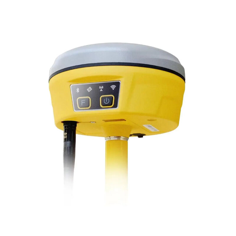
RTK (Real-Time Kinematic) GPS system represents a significant advancement in satellite positioning technology, offering centimeter-level accuracy for various applications. This sophisticated system enhances traditional GPS capabilities by utilizing a base station that broadcasts correction data to mobile receivers in real-time. The base station, positioned at a known fixed location, continuously monitors satellite signals and calculates corrections for various error sources, including atmospheric delays, satellite orbit errors, and clock discrepancies. These corrections are then transmitted to mobile RTK receivers, enabling them to achieve highly precise positioning results. The system operates by comparing the phase of the carrier wave signals from satellites, rather than just the coded messages they contain. This carrier phase measurement, combined with the correction data from the base station, allows RTK systems to achieve accuracy levels of 1-2 centimeters horizontally and 2-3 centimeters vertically. The technology has revolutionized numerous industries, from precision agriculture and construction to surveying and mapping. Modern RTK systems often incorporate multiple satellite constellations, including GPS, GLONASS, Galileo, and BeiDou, to improve reliability and accuracy further.

New Products

The RTK GPS system offers numerous compelling advantages that set it apart from conventional GPS solutions. First and foremost, its exceptional accuracy makes it invaluable for applications requiring precise positioning. Unlike standard GPS systems that may have accuracy ranges of several meters, RTK technology consistently delivers centimeter-level precision in real-time. This high accuracy remains stable under various environmental conditions, making it reliable for critical operations. The system's ability to provide instant position updates makes it particularly useful for dynamic applications, such as machine guidance and autonomous navigation. Another significant advantage is its versatility across different industries. In agriculture, it enables precise field mapping and automated steering systems, leading to optimized resource usage and increased productivity. In construction, RTK systems facilitate accurate equipment positioning and site layout, reducing errors and rework costs. The technology also proves invaluable in surveying, where it dramatically reduces the time and effort required for precise measurements. Modern RTK systems often feature user-friendly interfaces and seamless integration with existing equipment and software, making them accessible to users with varying levels of technical expertise. The system's ability to maintain accuracy over long distances from the base station, typically up to 20-30 kilometers, provides excellent coverage for large-scale operations. Additionally, the implementation of network RTK solutions has eliminated the need for users to set up their own base stations, making the technology more cost-effective and easier to deploy.

Practical Tips

What Are the Benefits of Using an Android Total Station?

21

Mar

What Are the Benefits of Using an Android Total Station?

View More
What are the common error sources in GNSS RTK positioning and how to mitigate them?

21

Mar

What are the common error sources in GNSS RTK positioning and how to mitigate them?

View More
What are the key differences between GNSS RTK and PPP?

25

Mar

What are the key differences between GNSS RTK and PPP?

View More
How to choose the right RTK GNSS equipment?

22

Apr

How to choose the right RTK GNSS equipment?

View More

Get a Free Quote

Our representative will contact you soon.
Email
Name
Company Name
Message
0/1000

rtk system gps

Exceptional Precision and Reliability

Exceptional Precision and Reliability

The RTK GPS system's standout feature is its ability to deliver unprecedented positioning accuracy in real-time. This system achieves horizontal accuracy within 1-2 centimeters and vertical accuracy within 2-3 centimeters, setting a new standard in satellite positioning technology. This level of precision is maintained through sophisticated error correction algorithms that account for various factors affecting satellite signals. The system's reliability is enhanced through multi-constellation support, allowing it to utilize signals from multiple satellite systems simultaneously. This redundancy ensures consistent performance even in challenging environments where satellite visibility might be limited. The system's ability to maintain such high accuracy levels while providing real-time updates makes it invaluable for applications requiring precise positioning and navigation.
Advanced Error Correction Technology

Advanced Error Correction Technology

At the heart of the RTK GPS system lies its sophisticated error correction technology. The system employs a network of base stations that continuously monitor satellite signals and atmospheric conditions to generate precise correction data. These corrections account for various error sources, including ionospheric and tropospheric delays, satellite orbit errors, and clock discrepancies. The correction data is transmitted to mobile receivers in real-time, allowing them to adjust their position calculations accordingly. This advanced error correction mechanism enables the system to eliminate most of the common errors that affect standard GPS receivers. The technology also includes intelligent algorithms that can detect and reject multipath signals, which occur when satellite signals reflect off buildings or other objects before reaching the receiver.
Versatile Industry Applications

Versatile Industry Applications

The RTK GPS system's versatility makes it an invaluable tool across numerous industries. In agriculture, it enables precision farming practices through accurate field mapping, automated guidance systems, and precise application of inputs. Construction professionals utilize RTK technology for precise machine control, site layout, and grade checking, significantly improving efficiency and reducing costs. In surveying and mapping, the system revolutionizes data collection by providing instant, highly accurate measurements without the need for post-processing. The technology also finds applications in autonomous vehicle navigation, precision landing systems for aircraft, and maritime operations. This wide range of applications is supported by the system's ability to integrate with various software platforms and equipment, making it adaptable to specific industry requirements.