Digital Survey Level: Advanced Precision Measurement Technology for Professional Surveying

All Categories

digital survey level

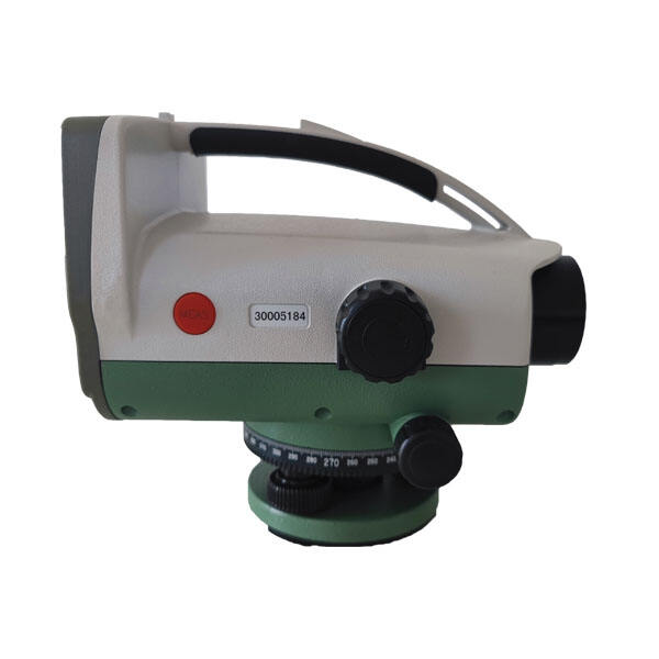
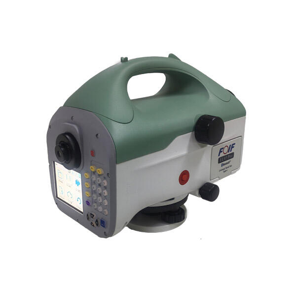
A digital survey level represents a sophisticated surveying instrument that combines traditional leveling capabilities with modern digital technology. This advanced tool utilizes electronic sensors and digital displays to provide precise measurements of height differences and distances between points. The instrument features an automatic compensator that ensures accuracy by maintaining levelness, even with slight variations in setup position. It incorporates a digital readout system that displays measurements in real-time, eliminating manual calculations and reducing human error. The device typically includes built-in memory storage for data collection, allowing surveyors to record and transfer measurements directly to computers for further analysis. Modern digital survey levels often come equipped with integrated Bluetooth or USB connectivity, facilitating seamless data transfer and integration with surveying software. These instruments are designed for durability with weather-resistant construction and can operate effectively in various environmental conditions. The optical system consists of high-quality lenses that provide clear sighting of leveling staffs, while the digital component accurately reads and processes the coded patterns on specialized staffs. This combination of traditional optical technology and digital innovation makes these instruments essential for construction projects, topographic surveys, and precise leveling work.

Popular Products

Digital survey levels offer numerous practical benefits that significantly enhance surveying operations. First, they dramatically reduce the time required for measurements by automatically calculating and displaying height differences, eliminating the need for manual computations and minimizing the risk of calculation errors. The automatic data recording capability ensures that all measurements are safely stored and can be easily retrieved, preventing data loss and enabling efficient project documentation. These instruments provide exceptional accuracy, typically achieving precision levels of up to 0.3mm per kilometer of double-run leveling, making them ideal for high-precision surveying tasks. The digital display presents measurements in clear, easy-to-read formats, reducing eye strain and fatigue during extended use. The ability to transfer data directly to computers eliminates transcription errors and streamlines the entire surveying workflow. Weather resistance and robust construction ensure reliable performance in challenging field conditions, while the long battery life supports extended operation periods. The automatic compensator system maintains accuracy even in slightly unstable conditions, reducing the need for repeated setups. Digital survey levels also offer significant cost savings in the long run by increasing productivity and reducing the time required for data processing. The instruments user-friendly interface makes training new operators more straightforward, and the digital technology allows for quick verification of measurements in the field. These advantages make digital survey levels an invaluable tool for modern surveying professionals, offering improved efficiency, accuracy, and reliability compared to traditional optical levels.

Practical Tips

How to Set Up and Calibrate an Android Total Station?

21

Mar

How to Set Up and Calibrate an Android Total Station?

View More
Auto Level vs. Digital Level: Choosing the Right Tool

21

Mar

Auto Level vs. Digital Level: Choosing the Right Tool

View More
How to Choose a Total Station Suitable for Engineering Needs?

22

Apr

How to Choose a Total Station Suitable for Engineering Needs?

View More
Laser RTK vs GNSS: Which One Is Better?

22

Apr

Laser RTK vs GNSS: Which One Is Better?

View More

Get a Free Quote

Our representative will contact you soon.
Email
Name
Company Name
Message
0/1000

digital survey level

Advanced Digital Technology Integration

Advanced Digital Technology Integration

The integration of cutting-edge digital technology in modern survey levels represents a significant advancement in surveying instrumentation. This feature encompasses sophisticated electronic sensors that can automatically detect and process measurements with unprecedented precision. The digital system incorporates advanced algorithms that compensate for environmental factors and instrument variations, ensuring consistently accurate results. The technology includes high-resolution displays that provide clear, real-time measurement data, making it easier for operators to verify readings instantly. The digital integration extends to data management capabilities, with built-in storage systems that can handle thousands of measurements and advanced processing functions that can perform complex calculations on the spot. This technological enhancement significantly reduces the possibility of human error while increasing the speed and efficiency of surveying operations.
Automated Data Collection and Management

Automated Data Collection and Management

The automated data collection and management system represents a revolutionary approach to surveying data handling. This feature enables surveyors to capture, store, and organize measurements automatically, eliminating the need for manual recording and reducing the risk of transcription errors. The system includes sophisticated data logging capabilities that can track project details, measurement sequences, and temporal information for each reading. Built-in quality control mechanisms automatically flag suspicious measurements, allowing immediate verification in the field. The data management interface provides intuitive organization options, enabling surveyors to structure information according to project requirements and easily retrieve specific measurements when needed. This automation streamlines the entire surveying workflow, from initial measurement to final report generation.
Enhanced Precision and Reliability

Enhanced Precision and Reliability

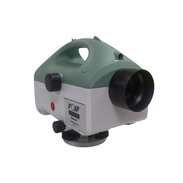
The enhanced precision and reliability features of digital survey levels set new standards for surveying accuracy. These instruments incorporate advanced compensator systems that automatically adjust for slight deviations from level, ensuring accurate measurements even in challenging conditions. The precision mechanisms include sophisticated optical systems combined with electronic sensors that can detect and measure minimal height differences with exceptional accuracy. The reliability is further enhanced by built-in error detection systems that monitor various parameters such as temperature, tilt, and vibration, adjusting measurements accordingly. The instruments maintain consistent accuracy over long periods of use, with minimal need for recalibration. This level of precision and reliability is crucial for high-stakes surveying projects where accuracy is paramount, such as in construction layout, deformation monitoring, and precision engineering applications.