Professional Digital Level Survey Equipment: High-Precision Measurement Solutions

All Categories

digital level survey equipment

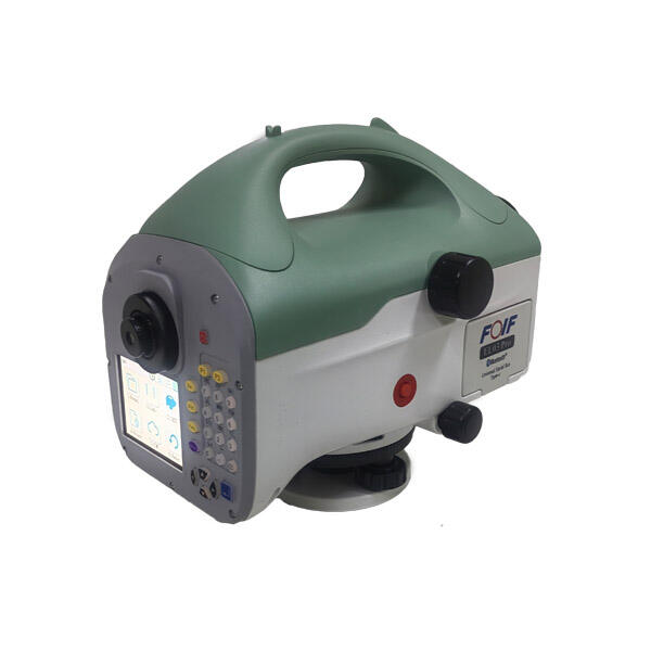
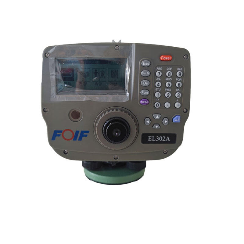
Digital level survey equipment represents a significant advancement in modern surveying technology, combining precision measurement capabilities with digital processing power. This sophisticated instrument utilizes electronic sensors and digital displays to provide highly accurate elevation measurements and height differences between points. At its core, the digital level features an electronic reading system that automatically captures and processes measurements through a specialized bar-coded staff, eliminating manual reading errors common in traditional optical levels. The equipment incorporates advanced image processing technology to analyze the coded staff patterns, delivering measurements with sub-millimeter accuracy. Built-in data storage capabilities allow surveyors to record thousands of measurements, while integrated software facilitates immediate data processing and analysis in the field. The system typically includes features such as automatic compensation for slight misalignments, built-in temperature sensors for environmental corrections, and various measurement modes for different applications. These instruments find extensive use in construction projects, topographic surveys, monitoring structural deformation, and precise leveling operations. The digital level's ability to perform rapid, accurate measurements while maintaining digital records has made it an indispensable tool in modern surveying operations.

New Product Releases

Digital level survey equipment offers numerous practical benefits that significantly enhance surveying operations. First and foremost, the automation of measurement readings dramatically reduces human error and increases overall accuracy. Surveyors can obtain precise measurements quickly and reliably, without the need for manual interpretation of graduated scales. The digital display provides clear, unambiguous readings that eliminate the confusion often associated with traditional optical instruments. Data management becomes remarkably more efficient as measurements are automatically stored in the instrument's memory, eliminating the need for manual recording and reducing the potential for transcription errors. The ability to transfer data directly to computers streamlines the entire workflow, saving considerable time in post-processing and report generation. The equipment's built-in error checking and compensation systems ensure consistency and reliability in measurements, even in challenging environmental conditions. The automatic calculation of height differences and elevations reduces the computational burden on surveyors, allowing them to focus on other critical aspects of their work. These instruments often feature user-friendly interfaces that make them accessible to operators with varying levels of experience, reducing training time and improving productivity. The digital level's capacity for rapid data collection and processing makes it particularly valuable in large-scale projects where time efficiency is crucial. Additionally, the equipment's ability to maintain digital records provides excellent documentation for quality control and project verification purposes.

Tips And Tricks

Auto Level vs. Digital Level: Choosing the Right Tool

21

Mar

Auto Level vs. Digital Level: Choosing the Right Tool

View More
What are the key differences between GNSS RTK and PPP?

25

Mar

What are the key differences between GNSS RTK and PPP?

View More
What are the common error sources and solutions when using RTK GNSS?

22

Apr

What are the common error sources and solutions when using RTK GNSS?

View More
How to Choose a Total Station Suitable for Engineering Needs?

22

Apr

How to Choose a Total Station Suitable for Engineering Needs?

View More

Get a Free Quote

Our representative will contact you soon.
Email
Name
Company Name
Message
0/1000

digital level survey equipment

Advanced Digital Processing Technology

Advanced Digital Processing Technology

The digital level survey equipment's advanced processing technology represents a quantum leap in surveying capability. At its heart lies a sophisticated electronic system that combines high-resolution imaging sensors with powerful processing algorithms. This technology enables the instrument to read specialized bar-coded staffs with exceptional precision, achieving accuracy levels of up to 0.3mm per kilometer of double-run leveling. The system employs advanced image recognition algorithms that can analyze multiple code segments simultaneously, ensuring reliable readings even in challenging lighting conditions. The processing unit automatically compensates for various environmental factors, including temperature fluctuations and slight misalignments, maintaining accuracy across diverse operating conditions. This technological sophistication eliminates the subjective element in measurements, ensuring consistent results regardless of operator experience level.
Comprehensive Data Management System

Comprehensive Data Management System

The integrated data management system in digital level survey equipment revolutionizes how surveying data is handled and processed. The system features robust internal storage capable of holding thousands of measurements, complete with point IDs, time stamps, and coordinate information. Real-time data processing capabilities allow immediate calculation of height differences, elevations, and standard deviations, providing instant feedback on measurement quality. The equipment supports various data export formats compatible with major surveying software packages, enabling seamless integration into existing workflow systems. Advanced data filtering and analysis tools built into the system help identify potential errors or inconsistencies, ensuring data integrity throughout the surveying process.
Enhanced Operational Efficiency

Enhanced Operational Efficiency

The operational efficiency achieved through digital level survey equipment transforms traditional surveying practices. The system's automatic reading and recording capabilities dramatically reduce the time required for each measurement, allowing surveyors to complete projects up to 50% faster than with conventional methods. The elimination of manual reading and recording processes not only saves time but also significantly reduces the physical strain on operators during extended survey sessions. The equipment's intuitive interface and guided workflow system minimize the learning curve for new users while providing advanced features for experienced surveyors. Built-in quality control measures, such as automatic tilt compensation and measurement verification, ensure reliable results while maintaining high productivity levels. This efficiency extends to the entire project lifecycle, from initial setup to final data export and analysis.