
UNIQUENAV Unveils U20, A Breakthrough Portable Multi-Functional GNSS RTK System with Integrated AR and Laser Measurement Capabilities
UNIQUENAV, an industry-leader in positioning and surveying technologies, recently unveiled its newest offering - the UNIQUENAV U20 multi-functional GNSS RTK receiver designed to set new benchmarks in precise surveying, construction stakeout and geospatial data collection. Equipped with advanced RTK, AR visualization and laser measurement features, the U20 provides unparalleled performance for professionals working across engineering, geodesy, construction and GIS applications.
Next-Generation GNSS RTK Technology The UNIQUENAV U20 features an inbuilt high-precision GNSS positioning module capable of real-time tracking of satellite signals from all major GNSS constellations - GPS (United States), GLONASS (Russia), Galileo (European Union), and BeiDou (China) across all frequency bands for complete global coverage and reliable reception even in challenging environments like urban canyons, forested areas or rural sites.
The UNIQUENAV U20 features Real-Time Kinematic (RTK) positioning technology that delivers centimeter-level accuracy for RTK GPS surveying, precision agriculture, machine control, infrastructure monitoring and more. The receiver works seamlessly with both network-based RTK corrections (via its 4G modem) and traditional base station setups to offer flexible deployment options depending on project requirements.
Modern Surveying Needs an All-in-One Connectivity Solution
Modern survey work demands fast data exchange and reliable communications, making an all-in-one connectivity architecture essential. The U20 provides just that solution by including:
4G Full Network Access -- Compatible with multiple carriers for seamless RTK correction services access. Bluetooth & Wi-Fi -- For effortless pairing between field controllers, tablets and mobile devices.
Built-In Data Transmission Radio -- For traditional base-rover RTK setups without external modules.
This combination allows survey teams to configure the U20 as both an RTK base station and GNSS RTK rover easily - whether for urban projects or more remote rural settings.

Beyond Traditional RTK Functions, the UNIQUENAV U20 Features an Advanced Inertial Measurement Unit with Automatic Tilt Compensation for Smart Measuring
Additionally to standard GNSS RTK features, this innovative unit also integrates an Inertial Measurement Unit (IMU) featuring automatic tilt compensation that allows swift data acquisition without compromising precision.
But UNIQUENAV takes it further: the U20's IMU is integrated seamlessly with Augmented Reality (AR) and Laser measurement functions to open up new possibilities in surveying workflows:
Tilt Measurement -- Allows accurate measurement even when the pole is tilted, increasing efficiency when working in uneven terrain or difficult locations.
Laser Measurement -- Accurately measure distances to points without physically reaching them -- perfect for inaccessible objects and targets.
AR Real-Time Stakeout -- Utilize Augmented Reality technology to visualize target positions in real-world camera view and guide operators quickly and intuitively towards stakeout points.
Measurement time and labor costs are significantly reduced thanks to these capabilities, especially on complex construction sites or hazardous environments.
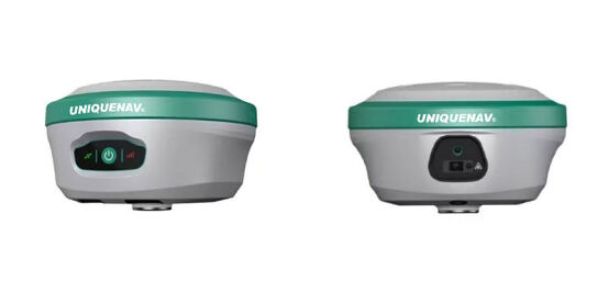
Survey professionals often encounter extreme environments - heat, rain, dust, or vibration from nearby machinery - when conducting their survey work. With that in mind, the UNIQUENAV U20 has been designed with field durability in mind: its IP67 waterproof casing ensures long-term reliability in field settings.
Rugged field-ready casing with IP ratings for dust and water resistance for increased dust protection and water resistance. Long-lasting battery for extended field operations.
Lightweight and portable design makes it easily transportable between sites, making it suitable for GNSS RTK laser construction projects, GIS field mapping projects, transport infrastructure surveying tasks and land development planning needs.
Application Scenarios
Construction and Engineering Showcasing its RTK GNSS capability paired with laser stakeout capabilities, the U20 is ideal for urban development, road construction or rail projects, providing accurate marking of design points directly in the field with AR guidance - thus eliminating errors and shortening project timelines.
Land Surveying & Cadastre Cadasters rely on GPS GNSS RTK technology to record precise parcel boundaries and topographic features in rugged terrains. Tilt compensation makes measurements even quicker.
Utility companies can utilize GNSS RTK GPS receivers to locate underground infrastructure, mark pipeline routes and integrate spatial data into geographic information systems (GIS).
Agriculture & Machine Guidance
Thanks to differential GPS/RTK integration, large farms can implement automated planting, fertilizing and harvesting machinery with centimeter accuracy for improved yield efficiency.
Differential GPS Meets Modern Connectivity
The U20 utilizes differential positioning techniques to deliver consistent accuracy even in environments of high interference or multipath propagation. By incorporating both GNSS and GPS RTK technology in a single compact device, equipment complexity is reduced while data integrity remains secure across surveying applications.
Market Position and Significance
The release of the UNIQUENAV U20 signifies their strategic commitment to providing portable yet professional grade RTK GNSS survey equipment that fits industry trends of mobility, integration and digitalization. By unifying RTK surveying instruments with IMU tilt technology, AR stakeout and Laser measurement into an all-in-one field system UNIQUENAV has redefined what surveyors expect from modern receivers.
The company anticipates strong adoption among:
Independent survey contractors looking for an all-in-one GPS/GNSS receiver. Construction firms requiring fast and dependable stakeout tools. GIS professionals requiring seamless integration between positional data and spatial analysis software.
Conclusion: A New Era in GNSS RTK Surveying
With the UNIQUENAV U20, surveyors, engineers and GIS professionals now have access to cutting-edge GNSS RTK technology embodied in a compact multifunctional tool that integrates RTK GPS accuracy, Laser measurement convenience and AR visual guidance - offering faster workflows, increased precision and safer operations.
UNIQUENAV's innovation addresses a growing demand for versatile survey equipment that can withstand diverse conditions while offering advanced capabilities necessary for today's complex projects. As industries embrace digital transformation in their fields, the UNIQUENAV U20 positions itself as the premier solution for GNSS RTK GPS surveying instruments for 2024 and beyond.
About UniqueNAV
UniqueNAV offers advanced GNSS technology, positioning systems and surveying solutions for professional use around the world. Their portfolio features GNSS receivers, RTK base stations, GPS GNSS RTK survey equipment as well as measurement technologies that give industries access to precise spatial intelligence.
Media Contact Information for UniqueNAV:
[Name],Victor FU
[Title], General manager
[Email], [email protected]
[Phone] and [Website]. Phone: +86-18202266529
Website: www.uniquenav.com