The Evolution of High-Precision Positioning Technology
GNSS RTK accuracy has revolutionized the way we approach precise positioning and navigation. This sophisticated technology represents a significant leap forward from traditional GPS systems, offering centimeter-level accuracy that has transformed industries from surveying to precision agriculture. Real-Time Kinematic (RTK) positioning has become the gold standard for applications requiring high-precision measurements, consistently delivering results that were once thought impossible with satellite-based systems.
The implementation of GNSS RTK technology marks a turning point in positioning capabilities, enabling professionals to achieve unprecedented levels of accuracy in real-time. As we delve deeper into this technology, we'll explore how GNSS RTK accuracy is achieved and the various factors that influence its performance in real-world applications.
Core Components of GNSS RTK Systems
Base Station Infrastructure
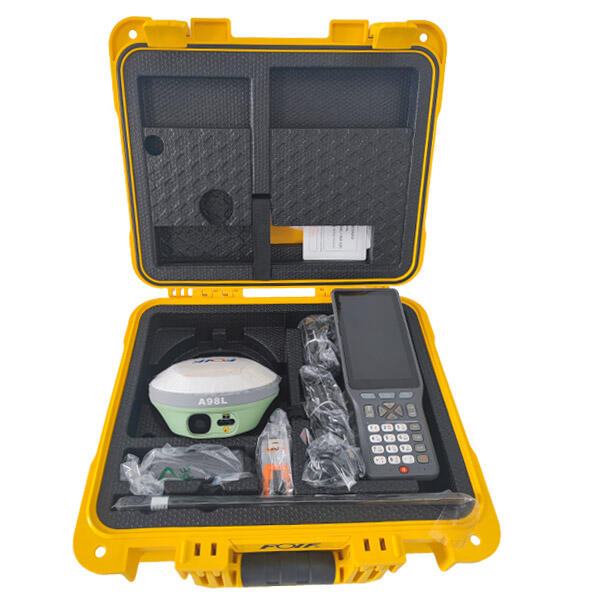
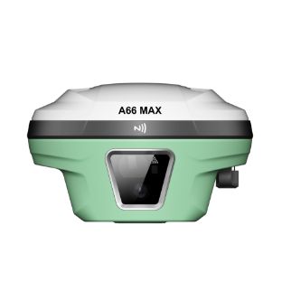
The foundation of GNSS RTK accuracy lies in its base station infrastructure. These fixed reference stations are precisely positioned and continuously receive satellite signals, serving as the benchmark for all RTK measurements. The base station tracks the same satellites as the rover unit and calculates corrections based on its known position.
Modern base stations are equipped with advanced receivers capable of tracking multiple satellite constellations, including GPS, GLONASS, Galileo, and BeiDou. This multi-constellation capability significantly enhances the reliability and accuracy of RTK solutions, providing redundancy and improved satellite geometry.
Rover Units and Communication Links
Rover units represent the mobile component of RTK systems, receiving both satellite signals and correction data from the base station. The quality of the rover's receiver and antenna plays a crucial role in GNSS RTK accuracy. High-end rovers feature sophisticated algorithms that process correction data in real-time, enabling precise positioning even in challenging environments.
The communication link between base and rover is equally important, typically utilizing radio modems or cellular networks to transmit correction data. The stability and latency of this communication channel directly impact the system's ability to maintain centimeter-level accuracy.
Factors Influencing GNSS RTK Performance
Atmospheric Conditions
The Earth's atmosphere significantly affects GNSS RTK accuracy through various mechanisms. The ionosphere, extending from about 60 to 1000 kilometers above Earth's surface, can cause signal delays and scintillation effects. These atmospheric disturbances can degrade positioning accuracy, particularly during periods of high solar activity.
The troposphere, the lowest layer of Earth's atmosphere, also impacts signal propagation through temperature, pressure, and humidity variations. Modern RTK systems employ sophisticated atmospheric modeling to compensate for these effects, but extreme weather conditions can still pose challenges to achieving optimal accuracy.
Satellite Geometry and Visibility
The number and geometric distribution of visible satellites play a crucial role in GNSS RTK accuracy. Optimal positioning requires a minimum of five satellites, though more satellites generally result in better accuracy. The geometric arrangement of satellites, measured by the Dilution of Precision (DOP), directly influences the quality of position solutions.
Urban environments, dense vegetation, and mountainous terrain can limit satellite visibility and create multipath effects, where signals reflect off surfaces before reaching the receiver. These challenges require careful planning and sometimes the deployment of additional base stations to maintain consistent accuracy.
Achieving Optimal GNSS RTK Performance
Site Calibration and Setup
Proper site calibration is essential for maximizing GNSS RTK accuracy. This process involves establishing control points and performing initialization measurements to ensure the system is properly aligned with local coordinate systems. Careful attention to base station placement and antenna height measurements helps minimize systematic errors.
Professional surveyors and engineers often conduct site-specific calibrations before beginning critical measurements, accounting for local conditions and potential sources of interference. This preliminary work is crucial for achieving and maintaining the highest possible accuracy levels.
Maintenance and Quality Control
Regular system maintenance and quality control procedures are vital for consistent GNSS RTK accuracy. This includes periodic verification of base station coordinates, monitoring communication link quality, and validating rover performance through check measurements.
Modern RTK systems include built-in quality indicators and integrity monitoring features that help users identify potential issues before they impact measurement accuracy. Regular firmware updates ensure the system benefits from the latest algorithmic improvements and bug fixes.
Future Developments in RTK Technology
Advanced Signal Processing
The future of GNSS RTK accuracy looks promising with ongoing developments in signal processing technology. Machine learning algorithms are being integrated into RTK solutions, enabling better multipath mitigation and improved performance in challenging environments. These advances will make high-precision positioning more robust and reliable across a broader range of applications.
New signal frequencies and modernized satellite constellations will provide additional opportunities for enhancing RTK performance. The integration of multiple GNSS systems and frequencies will lead to improved accuracy and reliability, particularly in difficult operating conditions.
Network RTK Innovations
Network RTK solutions are evolving to provide wider coverage and more reliable service. Advanced network algorithms and improved communication protocols are reducing the impact of distance-dependent errors and enabling seamless operation across larger geographic areas.
The integration of RTK with other positioning technologies, such as inertial navigation systems and visual odometry, is creating more robust hybrid solutions that maintain accuracy even during temporary GNSS signal outages.
Frequently Asked Questions
What is the typical accuracy level achievable with GNSS RTK?
Under optimal conditions, GNSS RTK systems can achieve horizontal accuracy of 1-2 centimeters and vertical accuracy of 2-3 centimeters. This level of accuracy requires good satellite visibility, stable communication links, and proper system setup and calibration.
How does baseline length affect RTK accuracy?
The distance between the base station and rover (baseline length) can impact GNSS RTK accuracy. Generally, accuracy decreases as the baseline length increases, with optimal performance typically achieved within 10-20 kilometers of the base station. Network RTK solutions can help maintain accuracy over longer distances.
What is the minimum satellite count needed for reliable RTK positioning?
While RTK positioning requires a minimum of five satellites for initialization, optimal performance typically requires 7-8 or more satellites. The actual number needed may vary depending on satellite geometry, signal quality, and environmental conditions.