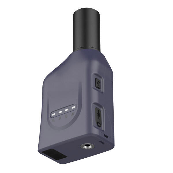
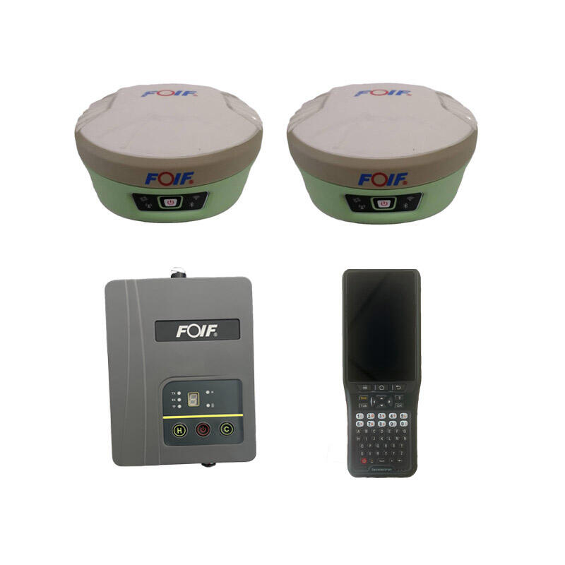
RTK Base and Rover System: Precision Positioning Solutions for Professional Applications

All Categories

rtk base and rover

RTK base and rover systems represent a significant advancement in precision positioning technology, combining high-accuracy GPS receivers with real-time correction capabilities. The system consists of two main components: a stationary base station positioned at a known location and a mobile rover unit. The base station continuously tracks GPS signals and calculates corrections based on its known position, while the rover receives both GPS signals and correction data from the base station. This setup enables real-time positioning with centimeter-level accuracy, far surpassing traditional GPS systems. The technology utilizes sophisticated algorithms to process carrier phase measurements and eliminate common GPS errors, including atmospheric delays, satellite orbit errors, and clock biases. Modern RTK systems often incorporate multiple satellite constellations (GPS, GLONASS, Galileo, BeiDou) to enhance reliability and accuracy. The communication between base and rover typically occurs through radio links or cellular networks, allowing for seamless data transmission. These systems find extensive applications in precision agriculture, construction surveying, GIS mapping, and autonomous vehicle navigation, where high-precision positioning is crucial for operational success.

New Product Releases

RTK base and rover systems offer numerous compelling advantages that make them indispensable for modern precision applications. First, they provide unmatched accuracy down to centimeter level, enabling precise measurements and positioning in real-time. This immediate access to highly accurate position data dramatically improves workflow efficiency, eliminating the need for post-processing in most applications. The systems demonstrate remarkable reliability in various environmental conditions, maintaining accuracy even in challenging terrain or urban environments. The versatility of RTK technology allows for seamless integration with various software platforms and equipment, making it adaptable to different industry needs. The ability to work with multiple satellite constellations significantly improves availability and reliability, reducing downtime due to poor satellite coverage. Modern RTK systems feature user-friendly interfaces that simplify operation, requiring minimal training for effective use. The technology's real-time capabilities enable immediate decision-making and on-the-fly adjustments, improving project efficiency and reducing costly errors. The systems also offer cost-effective solutions for high-precision positioning, providing substantial return on investment through increased productivity and accuracy. Additionally, many RTK systems now include advanced features such as tilt compensation, multi-frequency reception, and automatic calibration, further enhancing their utility across various applications.

Tips And Tricks

What Are the Benefits of Using an Android Total Station?

21

Mar

What Are the Benefits of Using an Android Total Station?

View More
How to choose the right RTK GNSS equipment?

22

Apr

How to choose the right RTK GNSS equipment?

View More
How to Choose a Total Station Suitable for Engineering Needs?

22

Apr

How to Choose a Total Station Suitable for Engineering Needs?

View More
Laser RTK vs GNSS: Which One Is Better?

22

Apr

Laser RTK vs GNSS: Which One Is Better?

View More

Get a Free Quote

Our representative will contact you soon.
Email
Name
Company Name
Message
0/1000

rtk base and rover

Superior Positioning Accuracy

Superior Positioning Accuracy

The RTK base and rover system's primary strength lies in its ability to achieve centimeter-level positioning accuracy in real-time. This exceptional precision is achieved through sophisticated carrier phase measurements and real-time correction algorithms. The base station, positioned at a known location, continuously monitors satellite signals and calculates correction factors for various error sources, including atmospheric delays, satellite orbit errors, and clock biases. These corrections are transmitted to the rover in real-time, allowing it to achieve positioning accuracies of 1-2 centimeters horizontally and 2-3 centimeters vertically. This level of precision is maintained consistently across operations, making it ideal for applications requiring high accuracy, such as precision agriculture, construction layout, and detailed surveying work.
Advanced Multi-Constellation Support

Advanced Multi-Constellation Support

Modern RTK base and rover systems are equipped with advanced multi-constellation support, enabling them to receive and process signals from multiple global navigation satellite systems simultaneously. This capability includes tracking signals from GPS, GLONASS, Galileo, and BeiDou constellations, providing access to over 100 satellites. The multi-constellation support significantly improves system reliability by ensuring continuous operation even when individual satellite signals are blocked or degraded. This feature is particularly valuable in challenging environments such as urban canyons or areas with partial sky visibility, where traditional single-constellation systems might struggle to maintain accuracy.
Versatile Communication Options

Versatile Communication Options

The RTK base and rover system offers flexible communication options to suit various operational requirements. Users can choose between radio transmission for direct base-to-rover communication or network RTK solutions utilizing cellular networks. Radio communication provides excellent reliability in remote areas without cellular coverage, while network RTK offers extended range capabilities and eliminates the need for a dedicated base station setup. The system supports multiple communication protocols and can seamlessly switch between different modes as needed. This versatility ensures optimal performance across different working environments and project requirements, making the system adaptable to changing operational needs.