GPS RTK Precision: Advanced Satellite Positioning Technology for Centimeter-Level Accuracy

All Categories

gps rtk precision

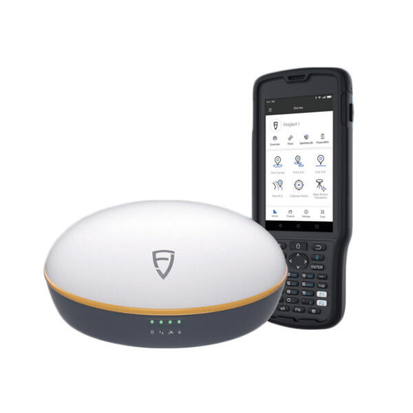
GPS RTK (Real-Time Kinematic) precision represents a significant advancement in satellite positioning technology, offering centimeter-level accuracy for various applications. This sophisticated system enhances standard GPS functionality by utilizing a network of fixed ground-based reference stations that transmit correction data to mobile receivers in real-time. The technology works by comparing signals from GPS satellites with known fixed positions, enabling the system to eliminate common sources of error such as atmospheric interference, satellite orbit errors, and clock discrepancies. Operating on both L1 and L2 GPS frequencies, RTK systems process carrier phase measurements along with standard GPS code measurements to achieve remarkable precision. The system typically consists of a base station that remains stationary at a known point and one or more rover units that can move freely while maintaining high-precision positioning. Modern GPS RTK systems can achieve horizontal accuracies of 1-2 centimeters and vertical accuracies of 2-3 centimeters under optimal conditions, making them invaluable for applications requiring precise positioning and navigation.
New Product Releases

GPS RTK precision offers numerous compelling advantages that make it an essential tool across multiple industries and applications. The primary benefit is its ability to provide real-time centimeter-level accuracy, which represents a significant improvement over traditional GPS systems. This enhanced precision enables users to perform highly accurate measurements and positioning tasks without the need for post-processing, saving valuable time and resources. The technology's ability to deliver instant results makes it particularly valuable for time-sensitive applications such as construction projects, precision agriculture, and surveying work. Another significant advantage is the system's reliability and consistency in maintaining accuracy across different environmental conditions. The RTK technology's sophisticated error correction mechanisms ensure stable performance even in challenging environments, such as urban areas with potential signal interference. The system's versatility allows for seamless integration with various devices and software platforms, making it adaptable to different operational requirements. Additionally, modern GPS RTK systems feature user-friendly interfaces and automated processes that reduce the learning curve and operational complexity, enabling even non-technical users to achieve professional-grade results. The technology's cost-effectiveness becomes apparent when considering the reduction in labor hours and the elimination of costly measurement errors that could lead to expensive corrections or rework.

Practical Tips

What Are the Benefits of Using an Android Total Station?

21

Mar

What Are the Benefits of Using an Android Total Station?

View More
What are the key differences between GNSS RTK and PPP?

25

Mar

What are the key differences between GNSS RTK and PPP?

View More
How to Choose a Total Station Suitable for Engineering Needs?

22

Apr

How to Choose a Total Station Suitable for Engineering Needs?

View More
Applicable Scenarios and Selection Tips for Different Types of Total Stations

22

Apr

Applicable Scenarios and Selection Tips for Different Types of Total Stations

View More

Get a Free Quote

Our representative will contact you soon.
Email
Name
Company Name
Message
0/1000

gps rtk precision

Unmatched Precision and Accuracy

Unmatched Precision and Accuracy

GPS RTK precision sets itself apart with its ability to deliver centimeter-level accuracy in real-time positioning. This exceptional level of precision is achieved through sophisticated algorithms that process carrier phase measurements from multiple satellite signals simultaneously. The system continuously monitors and adjusts for various error sources, including atmospheric delays, multipath effects, and satellite clock errors. This real-time correction capability ensures that users receive highly accurate position data without the need for post-processing or additional calculations. The technology's ability to maintain such high precision levels makes it particularly valuable for applications where even small positioning errors could have significant consequences, such as in precision agriculture, construction layout, and machine control systems.
Advanced Error Correction and Reliability

Advanced Error Correction and Reliability

The GPS RTK system employs advanced error correction mechanisms that significantly enhance its reliability and consistency. By utilizing a network of fixed reference stations, the technology can effectively eliminate or minimize common sources of GPS errors. The system's ability to process both code and carrier phase measurements allows it to achieve superior accuracy compared to standard GPS solutions. The continuous monitoring and correction of atmospheric effects, satellite orbit errors, and other potential sources of inaccuracy ensure that users can rely on consistent, high-quality positioning data. This robust error correction capability makes GPS RTK particularly effective in challenging environments where traditional GPS systems might struggle to maintain accuracy.
Versatile Integration and Applications

Versatile Integration and Applications

One of the most significant advantages of GPS RTK precision is its versatility and adaptability across different applications and industries. The technology can be seamlessly integrated with various devices and software platforms, making it highly flexible for different operational requirements. From surveying and mapping to precision agriculture and construction, GPS RTK systems can be customized to meet specific industry needs. The technology's compatibility with modern data collection and management systems allows for efficient workflow integration and improved productivity. Additionally, the system's ability to provide real-time results enables immediate decision-making and rapid response to changing conditions, making it an invaluable tool for time-sensitive applications.