GNSS RTK GPS: Professional-Grade Positioning with Centimeter-Level Accuracy

All Categories

gnss rtk gps

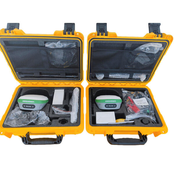
GNSS RTK GPS (Global Navigation Satellite System Real-Time Kinematic Global Positioning System) represents a cutting-edge advancement in precision positioning technology. This sophisticated system enhances standard GPS capabilities by utilizing real-time corrections to achieve centimeter-level accuracy. The system works by employing two receivers: a base station at a known location and a rover unit that moves with the user. The base station transmits correction data to the rover, allowing it to calculate its position with exceptional precision. What sets GNSS RTK GPS apart is its ability to process signals from multiple satellite constellations including GPS, GLONASS, Galileo, and BeiDou, significantly improving accuracy and reliability. The system continuously processes carrier phase measurements and corrects various errors caused by atmospheric conditions, satellite orbit inaccuracies, and other environmental factors. This technology has revolutionized numerous industries, from precision agriculture and construction to land surveying and mapping. The system provides real-time positioning updates at rates up to 20Hz, making it ideal for dynamic applications requiring immediate, accurate position information.

Popular Products

The GNSS RTK GPS system offers numerous compelling advantages that make it an invaluable tool across various applications. First and foremost, its centimeter-level accuracy sets it apart from conventional GPS systems, enabling precise measurements and positioning that were previously impossible without extensive equipment and time investment. This high accuracy is achieved in real-time, eliminating the need for post-processing and allowing immediate decision-making in the field. The system's ability to work with multiple satellite constellations significantly improves its reliability and availability, ensuring consistent performance even in challenging environments with partial sky visibility. Cost-effectiveness is another major advantage, as RTK systems have become increasingly affordable while maintaining professional-grade accuracy. The technology's versatility allows it to be integrated into various devices and machinery, from handheld surveying equipment to autonomous vehicles and agricultural machinery. The system's rapid initialization time means users can begin work quickly, while its robust error-checking mechanisms ensure reliable results. Additionally, modern GNSS RTK GPS systems often include user-friendly interfaces and wireless connectivity options, making them accessible to users with varying levels of technical expertise. The technology's ability to operate in almost any weather condition and its low power consumption make it practical for long-term field operations. These systems also support remote monitoring and data collection, enabling efficient project management and quality control across large areas.

Tips And Tricks

What Are the Benefits of Using an Android Total Station?

21

Mar

What Are the Benefits of Using an Android Total Station?

View More
Auto Level vs. Digital Level: Choosing the Right Tool

21

Mar

Auto Level vs. Digital Level: Choosing the Right Tool

View More
What are the key differences between GNSS RTK and PPP?

25

Mar

What are the key differences between GNSS RTK and PPP?

View More
How to Choose a Total Station Suitable for Engineering Needs?

22

Apr

How to Choose a Total Station Suitable for Engineering Needs?

View More

Get a Free Quote

Our representative will contact you soon.
Email
Name
Company Name
Message
0/1000

gnss rtk gps

Advanced Multi-Constellation Support

Advanced Multi-Constellation Support

The GNSS RTK GPS system's multi-constellation support represents a significant advancement in positioning technology. By simultaneously tracking signals from multiple satellite systems including GPS, GLONASS, Galileo, and BeiDou, the system dramatically improves position availability and accuracy. This feature is particularly valuable in challenging environments where traditional single-constellation systems might struggle, such as urban canyons or areas with partial sky visibility. The ability to process signals from multiple constellations also enhances the system's reliability by providing redundancy and cross-validation of position solutions. This robust capability ensures consistent performance even if one satellite system experiences issues or maintenance downtime.
Real-Time Centimeter Precision

Real-Time Centimeter Precision

The real-time centimeter-level precision capability of GNSS RTK GPS systems represents a revolutionary advancement in positioning technology. This feature enables users to achieve accuracies of up to 1-2 centimeters horizontally and 2-3 centimeters vertically in real-time, without any post-processing requirements. This level of precision is made possible through sophisticated algorithms that process carrier phase measurements and apply real-time corrections from the base station. The immediate availability of such precise positioning data transforms workflows across industries, enabling instant decision-making and reducing project completion times significantly.
Versatile Integration Capabilities

Versatile Integration Capabilities

The GNSS RTK GPS system's integration capabilities make it exceptionally versatile across different applications and industries. The technology can be seamlessly incorporated into various devices and machinery, from surveying equipment to autonomous vehicles and precision farming implements. Modern RTK systems often feature standard communication protocols and interfaces, allowing easy integration with existing software and hardware systems. This adaptability extends to data formats and output options, enabling users to collect and process information in ways that best suit their specific needs. The system's ability to integrate with cloud services and mobile devices further enhances its utility in modern workflows.