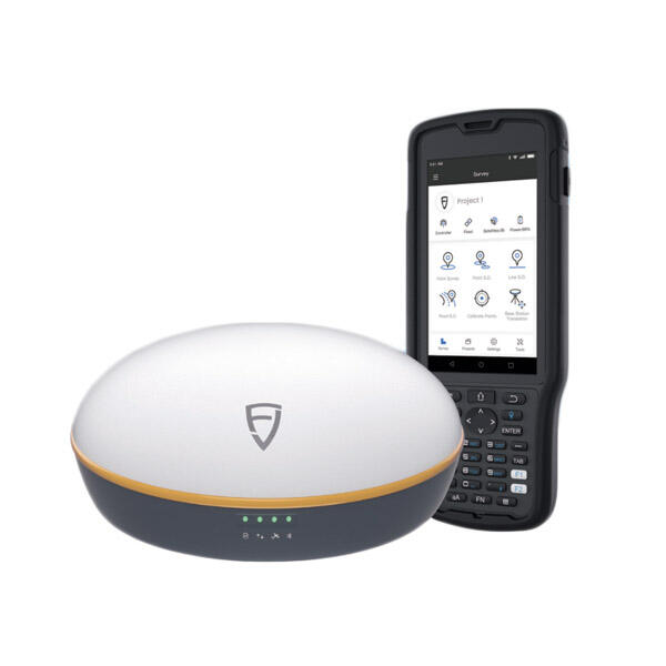
Understanding GNSS Receiver Requirements for Surveying
For anyone involved in survey work, knowing what makes a good GNSS receiver isn't just helpful it's pretty much mandatory nowadays. The tech world keeps changing so fast that even seasoned pros need to stay updated on what actually works in the field. When we talk about accuracy and precision, these aren't just buzzwords they matter a lot in real world scenarios. Think about construction sites where millimeter differences can mean thousands in costs, property boundaries that determine legal ownership, or emergency response teams mapping out flood zones during disasters. Getting the right equipment specs right matters more than most people realize.
Accuracy and Precision Needs in Surveying
Getting accurate readings when doing surveys matters a lot. When measurements are spot on, buildings go up straight, property values make sense, and disaster response teams can actually do their jobs without confusion. Most folks work with standards down to the tenth of a meter, sometimes even centimeters or millimeters depending on what they're looking at. For basic land plots and real estate stuff, getting within about a meter usually works fine. But when it comes to actual construction projects, contractors typically want those measurements nailed down to the centimeter level because there's simply no room for error in building foundations or roadways.
Regulatory bodies, including the American Society of Civil Engineers (ASCE), emphasize the importance of high accuracy in surveying to avoid errors and maintain project integrity. Such guidelines highlight investing in high-quality GNSS receivers capable of delivering precise data.
Durability for Challenging Field Conditions
Surveyors face environmental challenges like extreme weather, rough terrains, and water exposure, demanding durable GNSS receivers. Ruggedized receivers are designed for these conditions with features like robust IP ratings and shock absorption capabilities, ensuring reliable operation in adverse environments.
With testimonials from professionals citing frequent equipment failures under harsh conditions, rugged designs are critical for maintaining efficiency and success in surveying operations. Whether facing harsh weather or difficult terrains, reliable equipment can significantly impact surveying efficiency.
Critical Technical Specifications to Evaluate
Multi-Frequency Support and Signal Reliability
Multi-frequency support is crucial for enhancing signal reliability and minimizing errors. GNSS receivers accessing multiple frequencies mitigate multipath effects and ionospheric delays, providing accurate positioning. This capability is vital for urban areas with obstructed signals, compared to rural settings with clear signal access, ensuring reliable data collection.
RTK Compatibility for Centimeter-Level Accuracy
Real-Time Kinematic (RTK) positioning offers centimeter-level accuracy, proving invaluable for surveying precision. Compatibility with RTK systems allows operation efficiency even with environmental limitations. GNSS receivers equipped with RTK drastically improve accuracy essential for projects where precision is non-negotiable, overcoming challenges like variable signal strength.
Satellite Constellation and Correction Service Compatibility
Global Navigation Systems (GPS, GLONASS, Galileo, BeiDou)
Understanding global navigation systems is important for optimizing GNSS technology. GPS, GLONASS, Galileo, and BeiDou each provide unique advantages and accessing multiple constellations increases satellite availability, leading to enhanced positioning accuracy. Multi-constellation GNSS receivers improve accuracy in difficult environments.
Role of Real-Time Correction Services
Real-time correction services enhance GNSS precision by correcting satellite signal errors in real time. Differential GNSS (DGNSS) and Networked Transport of RTCM via Internet Protocol (NTRIP) provide corrections, significantly improving accuracy despite geographical challenges. Service quality depends on infrastructure, posing limitations in remote areas.
Integration with Surveying Workflows
Software Compatibility and Data Formats
Software compatibility impacts GNSS receiver effectiveness in surveying workflows. Integration with surveying software ensures smooth operations and data management. Formats like DXF and GIS are crucial for accurate data sharing, enabling flexibility for processing and analysis. Software like AutoCAD and ArcGIS accommodate diverse data for precise analysis.
Field-to-Office Data Transfer Efficiency
Efficient field-to-office data transfer optimizes operations significantly. Mobile apps and cloud storage solutions enable swift data movement from sites, enhancing productivity. Tools expedite transfer, although connectivity issues in remote areas can impact efficiency. Research shows streamlined processes save significant time compared to traditional methods.
Top GNSS Receiver Brands for Surveyors
Industry-Leading Manufacturers
The GNSS receiver market is populated with reliable brands known for innovation. These manufacturers offer exceptional GNSS solutions. It's recommended to evaluate based on reliability and innovation rather than specific brand advantages.
Cost vs. Performance Considerations
Surveyors evaluate cost-performance relationships to find suitable GNSS receivers. Higher-priced models often offer superior features like advanced satellite tracking and integration with correction services, providing unmatched precision. Budget-friendly options allow surveyors to maintain essential functionalities at a lower cost, catering to different needs.

Future-Proofing Your GNSS Investment
Adapting to Emerging Satellite Technologies
Surveyors should consider emerging satellite technologies' impact on GNSS operations. Evolving constellations like Galileo and BeiDou enhance accuracy and reliability, necessitating equipment updates. Investing in receivers compatible with multiple constellations ensures longevity and operational efficiency.
Firmware Updates and Upgrade Options
Firmware updates maintain GNSS receiver performance, enhancing accuracy and processing speed. Hardware upgrades optimize capabilities, ensuring GNSS systems remain current with technological developments. Regular updates prevent obsolescence, allowing surveyors to benefit from advancements.
FAQ
Why is accuracy important in surveying?
Accuracy ensures structures are built correctly and properties are appropriately valued, affecting construction, real estate and relief efforts.
How does multi-frequency support improve GNSS receiver reliability?
Multi-frequency support mitigates multipath effects and ionospheric delays, resulting in more accurate positioning, especially in areas prone to signal obstructions.
What are the real-time correction services available for GNSS receivers?
Real-time services include Differential GNSS (DGNSS) and Networked Transport of RTCM via Internet Protocol (NTRIP), providing satellite corrections to enhance accuracy.

