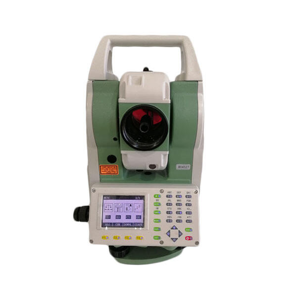
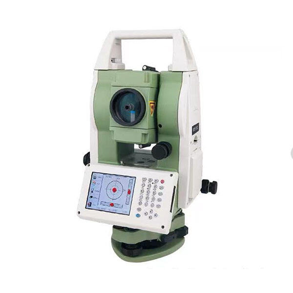
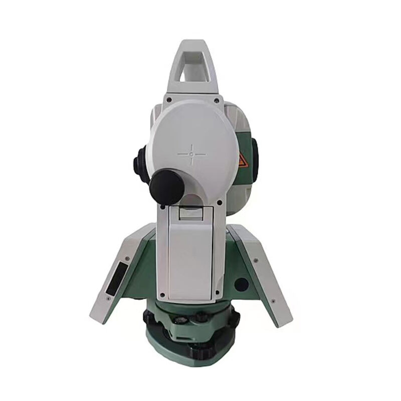
Total Station: Advanced Surveying Technology for Precision Measurements and Data Management

All Categories

total station

A total station is an advanced surveying instrument that combines electronic distance measurement, angle measurement, and digital data processing capabilities into a single, sophisticated device. This precision instrument revolutionizes modern surveying by integrating electronic theodolite functionality with electronic distance measurement technology. It can measure horizontal and vertical angles, as well as slope distances, making it an indispensable tool for surveyors, engineers, and construction professionals. The device operates by emitting infrared signals that bounce off a target prism or reflective surface, calculating distances through phase shift measurement technology. Modern total stations feature onboard computers that can instantly process measurements, calculate coordinates, and store data for later use. These instruments typically include features such as automatic target recognition, remote control operation, and integration with GPS technology. They excel in applications ranging from topographic surveying and construction layout to building monitoring and 3D modeling. The total station's ability to perform complex calculations and provide real-time data has significantly improved the efficiency and accuracy of surveying work, reducing the time required for field operations while maintaining exceptional precision.

New Product Releases

The total station offers numerous compelling advantages that make it an essential tool for modern surveying and construction projects. First, its exceptional accuracy and precision capabilities allow measurements to be taken with millimeter-level accuracy, ensuring project requirements are met with the highest standards. The instrument's ability to combine multiple measurement functions eliminates the need for separate devices, streamlining the surveying process and reducing equipment costs. The digital data collection and storage capabilities prevent manual recording errors and enable seamless integration with computer-aided design software. The automated features, including automatic target recognition and remote operation, significantly reduce the number of personnel required for surveying tasks while increasing productivity. Weather resistance and durability ensure reliable performance in various environmental conditions, making it suitable for both indoor and outdoor applications. The instrument's versatility allows it to handle diverse projects, from simple distance measurements to complex 3D modeling tasks. Integration with modern technology, such as Bluetooth connectivity and cloud data storage, enables real-time data sharing and collaboration among team members. The total station's user-friendly interface and intuitive operation reduce training time and minimize operator errors. Its ability to work in low-light conditions and maintain accuracy over long distances expands the possible working hours and project scope. The instrument's data security features ensure measurement information remains protected and traceable throughout the project lifecycle.

Latest News

How to Set Up and Calibrate an Android Total Station?

21

Mar

How to Set Up and Calibrate an Android Total Station?

View More
What are the common error sources in GNSS RTK positioning and how to mitigate them?

21

Mar

What are the common error sources in GNSS RTK positioning and how to mitigate them?

View More
What are the key differences between GNSS RTK and PPP?

25

Mar

What are the key differences between GNSS RTK and PPP?

View More
Laser RTK vs GNSS: Which One Is Better?

22

Apr

Laser RTK vs GNSS: Which One Is Better?

View More

Get a Free Quote

Our representative will contact you soon.
Email
Name
Company Name
Message
0/1000

total station

Advanced Measurement Technology

Advanced Measurement Technology

The total station incorporates cutting-edge measurement technology that sets new standards in surveying precision and efficiency. At its core, the instrument utilizes advanced electronic distance measurement (EDM) technology, employing precise infrared signals to determine distances with unprecedented accuracy. The phase shift measurement system ensures reliable results even in challenging conditions, while the dual-axis compensator automatically corrects for slight misalignments, maintaining measurement accuracy. The instrument's ability to measure both angles and distances simultaneously significantly reduces the time required for data collection. The advanced optical system, featuring high-quality lenses and precise angular encoders, enables measurements accurate to within seconds of arc. This technology is complemented by sophisticated error-correction algorithms that account for atmospheric conditions, curvature, and refraction, ensuring consistently accurate results.
Intelligent Data Management

Intelligent Data Management

The total station's comprehensive data management system transforms raw measurements into actionable information. The onboard computer processes measurements in real-time, performing complex calculations and coordinate transformations instantly. Data storage capabilities allow for thousands of points to be recorded and organized systematically, with customizable coding systems for efficient project organization. The instrument's ability to interface with various software platforms enables seamless data transfer and integration with existing workflow systems. Advanced data validation features help identify potential errors during measurement, allowing immediate correction in the field. The system supports multiple coordinate systems and can easily convert between them, facilitating work across different geographic regions. Custom template creation capabilities streamline repetitive tasks, while comprehensive data backup ensures measurement security.
Versatile Application Solutions

Versatile Application Solutions

The total station's versatility makes it an invaluable tool across numerous industries and applications. In construction, it excels at layout tasks, enabling precise positioning of structural elements and verification of as-built conditions. For topographic surveying, the instrument can rapidly collect terrain data for accurate surface modeling and volume calculations. In monitoring applications, it can track structural movements with sub-millimeter precision, making it ideal for deformation studies of buildings, bridges, and dams. The instrument's ability to perform resection and stake-out operations streamlines construction layout work, while its 3D measurement capabilities support architectural documentation and heritage preservation projects. Integration with GPS technology enables seamless transitions between local and global coordinate systems, expanding the scope of possible applications. The total station's reflectorless measurement capability allows for safe documentation of inaccessible or hazardous areas.