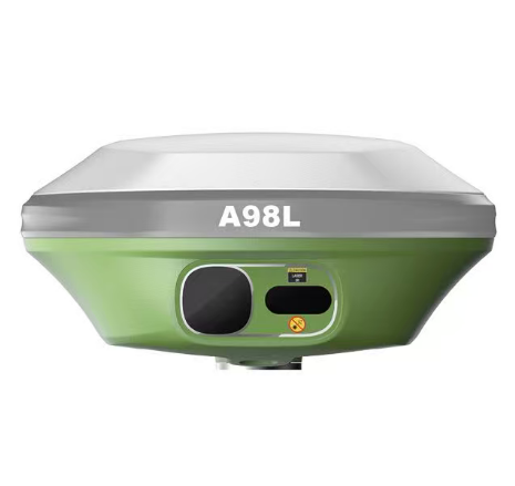
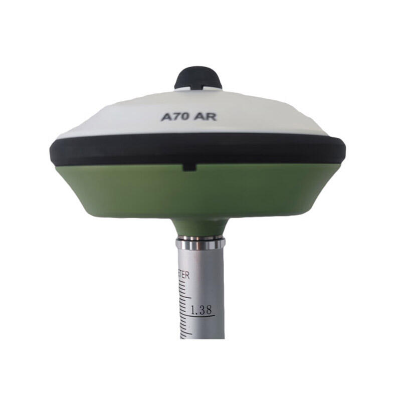
RTK GNSS Module: Centimeter-Level Precision Navigation Technology for Professional Applications

All Categories

rtk gnss module

The RTK GNSS module represents a revolutionary advancement in satellite navigation technology, delivering centimeter-level positioning accuracy that transforms industries requiring precise location data. Real-Time Kinematic Global Navigation Satellite System modules combine multiple satellite constellations including GPS, GLONASS, Galileo, and BeiDou to provide unprecedented positioning precision. These sophisticated modules utilize carrier-phase measurements and real-time correction data to achieve accuracy levels that standard GNSS receivers cannot match. The RTK GNSS module operates by receiving signals from multiple satellites simultaneously while processing correction data from reference stations or network services. This dual-input approach enables the module to calculate positions with accuracy ranging from one to five centimeters under optimal conditions. The technology works by comparing carrier-phase measurements between the rover receiver and a known reference point, eliminating common atmospheric and satellite orbit errors that typically affect standard positioning systems. Modern RTK GNSS modules incorporate advanced signal processing algorithms and multi-frequency reception capabilities, allowing them to maintain reliable performance even in challenging environments. These modules support various correction data formats including RTCM and proprietary protocols, ensuring compatibility with existing infrastructure and correction services. The compact design of contemporary RTK GNSS modules makes them suitable for integration into diverse applications, from autonomous vehicles and precision agriculture equipment to surveying instruments and construction machinery. Power efficiency improvements in recent RTK GNSS module designs extend operational time while maintaining consistent performance levels. The modules feature robust communication interfaces including UART, SPI, and USB connections, facilitating seamless integration with host systems and enabling real-time data transmission for immediate processing and analysis.

Popular Products

The RTK GNSS module delivers exceptional positioning accuracy that surpasses traditional navigation systems by significant margins, providing users with centimeter-level precision essential for professional applications. This enhanced accuracy translates directly into improved operational efficiency across multiple industries, reducing errors and increasing productivity in tasks requiring precise location data. Users benefit from faster convergence times compared to post-processing methods, enabling real-time decision-making and immediate results in field operations. The RTK GNSS module supports multiple satellite constellations simultaneously, increasing signal availability and reliability in various environmental conditions including urban canyons and areas with limited sky visibility. This multi-constellation capability ensures consistent performance where single-system receivers might struggle, providing users with dependable positioning data regardless of geographic location or surrounding obstacles. Cost savings represent another significant advantage, as the RTK GNSS module eliminates the need for expensive surveying equipment and reduces labor costs associated with traditional measurement methods. Organizations can complete projects faster and with fewer personnel while maintaining superior accuracy standards. The module's plug-and-play design simplifies integration processes, reducing development time and technical complexity for equipment manufacturers and end users alike. Versatile communication options enable seamless connectivity with existing systems and infrastructure, minimizing upgrade costs and compatibility concerns. Power efficiency improvements in modern RTK GNSS modules extend operational periods between charges or reduce overall power consumption in battery-operated devices. This efficiency proves particularly valuable in remote applications where power sources are limited or expensive to maintain. The compact form factor allows installation in space-constrained environments while maintaining full functionality and performance capabilities. Regular firmware updates and expandable features ensure long-term value and adaptability to evolving requirements. Weather resistance and rugged construction enable reliable operation in harsh environmental conditions, protecting investment and ensuring consistent performance across diverse applications. Automated error detection and correction features reduce user intervention requirements while maintaining data integrity and system reliability.

Practical Tips

How Can RTK Improve Surveying Precision for Large Construction Sites?

22

Dec

How Can RTK Improve Surveying Precision for Large Construction Sites?

Modern construction projects demand unprecedented accuracy and efficiency, particularly when dealing with expansive development sites spanning hundreds of acres. Traditional surveying methods often fall short when faced with the complexities of large...
View More
Why Do Mapping Teams Prefer RTK for Real-Time Positioning Tasks?

22

Dec

Why Do Mapping Teams Prefer RTK for Real-Time Positioning Tasks?

Modern mapping teams face unprecedented demands for precision and speed in their surveying operations. The evolution of positioning technologies has revolutionized how professionals approach field data collection, with RTK for real-time positioning e...
View More
How Do RTK GNSS Receivers Maintain Stability in Complex Terrains?

22

Dec

How Do RTK GNSS Receivers Maintain Stability in Complex Terrains?

Navigation accuracy in challenging environments has become a critical requirement across industries ranging from construction and surveying to autonomous vehicles and precision agriculture. RTK GNSS receivers represent the pinnacle of satellite-based...
View More
What Key Features Should You Check When Buying an Auto Level?

11

Feb

What Key Features Should You Check When Buying an Auto Level?

When precision matters most in construction and surveying projects, selecting the right auto level becomes a critical decision that can impact the success of your entire operation. An auto level serves as the backbone of accurate height measurements ...
View More

Get a Free Quote

Our representative will contact you soon.
Email
Name
Company Name
Message
0/1000

rtk gnss module

Unmatched Precision for Professional Applications

Unmatched Precision for Professional Applications

The RTK GNSS module sets new standards for positioning accuracy, delivering centimeter-level precision that revolutionizes professional workflows across industries. This exceptional accuracy stems from advanced carrier-phase measurement techniques combined with real-time correction data processing, enabling the module to achieve positioning precision between one to five centimeters consistently. Professional surveyors benefit enormously from this precision level, completing boundary determinations, topographic mapping, and construction layout tasks with confidence and efficiency previously impossible with standard GPS technology. The accuracy advantage extends beyond surveying into precision agriculture, where farmers utilize RTK GNSS modules for controlled traffic farming, variable rate applications, and automated guidance systems that optimize crop yields while minimizing input costs. Construction professionals rely on this precision for machine control applications, enabling excavators, graders, and other heavy equipment to work to exact specifications without traditional grade stakes or manual measurements. The module's ability to maintain accuracy across various environmental conditions ensures reliable performance whether working in open fields, near buildings, or under challenging atmospheric conditions. Quality control processes benefit significantly from the consistent precision, as multiple measurements yield repeatable results within millimeter tolerances. This reliability eliminates the need for redundant measurements and reduces project timelines substantially. Engineering applications leverage the precision for structural monitoring, deformation analysis, and infrastructure development projects where millimeter-level movements must be detected and tracked over time. The RTK GNSS module's precision capabilities transform how professionals approach location-dependent tasks, enabling new methodologies and improving existing processes through enhanced spatial accuracy and reliability.
Multi-Constellation Support for Enhanced Reliability

Multi-Constellation Support for Enhanced Reliability

The RTK GNSS module's multi-constellation support represents a fundamental advancement in satellite navigation technology, simultaneously tracking signals from GPS, GLONASS, Galileo, and BeiDou satellite systems to ensure maximum signal availability and positioning reliability. This comprehensive constellation support dramatically improves performance in challenging environments where traditional single-system receivers experience signal blockage or degradation. Urban environments particularly benefit from multi-constellation capabilities, as the increased number of visible satellites helps maintain positioning accuracy even when buildings, bridges, or other structures obstruct portions of the sky. The redundancy provided by multiple constellations ensures continuous operation even when individual satellites are temporarily unavailable due to maintenance, orbital adjustments, or atmospheric interference. Mining operations, forestry applications, and other industries working in terrain with limited sky visibility experience substantial improvements in positioning continuity and accuracy through multi-constellation support. The RTK GNSS module intelligently selects the best available satellites from all constellations, optimizing geometric diversity and signal strength to maintain the highest possible accuracy under varying conditions. This smart selection process occurs continuously, adapting to changing satellite positions and environmental factors without user intervention. International operations benefit significantly from multi-constellation support, as different regions may have varying satellite availability from individual systems, while combined constellation access ensures consistent global performance. The module's ability to process signals from multiple constellations simultaneously also improves initialization times, reducing the period required to achieve RTK-fixed solutions and enabling faster startup procedures. Quality metrics and reliability indicators provide users with real-time feedback on positioning confidence levels, enabling informed decisions about when conditions are optimal for critical measurements or operations requiring maximum precision.
Seamless Integration and User-Friendly Operation

Seamless Integration and User-Friendly Operation

The RTK GNSS module excels in providing seamless integration capabilities that simplify implementation processes for manufacturers and end-users across diverse applications and industries. Modern interface options including UART, SPI, USB, and wireless communication protocols ensure compatibility with virtually any host system or existing infrastructure, eliminating integration barriers that often complicate technology adoption. The module's standardized communication protocols and well-documented API enable rapid development cycles, allowing engineers to implement RTK positioning capabilities without extensive specialized knowledge of GNSS technology complexities. Plug-and-play functionality reduces setup time dramatically, as the RTK GNSS module arrives pre-configured for immediate operation while still offering extensive customization options for specialized applications. Web-based configuration tools and intuitive software interfaces enable users to adjust settings, monitor performance, and troubleshoot issues without requiring deep technical expertise or specialized training programs. Automatic correction source management simplifies operations by handling network connections, subscription services, and data formatting without manual intervention, allowing users to focus on their core applications rather than navigation system management. The module's compact form factor and flexible mounting options accommodate integration into space-constrained devices and existing equipment retrofits without significant design modifications or structural changes. Power management features optimize energy consumption while maintaining full performance capabilities, extending operational periods in battery-powered applications and reducing overall system power requirements. Diagnostic capabilities provide comprehensive system health monitoring, alerting users to potential issues before they impact operations and enabling proactive maintenance scheduling. Field-upgradeable firmware ensures long-term value by adding new features, improving performance, and maintaining compatibility with evolving industry standards and correction service protocols. Comprehensive technical support and documentation resources accelerate implementation timelines while reducing development risks and costs associated with RTK GNSS module integration projects.

Get a Free Quote

Our representative will contact you soon.
Email
Name
Company Name
Message
0/1000