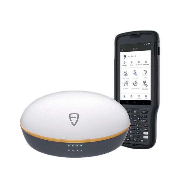
Android Total Station'lar Ölçüm Doğruluğunu Nasıl Artırır?
Entegre GNSS ve EDM Teknolojisi ile Hassasiyet
Androidlı Total Station, yerleşik GNSS ve EDM teknolojisi sayesinde günümüzde ölçümlerin nasıl yapıldığını değiştiriyor ve çok yüksek doğrulukta ölçümler sunulabiliyor. GNSS, adeta ölçüm ekibine saha koşulları değişkenken dahi gerçek zamanlı olarak tam konum bilgisi sağlıyor. Diğer taraftan EDM teknolojisi, eski yöntemlerle mümkün olmayan milimetre hassasiyetinde mesafe ölçümü yapabiliyor. Sektörel bazı araştırmalara göre, bu ölçüm istasyonlarında GNSS ve EDM yeteneklerinin bir araya gelmesi doğruluğu %10 ila %30 arasında artırabiliyor. Bu düzeyde bir iyileşme, özellikle şehirler yeni gelişmeler veya altyapı iyileştirmeleri planlandığında, ölçümlerin kesinlikle doğru yapılması gereken büyük projelerde çok büyük fark yaratıyor.
Güvenilir Veri İçin Otomatik Hata Düzeltme
Otomatik hata düzeltme, saha operasyonları için verilerin güvenilirliğini korumada önemli bir rol oynar. Sistem, hava değişikliklerinden veya ekipman arızalarından kaynaklanan ölçüm sorunlarını çözerek çalışır. Örneğin Android Total Station cihazları, ölçüm doğruluğunu artıran algoritmalarla önceden donatılmıştır. Özellikle küçük hataların ileride büyük sorunlara yol açabileceği büyük çaplı altyapı projelerinde çalışan saha personeli, bu özelliği çok takdir eder. Bu düzeltmeler uygulandıktan sonra, birçok uzman daha iyi sonuçlar elde ettiklerini belirtmektedir; çünkü rastgele hatalar daha büyük sorunlar haline gelmeden fark edilir. Sonuç olarak daha temiz veri, daha az yeniden çalışma süresi ve genel olarak daha güvenilir ölçümler anlamına gelir.
Sorunsuz İş Akışları için Yazılım Entegrasyonu
Bütünleştirilmiş Proje Yönetimi için BIM/CAD Uyumluluğu
BIM ve CAD yazılımları birlikte çalıştığında, sahadaki projelerin yönetimini gerçekten geliştirir. Bunların Android Total Station cihazlarla birleştirilmesi, tüm ilgililere işlerin çok daha açık görülmesini sağlar. Görselleştirme yönü oldukça gelişir ve tasarımcılar, gerçek dünya koşullarında neler olduğunu net olarak görebilir hale gelir. Ölçüm ekibinin, mühendislerden geri bildirim alması artık günlerce sürmez çünkü veriler departmanlar arasında neredeyse anında aktarılır. Erken tespit edilen hataların, inşaat sahalarında tekrar işlerin yapılmasını haftalarca önlediği birçok kez gözlemlenmiştir. Günümüzde çoğu müteahhit, iş akışlarını Autodesk Revit ve AutoCAD gibi platformlar üzerinden yönetmektedir. Bu araçlar, değişikliklerin tüm dokümantasyonlara otomatik olarak yansıtıldığı bir yapı sunar. Bazı şirketler, tüm sistemlerin uyumlu çalıştığı durumlarda beklenmedik gecikmelerin yaklaşık %30 oranında azaldığını bildirmektedir. Sadece zaman kazancı dahi, entegre sistemlere yapılan yatırımın haklılığını çoğu zaman açık bir şekilde gösterir.
İleri Düzey Uzamsal Analiz için GIS Araçları
Jeolojik Bilgi Sistemi (GIS), Android Total Station cihazlarıyla entegre edildiğinde, kullanıcılara mekânsal verileri analiz etme konusunda güçlü yeni yollar sunar. Bu özellikle kentsel gelişim projelerinde ya da zaman içinde ekosistemlerde meydana gelen değişikliklerin takibinde önemli sonuçlar doğurur. Bu birleşim, ölçüm hassasiyetini artırır ve profesyonellerin tahminlere değil, gerçek dünya koşullarına dayalı daha iyi kararlar almasını sağlar. Örneğin ESRI'nin ArcGIS yazılımı, bu ölçüm cihazlarıyla birlikte çalışarak coğrafi bilgilerin farklı katmanlarını üst üste yerleştirme ya da veri kümeleri içinde belirli konumlarla ilgili sorular sorma gibi kullanışlı özellikler sunar. Bu tür gelişmeler, inşaat sahalarında, çevresel değerlendirmelerde ve mekânın konumsal ilişkilerinin anlaşılması gerektiğinde haritalama ile ilgili görevlerde daha iyi sonuçlara yol açar.
Gerçek Zamanlı Veri Erişimi ve İşbirliği
Anında Veri Erişimi için Bulut Senkronizasyonu
Bulut senkronizasyonu, saha ölçüm ekipleri için ciddi faydalar sağlar. Ekipler bulut üzerinden anında veri paylaşabildiğinde, herkes nerede çalışırsa çalışsın aynı sayfada kalır. Bilgi, bir sonraki ihtiyacı olan kişiye açık bir şekilde güncel kalır. Bu tür tutarlılık, birlikte karar verme ve ekip halinde çalışma süreçlerini büyük ölçüde kolaylaştırır. Google Cloud veya AWS gibi platformları kullanan ölçüm mühendisleri, dosyaların aktarımını beklemek zorunda kalmadıkları ve güncellemeleri kaybetme riskiyle uğraşmadıkları için iş akışlarının çok daha sorunsuz olduğunu görürler. Bulut çözümler standart uygulama haline gelmeden önce, e-postaları beklemekle ya da sürüm kontrolü sorunlarıyla uğraşmakla harcanan saatleri bir düşünün.
Saha ile Ofis Arası İletişim Protokolleri
Saha ve ofis çalışanları arasında etkili iletişim, proje verimliliği için hayati öneme sahiptir. Video arama ve paylaşımlı sanal çalışma alanları gibi modern protokoller, daha hızlı güncellemeler ve bilinçli karar alma imkanı sunar. Slack gibi anlık mesajlaşma platformlarının Android Total Station cihazlarla birlikte kullanılması, paydaşlar arasında senkronizasyonu iyileştirerek ölçüm hatalarını azaltır ve verimliliği artırır.

Verimlilik için Kullanıcı Arayüzü Yenilikleri
Sezgisel Dokunmatik Ekran Navigasyonu
Android Total Station cihazlardaki dokunmatik ekran arayüzleri, kullanıcı dostu bir etkileşim sağlayarak öğrenme sürecini kısaltır ve saha verimliliğini artırır. Geleneksel düğme arayüzlerine kıyasla dokunmatik ekran teknolojisi, özelleştirilebilir ve hızlı bir kullanım deneyimi sunar; bu da iş akışında iyileştirmeler ve görevlerin daha hızlı yürütülmesine katkı sağlar.
Mobil Uygulama Entegrasyonu (BYOD Esnekliği)
BYOD kavramı, ölçüm mühendislerinin Android Total Station cihazlarla kişisel mobil cihazlarını kullanmasına olanak tanıyarak veri yönetimi konusunda esneklik sağlar. Mobil uygulamalar, verimli ve gerçek zamanlı veri yönetimi ile erişilebilirliği destekler; bu da anlık güncellemeler ve doğru veri toplama yoluyla saha verimliliğini artırır. Bu entegrasyon, ölçme sektöründe mobil teknolojilerin artan etkisini vurgulamaktadır.
Saha Operasyonlarında Verimlilik Artışı
Robotik Otomasyon ile Kurulum Süresinin Azaltılması
Android Total Station cihazlarda robotik otomasyon, kurulum süresini önemli ölçüde azaltarak saha verimliliğini artırır. Geleneksel olarak manuel olan süreçlerin otomatikleştirilmesiyle bu istasyonlar, hassasiyeti ve verimliliği iyileştirir; sektörde yapılan ölçümlerde kurulum süresinde %50 oranında azalma gösterilmiştir. Bu da ölçüm projelerinin hızlandırılmasına olanak tanır.
Karmaşık Ortamlarda Tek Operatör Verimliliği
Android Total Station'lardaki ilerlemeler, tek bir operatörün etkili bir şekilde karmaşık ortamları ölçmesini sağlar. Gelişmiş yapay zeka altyapıları ve makine öğrenimi algoritmalarından yararlanan bu istasyonlar, tek operatörlü çalışmanın verimliliğini artırır ve ek personel ihtiyacını azaltır. Bu durum, otonom ölçüm operasyonları için önemli sonuçlar doğurur.
SSS
Android Total Station cihazları ölçüm doğruluğunu nasıl artırır?
GNSS ve EDM teknolojilerini entegre ederek üstün hassasiyet sağlar ve verilerin güvenilirliğini artırmak için hata düzeltmeyi geliştirir.
Android Total Station cihazlarıyla kullanım için hangi yazılım entegrasyonları avantajlıdır?
Autodesk Revit gibi BIM/CAD yazılımları ve ArcGIS gibi CBS araçlarıyla entegrasyonlar, proje yönetimi ve mekânsal analizi geliştirir.
Modern iletişim protokolleri, ölçüm ekiplerine nasıl fayda sağlar?
Gerçek zamanlı güncellemeler ve karar verme sayesinde saha ile ofis arasındaki iş birliğini geliştirerek proje verimliliğini artırırlar.
Android Topografya Aletleri ile hangi verimlilik kazanımları elde edilir?
Kazanımlar arasında robotik otomasyon ile kurulum süresinin azaltılması ve karmaşık ortamlarda tek operatör verimliliğinin artırılması yer alır.

