เครื่องรับสัญญาณ GPS แบบ Real-Time Kinematic
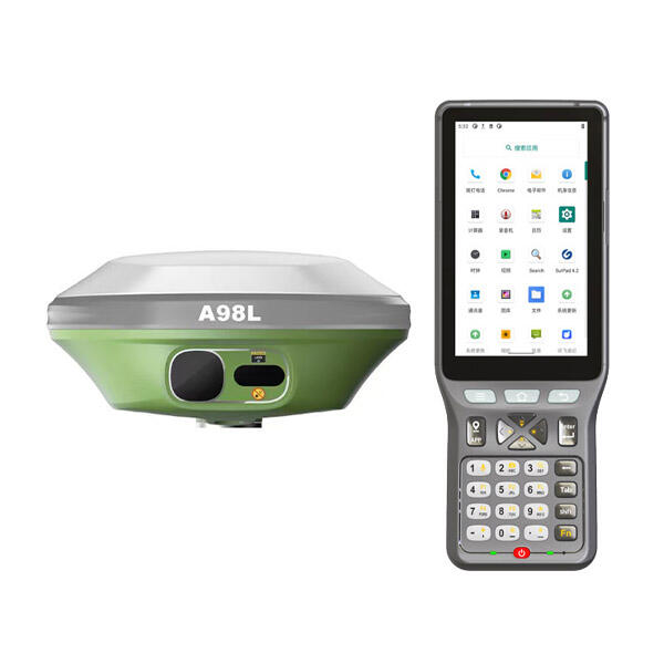
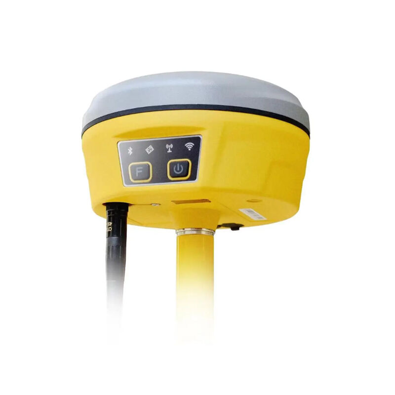
เครื่องรับสัญญาณ GPS แบบ Real-Time Kinematic (RTK) ถือเป็นความก้าวหน้าเชิงปฏิวัติในเทคโนโลยีการนำทางด้วยดาวเทียม ซึ่งให้ความแม่นยำที่เหนือชั้นยิ่งกว่าที่เคยมีมาสำหรับการกำหนดพิกัดและการสำรวจ อุปกรณ์ขั้นสูงนี้ผสานฟังก์ชันการทำงานของระบบ GPS แบบดั้งเดิมเข้ากับการปรับค่าแบบเรียลไทม์ เพื่อบรรลุความแม่นยำระดับเซนติเมตร จึงกลายเป็นเครื่องมือสำคัญสำหรับผู้เชี่ยวชาญที่ต้องการผลการวัดที่แม่นยำอย่างยิ่ง เครื่องรับสัญญาณ GPS แบบ RTK ทำงานโดยใช้สถานีฐานที่ส่งข้อมูลการปรับค่าไปยังรถโรเวอร์เคลื่อนที่ ซึ่งช่วยกำจัดความผิดพลาดที่เกิดจากสภาวะบรรยากาศและวงโคจรของดาวเทียม ซึ่งมักส่งผลกระทบต่อความแม่นยำของระบบ GPS ทั่วไป ระบบดังกล่าวใช้การวัดเฟสของสัญญาณพาหะ (carrier phase measurements) แทนที่จะอาศัยเพียงการสังเกตสัญญาณรหัส (code observations) ของ GPS เท่านั้น จึงสามารถคำนวณพิกัดได้อย่างแม่นยำอย่างน่าทึ่ง หน่วยเครื่องรับสัญญาณ GPS แบบ RTK รุ่นใหม่ล่าสุดใช้อัลกอริธึมการประมวลผลสัญญาณขั้นสูงที่สามารถติดตามดาวเทียมจากหลายระบบพร้อมกัน ได้แก่ ระบบ GPS, GLONASS, Galileo และ BeiDou ความสามารถในการรองรับหลายระบบดาวเทียมนี้ทำให้ระบบมีประสิทธิภาพที่แข็งแกร่งแม้ในสภาพแวดล้อมที่ท้าทาย เช่น พื้นที่ที่ท้องฟ้ามองเห็นได้จำกัด เครื่องรับสัญญาณ GPS แบบ RTK ยังมีเทคโนโลยีแบบสองความถี่ (dual-frequency) ที่ประมวลผลสัญญาณ GPS ทั้งความถี่ L1 และ L2 ทำให้เวลาเริ่มต้นระบบ (initialization time) สั้นลง และเพิ่มความแม่นยำภายใต้สภาวะบรรยากาศที่หลากหลาย โมเดลสมัยใหม่ส่วนใหญ่ยังมีโมดูลการสื่อสารแบบบูรณาการผ่านเครือข่ายเซลลูลาร์หรือคลื่นวิทยุ เพื่อให้การส่งข้อมูลระหว่างสถานีฐานกับรถโรเวอร์เป็นไปอย่างไร้รอยต่อ เครื่องรับสัญญาณ GPS แบบ RTK มักมีโหมดการใช้งานหลายโหมด ได้แก่ โหมดสถิต (static surveying) สำหรับการวางแนวเขตที่ดิน โหมดคิเนมาติก (kinematic mode) สำหรับการติดตามการเคลื่อนที่อย่างต่อเนื่อง และความสามารถในการประมวลผลหลังการเก็บข้อมูล (post-processing) เพื่อยืนยันความแม่นยำสูงสุด อุปกรณ์เหล่านี้มักออกแบบให้มีโครงสร้างทนทานเพื่อใช้งานในสนามที่ยากลำบาก โดยมีฝาครอบกันน้ำและแบตเตอรี่ที่ใช้งานได้นานตลอดวัน ระบบเครื่องรับสัญญาณ GPS แบบ RTK ระดับมืออาชีพมักมาพร้อมซอฟต์แวร์แบบครบวงจรสำหรับการเก็บรวบรวม ประมวลผล และวิเคราะห์ข้อมูล ซึ่งช่วยให้กระบวนการทำงานของนักสำรวจ ผู้เชี่ยวชาญด้านการก่อสร้าง และผู้เชี่ยวชาญด้านการเกษตรที่ต้องการข้อมูลตำแหน่งที่แม่นยำสำหรับงานปฏิบัติการที่สำคัญนั้นมีประสิทธิภาพมากยิ่งขึ้น