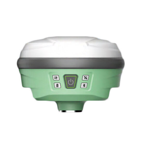
Características do produto
● Satélites GNSS profissionais rastreados simultaneamente (GPS, Glonass, Galileo, Beidou)
● Adota tecnologia de sensor de inclinação de ponta, suportando inicialização rápida e levantamento de inclinação dinâmica de até 60°
● Aplica conexão WIFI para realizar o controle WebUI, projetado para modificar e monitorar o status do receptor.
● O software de campo Android incluído traz uma grande mudança na experiência do usuário e acessibilidade
Descrição do produto
Motor GNSS |
Rastreamento por satélite |
GPS: L1C/A, L1C, L2P(Y), L2C, L5 |
GLONASS:GI,G2,G3 |
BDS: B1I, B2I, B3I, BIC, B2a, B2b |
GALILEU:E1,E5a,E5b,E6 |
QZSS:L1,L2C,L5,L6* |
NAVIC(IRNSS):L5 |
SBAS:L1C/A |
PPP:B2B-PPP I E6-HAS |
Canal |
1408 canais |
Frequência de atualização de dados |
Suporta saída de 50 Hz |
Frequência de posicionamento |
1 Hz 2 Hz 5 Hz 10 Hz 20 Hz 50 Hz |
Partida a Frio |
<12 segundos |
Tempo de Inicialização |
<5 segundos |
Confiabilidade de inicialização |
>99.9% |
Precisão do levantamento de inclinação |
≤2cm dentro de uma inclinação de 60° |
Precisão de Tempo |
20ns |
Precisão RTK |
H:±8,0 mm +1 ppm V:±15,0 mm +1 ppm |
Precisão estática |
H:±2,5 mm +0,5 ppm V:±5,0 mm +0,5 ppm |
Precisão de ponto único |
H: 1,5 mV: 2,5 m |
Precisão diferencial |
H: 0,4 mV: 0,8 m |
BATERIA |
Vida útil da bateria |
Estático 20H, Rover 16H, Base 10H |
Fonte de Alimentação |
9 V/2 A, 5 V/2 A MÁX. 18 W, 3,6 V_13600 mAh |
Físico |
Material da Carcaça |
Liga de magnésio e alumínio |
Botão |
Botão de Liga/Desliga |
Indicador |
Satélites, link de dados, bateria |
Temperatura de operação |
-30℃~+65℃ |
Temperatura de armazenamento |
-40℃~+80℃ |
À prova de água/poeira |
IP68 |
Umidade de operação |
99,90% sem condensação |
Choque |
resistente a quedas de 1,8 m em temperatura normal |
Sistema |
Sistema Operacional |
Linux |
Memória interna |
8GB |
Transmissão de Dados |
4G/WIFI/Rádio |
Rádio |
1W |
Frequência de Rádio |
410-470 MHz |
Taxa de transmissão do ar |
19200,9600,4800 |
Idioma suportado |
Chinês, inglês, turco, polonês, coreano, indonésio, espanhol, télugo, russo, etc. |
Câmera |
Número de lentes |
2 |
Campo de visão da lente |
88 graus |
Pixel do sensor |
2 megapixels (frontal/inferior) |
Distância focal da câmera |
2m |
Resolução do sensor |
1920*1080 |